Tamayama, Iwate
| Tamayama 玉山村 | ||
|---|---|---|
| Former municipality | ||
| ||
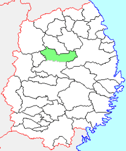 Location of Tamayama in Iwate Prefecture | ||
 Tamayama Location in Japan | ||
| Coordinates: 39°50′48.5″N 141°9′58.4″E / 39.846806°N 141.166222°ECoordinates: 39°50′48.5″N 141°9′58.4″E / 39.846806°N 141.166222°E | ||
| Country | Japan | |
| Region | Tōhoku | |
| Prefecture | Iwate Prefecture | |
| District | Iwate | |
| Merged |
June 6, 2005 (now part of Morioka) | |
| Area | ||
| • Total | 397.32 km2 (153.41 sq mi) | |
| Population (January 10, 2006) | ||
| • Total | 13,530 | |
| • Density | 34.05/km2 (88.2/sq mi) | |
| Symbols | ||
| • Tree | Cryptomeria | |
| • Flower | Lily of the valley | |
| • Bird | Green pheasant | |
| Time zone | Japan Standard Time (UTC+9) | |

Tamayama (玉山村 Tamayama-mura) was a village located in Iwate District, Iwate Prefecture, Japan.
History
The village of Tamayama created on April 1, 1889 within Minami-Iwate District with the establishment of the municipality system. Minami-Iwate merged with Kita-Iwate District to form Iwate District on March 29, 1896. Tamayama merged with the neighboring villages of Shibutami and Yabukawa on April 1, 1954, and with Makihori on June 1, 1955. On January 10, 2006, Tamayama was merged into the expanded city of Morioka and no longer exists as an independent municipality.
As of January 2006, the village had an estimated population of 13,530 and a population density of 34.05 persons per km2. The total area was 397.32 km2.
References
External links
- Official website of Morioka (Japanese)
This article is issued from Wikipedia - version of the 11/6/2015. The text is available under the Creative Commons Attribution/Share Alike but additional terms may apply for the media files.