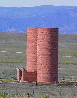
The Silos, Montana
| The Silos, Montana | |
|---|---|
| Census-designated place | |
|
The Silos | |
 The Silos | |
| Coordinates: 46°23′21″N 111°34′32″W / 46.38917°N 111.57556°WCoordinates: 46°23′21″N 111°34′32″W / 46.38917°N 111.57556°W | |
| Country | United States |
| State | Montana |
| County | Broadwater |
| Area | |
| • Total | 5.1 sq mi (13.3 km2) |
| • Land | 5.1 sq mi (13.3 km2) |
| • Water | 0.0 sq mi (0.0 km2) |
| Elevation | 3,850 ft (1,170 m) |
| Population (2010) | |
| • Total | 506 |
| • Density | 98/sq mi (37.9/km2) |
| Time zone | Mountain (MST) (UTC-7) |
| • Summer (DST) | MDT (UTC-6) |
| Area code(s) | 406 |
| FIPS code | 30-73760 |
| GNIS feature ID | 2583858 |
The Silos is a census-designated place (CDP) in Broadwater County, Montana, United States. The population was 506 at the 2010 census.[1]
Geography
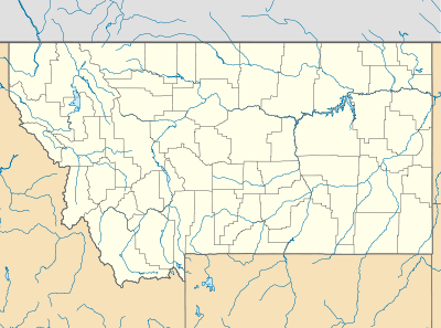
The Silos is located along the west shore of Canyon Ferry Lake, a reservoir on the Missouri River. U.S. Route 12/287 runs through the CDP, leading 5 miles (8 km) southeast to Townsend, the Broadwater County seat, and 28 miles (45 km) northwest to Helena, the state capital.
According to the United States Census Bureau, the CDP has a total area of 5.1 square miles (13.3 km2), all of it land.[1]
References
- 1 2 "Geographic Identifiers: 2010 Demographic Profile Data (G001): The Silos CDP, Montana". U.S. Census Bureau, American Factfinder. Retrieved June 26, 2013.
Municipalities and communities of Broadwater County, Montana, United States | ||
|---|---|---|
| City | 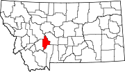 | |
| CDPs | ||
| Unincorporated community | ||
This article is issued from Wikipedia - version of the 11/12/2015. The text is available under the Creative Commons Attribution/Share Alike but additional terms may apply for the media files.