Townsend, Montana
| Townsend, Montana | |
|---|---|
| City | |
|
Mainstreet, Townsend | |
| Motto: First City on the Missouri & Valley of Adventure | |
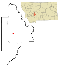 Location of Townsend, Montana | |
| Coordinates: 46°19′13″N 111°31′4″W / 46.32028°N 111.51778°WCoordinates: 46°19′13″N 111°31′4″W / 46.32028°N 111.51778°W | |
| Country | United States |
| State | Montana |
| County | Broadwater |
| Government | |
| Area[1] | |
| • Total | 1.59 sq mi (4.12 km2) |
| • Land | 1.58 sq mi (4.09 km2) |
| • Water | 0.01 sq mi (0.03 km2) |
| Elevation | 3,842 ft (1,171 m) |
| Population (2010)[2] | |
| • Total | 1,878 |
| • Estimate (2015)[3] | 1,959 |
| • Density | 1,188.6/sq mi (458.9/km2) |
| Time zone | Mountain (MST) (UTC-7) |
| • Summer (DST) | MDT (UTC-6) |
| ZIP code | 59644 |
| Area code(s) | 406 |
| FIPS code | 30-74575 |
| GNIS feature ID | 0792298 |

Townsend is a city in and the county seat of Broadwater County, Montana, United States.[4] The population was 1,878 at the 2010 census.
History
Lewis and Clark passed through on the voyage of discovery in 1805, although the first white settlers, homesteaders and Civil War veterans in search of gold, did not arrive until the late 1860s.[5] In 1883, a railstop was established as businesses became established supporting gold mining in the region. Townsend was named by railroad officials, in honor of the wife of Charles Barstow Wright, president of the Northern Pacific (1875–1879).
Geography
Townsend is located at 46°19′13″N 111°31′4″W / 46.32028°N 111.51778°W (46.320218, -111.517642).[6]
Situated at approximately 3800 feet above sea level. Located approximately 35 miles from Helena, the state capital and 35 miles from the convergence of the Jefferson, Madison, and Gallatin rivers which form the headwaters of the Missouri River. Nicknamed "the first city on the Missouri River", Townsend sits nearby the southern tip of Canyon Ferry Lake (a part of, and fed by, the Missouri River) a popular recreation destination and Montana's third largest body of water.
According to the United States Census Bureau, the city has a total area of 1.59 square miles (4.12 km2), of which 1.58 square miles (4.09 km2) is land and 0.01 square miles (0.03 km2) is water.[1]
Demographics
| Historical population | |||
|---|---|---|---|
| Census | Pop. | %± | |
| 1890 | 245 | — | |
| 1900 | 446 | 82.0% | |
| 1910 | 759 | 70.2% | |
| 1920 | 897 | 18.2% | |
| 1930 | 735 | −18.1% | |
| 1940 | 1,309 | 78.1% | |
| 1950 | 1,316 | 0.5% | |
| 1960 | 1,528 | 16.1% | |
| 1970 | 1,371 | −10.3% | |
| 1980 | 1,587 | 15.8% | |
| 1990 | 1,635 | 3.0% | |
| 2000 | 1,867 | 14.2% | |
| 2010 | 1,878 | 0.6% | |
| Est. 2015 | 1,959 | [7] | 4.3% |
| U.S. Decennial Census[8][9] 2015 Estimate[3] | |||
2010 census
As of the census[2] of 2010, there were 1,878 people, 822 households, and 495 families residing in the city. The population density was 1,188.6 inhabitants per square mile (458.9/km2). There were 888 housing units at an average density of 562.0 per square mile (217.0/km2). The racial makeup of the city was 95.5% White, 0.2% African American, 1.5% Native American, 0.3% Asian, 0.7% from other races, and 1.8% from two or more races. Hispanic or Latino of any race were 2.8% of the population.
There were 822 households of which 25.8% had children under the age of 18 living with them, 47.9% were married couples living together, 7.9% had a female householder with no husband present, 4.4% had a male householder with no wife present, and 39.8% were non-families. 35.4% of all households were made up of individuals and 16.5% had someone living alone who was 65 years of age or older. The average household size was 2.22 and the average family size was 2.85.
The median age in the city was 45.7 years. 22% of residents were under the age of 18; 7.6% were between the ages of 18 and 24; 19.5% were from 25 to 44; 28.2% were from 45 to 64; and 22.8% were 65 years of age or older. The gender makeup of the city was 51.1% male and 48.9% female.
2000 census
As of the census[10] of 2000, there were 1,867 people, 786 households, and 507 families residing in the city. The population density was 1,176.2 people per square mile (453.4/km²). There were 847 housing units at an average density of 533.6 per square mile (205.7/km²). The racial makeup of the city was 97.59% White, 0.11% African American, 1.39% Native American, 0.43% from other races, and 0.48% from two or more races. Hispanic or Latino of any race were 1.77% of the population.
There were 786 households out of which 26.6% had children under the age of 18 living with them, 52.2% were married couples living together, 8.1% had a female householder with no husband present, and 35.4% were non-families. 32.2% of all households were made up of individuals and 16.5% had someone living alone who was 65 years of age or older. The average household size was 2.32 and the average family size was 2.89.
In the city the population was spread out with 23.7% under the age of 18, 6.5% from 18 to 24, 23.7% from 25 to 44, 23.5% from 45 to 64, and 22.5% who were 65 years of age or older. The median age was 43 years. For every 100 females there were 100.1 males. For every 100 females age 18 and over, there were 100.6 males.
The median income for a household in the city was $26,820, and the median income for a family was $32,679. Males had a median income of $26,859 versus $19,375 for females. The per capita income for the city was $13,674. About 10.1% of families and 13.2% of the population were below the poverty line, including 19.5% of those under age 18 and 9.6% of those age 65 or over.
Climate
Townsend experiences a semi-arid climate (Köppen BSk) with cold, dry winters and hot, wetter summers.
| Climate data for Townsend, Montana | |||||||||||||
|---|---|---|---|---|---|---|---|---|---|---|---|---|---|
| Month | Jan | Feb | Mar | Apr | May | Jun | Jul | Aug | Sep | Oct | Nov | Dec | Year |
| Record high °F (°C) | 64 (18) |
72 (22) |
77 (25) |
88 (31) |
94 (34) |
100 (38) |
101 (38) |
105 (41) |
99 (37) |
89 (32) |
73 (23) |
67 (19) |
105 (41) |
| Average high °F (°C) | 34.5 (1.4) |
41.1 (5.1) |
50.3 (10.2) |
59.9 (15.5) |
68.2 (20.1) |
75.8 (24.3) |
82.5 (28.1) |
82.4 (28) |
72.4 (22.4) |
61.0 (16.1) |
44.7 (7.1) |
35.6 (2) |
59.03 (15.03) |
| Daily mean °F (°C) | 23.6 (−4.7) |
29.0 (−1.7) |
37.3 (2.9) |
45.6 (7.6) |
53.8 (12.1) |
61.2 (16.2) |
66.7 (19.3) |
65.7 (18.7) |
56.3 (13.5) |
46.4 (8) |
33.5 (0.8) |
24.7 (−4.1) |
45.32 (7.38) |
| Average low °F (°C) | 12.6 (−10.8) |
16.9 (−8.4) |
24.3 (−4.3) |
31.3 (−0.4) |
39.3 (4.1) |
46.6 (8.1) |
50.8 (10.4) |
49.0 (9.4) |
40.2 (4.6) |
31.7 (−0.2) |
22.2 (−5.4) |
13.7 (−10.2) |
31.55 (−0.26) |
| Record low °F (°C) | −39 (−39) |
−38 (−39) |
−26 (−32) |
6 (−14) |
13 (−11) |
19 (−7) |
34 (1) |
25 (−4) |
12 (−11) |
−11 (−24) |
−29 (−34) |
−37 (−38) |
−39 (−39) |
| Average precipitation inches (mm) | 0.35 (8.9) |
0.23 (5.8) |
0.54 (13.7) |
0.71 (18) |
1.73 (43.9) |
2.03 (51.6) |
1.36 (34.5) |
1.36 (34.5) |
1.01 (25.7) |
0.60 (15.2) |
0.40 (10.2) |
0.35 (8.9) |
10.67 (270.9) |
| Source #1: NOAA (normals, 1971–2000) [11] | |||||||||||||
| Source #2: The Weather Channel (Records) [12] | |||||||||||||
Notable people
| Wikimedia Commons has media related to Townsend, Montana. |
- Ben Clopton - cartoon artist
- Patrick Duffy - actor who played Bobby Ewing in Dallas and was also in Step By Step, was born in Townsend
- Esther Reed - identity thief, was born in Townsend
References
- 1 2 "US Gazetteer files 2010". United States Census Bureau. Retrieved 2012-12-18.
- 1 2 "American FactFinder". United States Census Bureau. Retrieved 2012-12-18.
- 1 2 "Population Estimates". United States Census Bureau. Retrieved July 20, 2016.
- ↑ "Find a County". National Association of Counties. Retrieved 2011-06-07.
- ↑ "Townsend Montana". Townsend Chamber of Commerce. Retrieved 30 December 2013.
- ↑ "US Gazetteer files: 2010, 2000, and 1990". United States Census Bureau. 2011-02-12. Retrieved 2011-04-23.
- ↑ "Annual Estimates of the Resident Population for Incorporated Places: April 1, 2010 to July 1, 2015". Retrieved July 2, 2016.
- ↑ "Census of Population and Housing". Census.gov. Retrieved June 4, 2015.
- ↑ "Census & Economic Information Center". Retrieved July 3, 2015.
- ↑ "American FactFinder". United States Census Bureau. Retrieved 2008-01-31.
- ↑ "Climatography of the United States NO.81" (PDF). National Oceanic and Atmospheric Administration. Retrieved January 15, 2011.
- ↑ "Monthly Averages for Townsend, MT". The Weather Channel. Retrieved January 15, 2011.
Municipalities and communities of Broadwater County, Montana, United States | ||
|---|---|---|
| City | 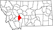 | |
| CDPs | ||
| Unincorporated community | ||