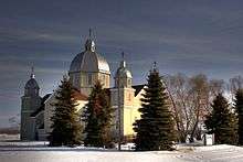
Thorsby, Alberta
| Thorsby | |
|---|---|
| Village | |
| Village of Thorsby | |
 Thorsby Location of Thorsby in Alberta | |
| Coordinates: 53°13′39″N 114°03′2″W / 53.22750°N 114.05056°WCoordinates: 53°13′39″N 114°03′2″W / 53.22750°N 114.05056°W | |
| Country | Canada |
| Province | Alberta |
| Region | Edmonton Capital Region |
| Municipal district | Leduc County |
| Incorporated[1] | |
| • Village | December 31, 1949 |
| Government | |
| • Mayor | Barry Rasch |
| • Governing body | Thorsby Village Council |
| Area (2011)[2] | |
| • Total | 3.87 km2 (1.49 sq mi) |
| Elevation | 745 m (2,444 ft) |
| Population (2011)[2][3] | |
| • Total | 951 |
| • Density | 250/km2 (640/sq mi) |
| Time zone | MST (UTC-7) |
| Highways |
39 778 |
| Waterways | Weed Creek |
| Website | Official website |
Thorsby is a village in central Alberta, Canada. It is located 38 km (24 mi) west of the City of Leduc, along Highway 39. Pigeon Lake and Pigeon Lake Provincial Park are located 20 km (12 mi) south of the community.
Demographics
The population of the Village of Thorsby according to its 2015 municipal census is 1,025,[4] a 8% change from its 2012 municipal census population of 947.[5] At its current population, Thorsby is one of the largest villages in the province and is eligible for town status. According to Alberta's Municipal Government Act, a village is eligible for town status when it reaches 1,000 residents.[6]
In the 2011 Census, Statistics Canada originally reported that the Village of Thorsby had a population of 797 living in 334 of its 373 total dwellings, a -15.7% change from its 2006 population of 945.[2] Statistics Canada subsequently amended the 2011 census results to a population of 951 living in 394 of its 436 total dwellings, a 0.6% change from 2006.[3] With a land area of 3.87 km2 (1.49 sq mi), it had a population density of 245.7/km2 (636.5/sq mi) in 2011.[2][3]
In 2006, Thorsby had a population of 945 living in 397 dwellings, an 18.3% increase from its 2001 population of 799. The village has a land area of 2.92 km2 (1.13 sq mi) and a population density of 323.6/km2 (838/sq mi).[7]
Economy
The Village of Thorsby is a member of the Leduc-Nisku Economic Development Association, an economic development partnership that markets Alberta's International Region[8] in proximity to the Edmonton International Airport.[9]
See also
References
- ↑ "Location and History Profile: Village of Thorsby" (PDF). Alberta Municipal Affairs. October 21, 2016. p. 569. Retrieved October 23, 2016.
- 1 2 3 4 "Population and dwelling counts, for Canada, provinces and territories, and census subdivisions (municipalities), 2011 and 2006 censuses (Alberta)". Statistics Canada. February 8, 2012. Retrieved February 8, 2012.
- 1 2 3 "Corrections and updates". Statistics Canada. March 21, 2013. Retrieved April 15, 2013.
- ↑ Mark Wierzbicki (May 21, 2015). "Thorsby council briefs". Leduc Representative. Canoe Sun Media. Retrieved May 23, 2015.
- ↑ Stephanie Dubois (June 8, 2012). "Thorsby Council Briefs". Leduc Representative. Sun Media Corporation. Retrieved June 22, 2012.
- ↑ "Municipal Government Act" (PDF). Alberta Queen's Printer. March 30, 2015. Retrieved May 23, 2015.
- ↑ "Canada 2006 Census: Thorsby - Community Profile". Statistics Canada. Retrieved June 9, 2007.
- ↑ "About Us". Leduc-Nisku Economic Development Association. Retrieved June 23, 2012.
- ↑ "Explore the Region". Leduc-Nisku Economic Development Association. Retrieved June 23, 2012.