Tinicum Township, Delaware County, Pennsylvania
| Tinicum Township, Delaware County, Pennsylvania | |
|---|---|
| Township | |
|
| |
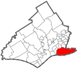 Location of Tinicum Township in Delaware County | |
 Tinicum Township Location in Pennsylvania | |
| Coordinates: 39°52′15″N 75°16′57″W / 39.87083°N 75.28250°WCoordinates: 39°52′15″N 75°16′57″W / 39.87083°N 75.28250°W | |
| Country | United States |
| State | Pennsylvania |
| County | Delaware |
| Settled | 1643 |
| Area | |
| • Total | 8.8 sq mi (23 km2) |
| • Land | 5.8 sq mi (15 km2) |
| • Water | 3.0 sq mi (8 km2) |
| Elevation | 13 ft (4 m) |
| Population (2010) | |
| • Total | 4,091 |
| • Density | 709.2/sq mi (273.8/km2) |
| Time zone | EST (UTC-5) |
| • Summer (DST) | EDT (UTC-4) |
| ZIP code | 19029 |
| Area code(s) | 610 and 484 |
| Website |
www |
Tinicum Township, more popularly known as "Tinicum Island" or "The Island", is a township in Delaware County, Pennsylvania, United States. The population was 4,091 at the 2010 census,[1] down from 4,353 at the 2000 census. Included within the township's boundaries are the communities of Essington and Lester. One of the island's notable aspects is the John Heinz National Wildlife Refuge at Tinicum, attracting visitors to the island year-round. The international terminal, the western end of the airfield, and runways 9L/27R and 9R/27L of Philadelphia International Airport are located in Tinicum Township.
History
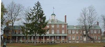
Tinicum Township has the distinction of being the site of the first recorded European settlement in Pennsylvania. Fort Nya Gothenborg, located on the South River, was settled by colonial Swedes in 1643. It served as capital of the New Sweden colony, under the rule of Royal Governor Johan Björnsson Printz. Governor Printz built his manor house, The Printzhof, on Tinicum Island, from which he administered the colony. The original Lenape called the place Tin-eek Unk.[2] The township is the site of the Philadelphia Lazaretto.[3] It and the Printzhof are listed on the National Register of Historic Places.[4]
Geography
Tinicum Township is located in southeastern Delaware County at 39°52′8″N 75°17′17″W / 39.86889°N 75.28806°W (39.868962, -75.288273).[5] It is bordered to the south by the Delaware River, to the west and northwest by Darby Creek, and to the northeast by the city of Philadelphia. The township borders the state of New Jersey at the center of the Delaware River. The unincorporated community of Essington is in the western part of the township, and Lester is directly to its east. The western part of Philadelphia International Airport takes up nearly all of the center and eastern parts of the township. The John Heinz National Wildlife Refuge lies along Darby Creek on the northwestern side of the township.
According to the United States Census Bureau, the township has a total area of 8.8 square miles (22.7 km2), of which 5.8 square miles (14.9 km2) is land and 3.0 square miles (7.8 km2), or 34.33%, is water.[1]
Demographics
| Historical population | |||
|---|---|---|---|
| Census | Pop. | %± | |
| 1930 | 3,630 | — | |
| 1940 | 3,792 | 4.5% | |
| 1950 | 5,314 | 40.1% | |
| 1960 | 4,375 | −17.7% | |
| 1970 | 4,906 | 12.1% | |
| 1980 | 4,291 | −12.5% | |
| 1990 | 4,440 | 3.5% | |
| 2000 | 4,353 | −2.0% | |
| 2010 | 4,091 | −6.0% | |
As of the census[6] of 2000, there were 4,353 people, 1,749 households, and 1,136 families residing in the township. The population density was 758.5 people per square mile (292.8/km²). There were 1,876 housing units at an average density of 326.9/sq mi (126.2/km²). The racial makeup of the township was 89.08% White, 4.80% Black or African American, 0.07% Native American, 0.44% Asian, 0.32% from other races, and 0.29% from two or more races. Hispanic or Latino of any race were 5.26% of the population.
There were 1,749 households, out of which 27.4% had children under the age of 18 living with them, 45.5% were married couples living together, 13.8% had a female householder with no husband present, and 35.0% were non-families. 28.8% of all households were made up of individuals, and 11.0% had someone living alone who was 65 years of age or older. The average household size was 2.49 and the average family size was 3.07.
In the township the population was spread out, with 23.3% under the age of 18, 7.2% from 18 to 24, 31.5% from 25 to 44, 22.6% from 45 to 64, and 15.4% who were 65 years of age or older. The median age was 38 years. For every 100 females there were 99.7 males. For every 100 females age 18 and over, there were 97.8 males.
The median income for a household in the township was $42,910, and the median income for a family was $49,129. Males had a median income of $37,358 versus $27,134 for females. The per capita income for the township was $19,203. About 6.8% of families and 7.6% of the population were below the poverty line, including 10.5% of those under age 18 and 2.7% of those age 65 or over.
Economy
When Scott Paper Company was an independent company, it had its headquarters in International Plaza (Scott Plaza) in Tinicum Township.[7]
Education
Tinicum Township is part of the Interboro School District. It is the district's only township, the remaining municipalities having borough status. Tinicum School and Interboro High School serve the township. All-State Career School has two campuses in the Tinicum Township, in Lester and Essington.[8]
Taxation
Employers who maintain worksites in Pennsylvania or employ individuals who may work from their homes are required to withhold applicable Earned Income Tax (EIT) from those employees.[9] This is a result of Act 32, which consolidated the tax collecting entities for the state of Pennsylvania.[10] The current Earned Income tax rate for Tinicum Township workers is 1.0%.[11] This tax must be withheld from employee pay and paid to the representative of the local tax collector, Keystone Collections Group.[12]
Birth of the stromboli
The stromboli is reported by Peter Romano to have originated in 1950 in Tinicum Township at Romano's Italian Restaurant & Pizzeria, by his grandfather Nazzareno Romano. There, William Schofield supposedly gave it the name, after the movie Stromboli, starring Ingrid Bergman.[13][14] Others claim that the stromboli was the brainchild of Mike Aquino, Sr. and that he created it in Spokane, Washington, in 1954.[15]
References
- 1 2 "Geographic Identifiers: 2010 Demographic Profile Data (G001): Tinicum township, Delaware County, Pennsylvania". U.S. Census Bureau, American Factfinder. Retrieved December 30, 2015.
- ↑ History of Delaware County, Pennsylvania (Henry Graham Ashmead. Philadelphia: L. H. Everts & Co. 1884)
- ↑ Tinicum history
- ↑ National Park Service (2010-07-09). "National Register Information System". National Register of Historic Places. National Park Service.
- ↑ "US Gazetteer files: 2010, 2000, and 1990". United States Census Bureau. 2011-02-12. Retrieved 2011-04-23.
- ↑ "American FactFinder". United States Census Bureau. Retrieved 2008-01-31.
- ↑ Kostelni, Natalie. "Old Scott Paper HQ for sale." Philadelphia Business Journal. September 16, 2002. 1. Retrieved on September 6, 2012.
- ↑ All-State Career School locations
- ↑ "Act 32 for Employees/Self-Employed"
- ↑ "Act 32 Overview"
- ↑ "Municipal Statistics Tax Report." Retrieved Feb. 11, 2015.
- ↑ "Business-Keystone Collections."
- ↑ "Romano's Pizzaria Facebook page"
- ↑ Daley, Bill (March 26, 2013). "Calzone v. stromboli". Chicago Tribune. Retrieved 2013-03-29.
- ↑ Stimson, William (June 5, 1976). "Stromboli Sandwich is Spokane Original". Spokane Daily Chronicle. Retrieved 2014-08-13.
External links
| Wikimedia Commons has media related to Tinicum Township, Delaware County, Pennsylvania. |
| Wikivoyage has a travel guide for Tinicum Township. |
| Preceded by West Deptford Township, New Jersey Gloucester County |
Bordering communities of Philadelphia |
Succeeded by Folcroft |
Municipalities and communities of Delaware County, Pennsylvania, United States | ||
|---|---|---|
| City | 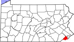 | |
| Boroughs | ||
| Townships | ||
| CDPs | ||
| Unincorporated communities |
| |
| Footnotes | ‡This populated place also has portions in an adjacent county or counties | |