West Deptford Township, New Jersey
| West Deptford Township, New Jersey | |
|---|---|
| Township | |
| Township of West Deptford | |
|
| |
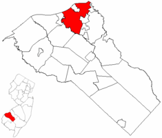 West Deptford Township highlighted in Gloucester County. Inset map: Gloucester County highlighted in the State of New Jersey. | |
 Census Bureau map of West Deptford Township, New Jersey | |
| Coordinates: 39°50′31″N 75°11′07″W / 39.842012°N 75.185397°WCoordinates: 39°50′31″N 75°11′07″W / 39.842012°N 75.185397°W[1][2] | |
| Country |
|
| State |
|
| County |
|
| Incorporated | March 1, 1871 |
| Government[3] | |
| • Type | Township |
| • Body | Township Committee |
| • Mayor | Denice DiCarlo (D, term ends December 31, 2018)[4][5] |
| • Administrator | Debra Turner-Fox[6] |
| • Clerk | Lee Ann DeHart[6] |
| Area[1] | |
| • Total | 17.865 sq mi (46.271 km2) |
| • Land | 15.411 sq mi (39.915 km2) |
| • Water | 2.454 sq mi (6.356 km2) 13.74% |
| Area rank |
159th of 566 in state 8th of 24 in county[1] |
| Elevation[7] | 7 ft (2 m) |
| Population (2010 Census)[8][9][10] | |
| • Total | 21,677 |
| • Estimate (2015)[11] | 21,420 |
| • Rank |
118th of 566 in state 4th of 24 in county[12] |
| • Density | 1,406.6/sq mi (543.1/km2) |
| • Density rank |
345th of 566 in state 12th of 24 in county[12] |
| Time zone | Eastern (EST) (UTC-5) |
| • Summer (DST) | Eastern (EDT) (UTC-4) |
| ZIP code | 08051, 08063, 08066, 08086, 08093, 08096[13] |
| Area code(s) | 856[14] |
| FIPS code | 3401578800[1][15][16] |
| GNIS feature ID | 0882148[1][17] |
| Website |
www |

West Deptford Township is a township in Gloucester County, New Jersey, United States. As of the 2010 United States Census, the township's population was 21,677,[8][9][10] reflecting an increase of 2,309 (+11.9%) from the 19,368 counted in the 2000 Census, which had in turn declined by 12 (-0.1%) from the 19,380 counted in the 1990 Census.[18]
West Deptford Township was formed as a township by an act of the New Jersey Legislature on March 1, 1871, from portions of Deptford Township. Portions of the township were taken to form the boroughs of National Park (April 15, 1902) and Westville (April 7, 1914).[19] Woodbury annexed portions of the township in May 1907.[20] The township was named for Deptford, which in turn was named after the English port of Deptford.[21][22]
History
Ladd's Castle (also known as Candor Hall) is a historic building located in the Colonial Manor section that is Gloucester County's oldest brick home. Added to the National Register of Historic Places in 1972, it was constructed around 1688 by William Ladd, a surveyor who is said to have helped William Penn to lay out a master design for the city of Philadelphia.[23]
Geography
According to the United States Census Bureau, the township had a total area of 17.865 square miles (46.271 km2), including 15.411 square miles (39.915 km2) of land and 2.454 square miles (6.356 km2) of water (13.74%).[1][2]
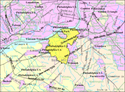
Unincorporated communities, localities and place names located partially or completely within the township include Colonial Manor, Eagle Point, Greenfields Village, Hoffman Wharf, League Island, Leonards, North Woodbury, Ogens, Paradise, Parkville, Pierces Corner, Red Bank, Tatens, Thorofare, Verga, Washington Park and West End.[24]
 |
Tinicum Township, PA | Philadelphia National Park |
Westville | |
| Paulsboro | |
Woodbury Woodbury Heights Deptford Township | ||
| ||||
| | ||||
| East Greenwich Township | Mantua Township |
Demographics
| Historical population | |||
|---|---|---|---|
| Census | Pop. | %± | |
| 1880 | 1,399 | — | |
| 1890 | 1,588 | 13.5% | |
| 1900 | 1,951 | 22.9% | |
| 1910 | 2,057 | * | 5.4% |
| 1920 | 1,781 | * | −13.4% |
| 1930 | 3,956 | 122.1% | |
| 1940 | 4,336 | 9.6% | |
| 1950 | 5,446 | 25.6% | |
| 1960 | 11,152 | 104.8% | |
| 1970 | 13,928 | 24.9% | |
| 1980 | 18,002 | 29.3% | |
| 1990 | 19,380 | 7.7% | |
| 2000 | 19,368 | −0.1% | |
| 2010 | 21,677 | 11.9% | |
| Est. 2015 | 21,420 | [11][25] | −1.2% |
| Population sources: 1880-2000[26] 1880-1920[27] 1880-1890[28] 1890-1910[29] 1910-1930[30] 1930-1990[31] 2000[32][33] 2010[8][9][10] * = Lost territory on previous decade.[19] | |||
Census 2010
The 2010 United States Census counted 21,677 people, 8,829 households, and 5,757 families residing in the township. The population density was 1,406.6 per square mile (543.1/km2). The township contained 9,441 housing units at an average density of 612.6 per square mile (236.5/km2). The racial makeup of the township was 88.96% (19,283) White, 6.52% (1,414) Black or African American, 0.12% (25) Native American, 1.91% (415) Asian, 0.01% (3) Pacific Islander, 0.86% (187) from other races, and 1.61% (350) from two or more races. Hispanics or Latinos of any race were 3.37% (731) of the population.[8]
Out of a total of 8,829 households, 27.9% had children under the age of 18 living with them, 48.5% were married couples living together, 11.8% had a female householder with no husband present, and 34.8% were non-families. 28.5% of all households were made up of individuals, and 10.3% had someone living alone who was 65 years of age or older. The average household size was 2.44 and the average family size was 3.03.[8]
In the township, 21.6% of the population were under the age of 18, 7.8% from 18 to 24, 26.5% from 25 to 44, 29.7% from 45 to 64, and 14.4% who were 65 years of age or older. The median age was 40.7 years. For every 100 females the census counted 94.0 males, but for 100 females at least 18 years old, it was 90.2 males.[8]
The Census Bureau's 2006-2010 American Community Survey showed that (in 2010 inflation-adjusted dollars) median household income was $69,316 (with a margin of error of +/- $3,689) and the median family income was $84,900 (+/- $5,549). Males had a median income of $61,346 (+/- $4,244) versus $47,155 (+/- $4,421) for females. The per capita income for the borough was $33,874 (+/- $1,513). About 4.0% of families and 5.5% of the population were below the poverty line, including 7.6% of those under age 18 and 7.0% of those age 65 or over.[34]
Census 2000
As of the 2000 United States Census[15] there were 19,368 people, 7,719 households, and 5,125 families residing in the township. The population density was 1,218.4 people per square mile (470.3/km²). There were 7,999 housing units at an average density of 503.2 per square mile (194.2/km²). The racial makeup of the township was 92.29% White, 5.08% Black, 0.23% Native American, 1.13% Asian, 0.02% Pacific Islander, 0.42% from other races, and 0.82% from two or more races. Hispanic or Latino of any race were 1.76% of the population.[32][33]
There were 7,719 households out of which 30.6% had children under the age of 18 living with them, 51.7% were married couples living together, 10.6% had a female householder with no husband present, and 33.6% were non-families. 27.4% of all households were made up of individuals and 8.6% had someone living alone who was 65 years of age or older. The average household size was 2.49 and the average family size was 3.07.[32][33]
In the township the population was spread out with 23.5% under the age of 18, 8.2% from 18 to 24, 31.8% from 25 to 44, 24.2% from 45 to 64, and 12.2% who were 65 years of age or older. The median age was 38 years. For every 100 females there were 93.4 males. For every 100 females age 18 and over, there were 90.1 males.[32][33]
The median income for a household in the township was $50,583, and the median income for a family was $64,477. Males had a median income of $42,711 versus $30,621 for females. The per capita income for the township was $24,219. About 3.0% of families and 5.3% of the population were below the poverty line, including 4.5% of those under age 18 and 7.5% of those age 65 or over.[32][33]
Government
Local government
West Deptford Township is governed under the Township form of government. The five-member Township Committee is elected directly by the voters at-large in partisan elections to serve three-year terms of office on a staggered basis, with either one or two seats coming up for election each year as part of the November general election in a three-year cycle.[3][35] At an annual reorganization meeting, the Township Committee selects one of its members to serve as Mayor and another as Deputy Mayor. The Township Committee is the legislative branch of the Township government, developing and adopting ordinances that become the laws of the township.
As of 2016, the Mayor of West Deptford is Democrat Denice DiCarlo, whose term of office ends December 31, 2018.[4] The other members of the West Deptford Township Committee are Deputy Mayor James Mehaffey (D, 2017), Jeff Hansen (R, 2016), Jerry Maher (R, 2016) and Adam Reid (D, 2017).[36][37][38][39][40][41]
The pick-up of two seats by Republicans in the 2011 election gave the party control of the Township Committee for the first time since the 1980s.[42][43]
Republicans Jeff Hansen and Gerald P. Maher won three-year seats in the November 2013 election, giving Republicans a 4-1 edge on the 2014 committee.[44][45]
In the 2014 election, Democratic challengers James Mehaffey and Adam Reid defeated incumbent Republicans Raymond Chintall and John Keuler Jr., giving the Democrats a 3-2 majority, with the three Democrats choosing as mayor Denice DiCarlo, who had been the lone Democrat in the previous council.[46]
Federal, state and county representation
West Deptford Township is located in the 1st Congressional District[47] and is part of New Jersey's 3rd state legislative district.[9][48][49]
New Jersey's First Congressional District is represented by Donald Norcross (D, Camden).[50] New Jersey is represented in the United States Senate by Cory Booker (D, Newark, term ends 2021)[51] and Bob Menendez (D, Paramus, 2019).[52][53]
For the 2016–2017 session (Senate, General Assembly), the 3rd Legislative District of the New Jersey Legislature is represented in the State Senate by Stephen M. Sweeney (D, West Deptford Township) and in the General Assembly by John J. Burzichelli (D, Paulsboro) and Adam Taliaferro (D, Woolwich Township).[54] The Governor of New Jersey is Chris Christie (R, Mendham Township).[55] The Lieutenant Governor of New Jersey is Kim Guadagno (R, Monmouth Beach).[56]
Gloucester County is governed by a Board of Chosen Freeholders, whose seven members are elected at-large to three-year terms of office on a staggered basis in partisan elections, with two or three seats coming up for election each year. At a reorganization meeting held each January, the Board selects a Freeholder Director and a Deputy Freeholder Director from among its members. As of 2016, Gloucester County's Freeholders are Freeholder Director Robert M. Damminger (D, West Deptford Township; term ends December 31, 2018),[57] Deputy Freeholder Director Giuseppe "Joe" Chila (D, Woolwich Township; 2018),[58] Lyman J. Barnes (D, Logan Township; 2017),[59] Daniel Christy (D, Washington Township; 2016),[60] Frank J. DiMarco (D, Deptford Township; 2016),[61] Heather Simmons (D, Glassboro; 2017)[62] and Jim Jefferson (D, Woodbury; 2017).[63][64][65][66] Constitutional officers elected countywide are County Clerk James N. Hogan,[67] Surrogate Helene M. Reed (Monroe Township)[68] and Sheriff Carmel Morina (Greenwich Township).[69][70][65]
Politics
As of March 23, 2011, there were a total of 14,703 registered voters in West Deptford, of which 5,661 (38.5%) were registered as Democrats, 2,312 (15.7%) were registered as Republicans and 6,724 (45.7%) were registered as Unaffiliated. There were 6 voters registered to other parties.[71]
In the 2012 presidential election, Democrat Barack Obama received 57.1% of the vote (6,119 cast), ahead of Republican Mitt Romney with 41.7% (4,463 votes), and other candidates with 1.2% (132 votes), among the 10,804 ballots cast by the township's 15,400 registered voters (90 ballots were spoiled), for a turnout of 70.2%.[72][73] In the 2008 presidential election, Democrat Barack Obama received 57.1% of the vote (6,351 cast), ahead of Republican John McCain with 40.2% (4,468 votes) and other candidates with 1.4% (158 votes), among the 11,119 ballots cast by the township's 15,030 registered voters, for a turnout of 74.0%.[74] In the 2004 presidential election, Democrat John Kerry received 55.3% of the vote (5,566 ballots cast), outpolling Republican George W. Bush with 43.5% (4,375 votes) and other candidates with 0.5% (71 votes), among the 10,065 ballots cast by the township's 13,400 registered voters, for a turnout percentage of 75.1.[75]
In the 2013 gubernatorial election, Republican Chris Christie received 66.3% of the vote (4,593 cast), ahead of Democrat Barbara Buono with 32.3% (2,236 votes), and other candidates with 1.4% (96 votes), among the 7,118 ballots cast by the township's 15,194 registered voters (193 ballots were spoiled), for a turnout of 46.8%.[76][77] In the 2009 gubernatorial election, Democrat Jon Corzine received 45.4% of the vote (3,212 ballots cast), ahead of Republican Chris Christie with 43.5% (3,077 votes), Independent Chris Daggett with 8.9% (629 votes) and other candidates with 0.6% (39 votes), among the 7,072 ballots cast by the township's 14,879 registered voters, yielding a 47.5% turnout.[78]
Education
The West Deptford Public Schools serve students in Kindergarten through twelfth grade. As of the 2011-12 school year, the district's five schools had an enrollment of 3,039 students and 197.2 classroom teachers (on an FTE basis), for a student–teacher ratio of 15.41:1.[79] Schools in the district (with 2011-12 enrollment data from the National Center for Education Statistics[80]) are Oakview Elementary School[81] (grades K-1; 303 students), Red Bank Elementary School[82] (grade 2; 300), Green-Fields Elementary School[83] (3-4; 505), West Deptford Middle School[84] (5-8; 1,029) and West Deptford High School[85] (9-12; 907).[86]
Transportation
Roads and highways
As of May 2010, the township had a total of 98.00 miles (157.72 km) of roadways, of which 64.28 miles (103.45 km) were maintained by the municipality, 20.79 miles (33.46 km) by Gloucester County and 11.07 miles (17.82 km) by the New Jersey Department of Transportation and 1.86 miles (2.99 km) by the New Jersey Turnpike Authority.[87]
Major roadways in and around West Deptford Township include Interstate 295, which enters the township's southwest from Paulsboro and continues for 5.5 miles (8.9 km) towards the northeast to Deptford Township and includes exits 19, 20, 21, 22 and 23.[88] U.S. Route 130 follows a concurrency with Interstate 295, splitting off near interchange 23 towards the township's northeast as Crown Point Avenue and continuing into Westville.[89][90] Route 44 (Crown Point Road) enters from Paulsboro, closely paralleling Interstate 295 for 4.0 miles (6.4 km) to its northern terminus in the township.[91] Route 45 (Mantua Avenue) enters from Mantua Township in the extreme southeast corner of the township and runs along the eastern border with Deptford Township and then Woodbury Heights, enters Woodbury and then re-enters West Deptford Township as its border with Deptford Township before continuing to the north towards its terminus in Westville.[92]
County Route 551 (Kings Highway) enters on the south from East Greenwich Township and continues for 2.4 miles (3.9 km) heading northeast into Woodbury.[93] The New Jersey Turnpike passes through the township's southeastern corner, heading northeast from East Greenwich Township to Woodbury Heights, but the nearest exits are Interchanges 3 and 2.[94]
Public transportation
New Jersey Transit bus service between the township and Philadelphia is available on the 401 (Salem to Philadelphia), 402 (Pennsville Township to Philadelphia) and 410 (Bridgeton to Philadelphia) routes, with local service offered on the 455 route between Cherry Hill Township and Paulsboro.[95][96]
Port of Paulsboro
The Port of Paulsboro is located on the Delaware River and Mantua Creek in Paulsboro and West Deptford. Traditionally one of the nation's busiest for marine transfer operations of petroleum products, the port is being redeveloped as an adaptable omniport able to handle a diversity of bulk, break bulk cargo and shipping containers. Studies completed in 2012.[97][98] concluded that the port is well suited to become a center for the manufacture, assembly, and transport of wind turbines and platforms the development of Atlantic Wind Connection[99][100][101][102][103][104]
Community
West Deptford is host of the annual Senior Little League Baseball Eastern Regional Tournament. The winner of this tournament advances to the Senior League World Series held annually in Bangor, Maine since 2002.[105]
Notable people
People who were born in, residents of, or otherwise closely associated with West Deptford Township include:
- Dan Baker (born 1946), sports announcer for the Philadelphia Eagles and Philadelphia Phillies.[106]
- Martin A. Herman (born 1939), politician who served in the New Jersey General Assembly, where he represented the 3nd Legislative District from 1974 to 1986, and was later appointed as a judge in New Jersey Superior Court in Gloucester County.[107]
- Jeremy Maclin (born 1988), wide receiver for the Philadelphia Eagles.[108][109]
- Stephen M. Sweeney (born 1959), current President of the New Jersey Senate.[110]
- Dajuan Wagner, (born 1983), former National Basketball Association player.[111]
References
- 1 2 3 4 5 6 2010 Census Gazetteer Files: New Jersey County Subdivisions, United States Census Bureau. Accessed May 21, 2015.
- 1 2 US Gazetteer files: 2010, 2000, and 1990, United States Census Bureau. Accessed September 4, 2014.
- 1 2 2012 New Jersey Legislative District Data Book, Rutgers University Edward J. Bloustein School of Planning and Public Policy, March 2013, p. 19.
- 1 2 Mayor's Office, West Deptford. Accessed July 6, 2016.
- ↑ 2016 New Jersey Mayors Directory, New Jersey Department of Community Affairs. Accessed June 14, 2016. As of date accessed, DiCarlo is listed as mator with an incorrect term-end year of 2016.
- 1 2 Contact List, West Deptford Township. Accessed July 6, 2016.
- ↑ U.S. Geological Survey Geographic Names Information System: Township of West Deptford, Geographic Names Information System. Accessed March 14, 2013.
- 1 2 3 4 5 6 DP-1 - Profile of General Population and Housing Characteristics: 2010 for West Deptford township, Gloucester County, New Jersey, United States Census Bureau. Accessed November 8, 2012.
- 1 2 3 4 Municipalities Grouped by 2011-2020 Legislative Districts, New Jersey Department of State, p. 3. Accessed January 6, 2013.
- 1 2 3 Profile of General Demographic Characteristics: 2010 for West Deptford township, New Jersey Department of Labor and Workforce Development. Accessed November 8, 2012.
- 1 2 PEPANNRES - Annual Estimates of the Resident Population: April 1, 2010 to July 1, 2015 - 2015 Population Estimates for New Jersey municipalities, United States Census Bureau. Accessed May 22, 2016.
- 1 2 GCT-PH1 Population, Housing Units, Area, and Density: 2010 - State -- County Subdivision from the 2010 Census Summary File 1 for New Jersey, United States Census Bureau. Accessed November 8, 2012.
- ↑ Look Up a ZIP Code for West Deptford, NJ, United States Postal Service. Accessed November 8, 2012.
- ↑ Area Code Lookup - NPA NXX for West Deptford, NJ, Area-Codes.com. Accessed November 11, 2013.
- 1 2 American FactFinder, United States Census Bureau. Accessed September 4, 2014.
- ↑ A Cure for the Common Codes: New Jersey, Missouri Census Data Center. Accessed October 31, 2012.
- ↑ US Board on Geographic Names, United States Geological Survey. Accessed September 4, 2014.
- ↑ Table 7. Population for the Counties and Municipalities in New Jersey: 1990, 2000 and 2010, New Jersey Department of Labor and Workforce Development, February 2011. Accessed November 8, 2012.
- 1 2 Snyder, John P. The Story of New Jersey's Civil Boundaries: 1606-1968, Bureau of Geology and Topography; Trenton, New Jersey; 1969. p. 141. Accessed October 25, 2012.
- ↑ Honeyman, Abraham Van Doren. Index-analysis of the Statutes of New Jersey, 1896-1909: Together with References to All Acts, and Parts of Acts, in the 'General Statutes' and Pamphlet Laws Expressly Repealed: and the Statutory Crimes of New Jersey During the Same Period, p. 313. New Jersey Law Journal Publishing Company, 1910. Accessed October 25, 2015.
- ↑ Hutchinson, Viola L. The Origin of New Jersey Place Names, New Jersey Public Library Commission, May 1945. Accessed October 25, 2015.
- ↑ Gannett, Henry. The Origin of Certain Place Names in the United States, p. 104. United States Government Printing Office, 1905. Accessed October 25, 2015.
- ↑ Candor Hall or Ladd's Castle, Gloucester County, New Jersey. Accessed October 25, 2015. "This Colonial manor is the oldest brick house in the county. It was built ca. 1688 by John Ladd, who lived there until his death.He is said to have helped William Penn lay out the streets of Philadelphia."
- ↑ Locality Search, State of New Jersey. Accessed May 21, 2015.
- ↑ Census Estimates for New Jersey April 1, 2010 to July 1, 2015, United States Census Bureau. Accessed May 22, 2016.
- ↑ Barnett, Bob. "Population Data for Gloucester County Municipalities, 1800 - 2000, WestJersey.org, January 6, 2011. Accessed November 8, 2012.
- ↑ Compendium of censuses 1726-1905: together with the tabulated returns of 1905, New Jersey Department of State, 1906. Accessed November 11, 2013.
- ↑ Porter, Robert Percival. Preliminary Results as Contained in the Eleventh Census Bulletins: Volume III - 51 to 75, p. 98. United States Census Bureau, 1890. Accessed November 11, 2013.
- ↑ Thirteenth Census of the United States, 1910: Population by Counties and Minor Civil Divisions, 1910, 1900, 1890, United States Census Bureau, p. 336. Accessed November 8, 2012.
- ↑ Fifteenth Census of the United States : 1930 - Population Volume I, United States Census Bureau, p. 716. Accessed November 8, 2012.
- ↑ Table 6. New Jersey Resident Population by Municipality: 1930 - 1990, New Jersey Department of Labor and Workforce Development. Accessed June 28, 2015.
- 1 2 3 4 5 Census 2000 Profiles of Demographic / Social / Economic / Housing Characteristics for West Deptford township, Gloucester County, New Jersey, United States Census Bureau. Accessed November 8, 2012.
- 1 2 3 4 5 DP-1: Profile of General Demographic Characteristics: 2000 - Census 2000 Summary File 1 (SF 1) 100-Percent Data for West Deptford township, Gloucester County, New Jersey, United States Census Bureau. Accessed November 8, 2012.
- ↑ DP03: Selected Economic Characteristics from the 2006-2010 American Community Survey 5-Year Estimates for West Deptford township, Gloucester County, New Jersey, United States Census Bureau. Accessed November 8, 2012.
- ↑ "Forms of Municipal Government in New Jersey", p. 7. Rutgers University Center for Government Studies. Accessed June 3, 2015.
- ↑ Township Committee, West Deptford. Accessed July 6, 2016.
- ↑ 2015 Municipal Data Sheet, West Deptford. Accessed July 6, 2016.
- ↑ Gloucester County 2016 Official Directory, Gloucester County, New Jersey. Accessed July 5, 2016.
- ↑ General Election November 3, 2015 Unofficial Results, Gloucester County, New Jersey Clerk, updated November 9, 2015. Accessed July 5, 2016.
- ↑ 2014 General Election Unofficial Results, Gloucester County, New Jersey Clerk, updated November 13, 2014. Accessed July 5, 2016.
- ↑ 2013 General Election November 5, 2013 Summary Report Gloucester County, Gloucester County, New Jersey Clerk, updated March 10, 2014. Accessed July 5, 2016.
- ↑ Barna, John. "Republicans gain five local government seats in Gloucester County", Gloucester County Times, November 8, 2011. Accessed November 11, 2013. "The Republican Party picked up five seats on municipal councils and committees in Gloucester County on Tuesday, including gaining control of municipal government in West Deptford Township for the first time since the mid-80s.... Republicans Samuel G. Cianfarini (2,828) and Raymond Chintall (2,676) defeated Democrats Denice DiCarlo (2,433) and Hunter Kintzing (2,384) and incumbent Len E. Daws (1,078), a longtime Democratic committeeman seeking a new term as an independent, for two open committee seats."
- ↑ Bittner, Gina. "Cianfarini and Chintall win West Deptford committee race", Gloucester County Times, November 8, 2011. Accessed November 11, 2013. "Republicans Ray Chintall and Sam Cianfarini will fill the two open township committee seats come January, giving the GOP their first 3-2 lead in more than a decade."
- ↑ Beym, Jessica. 'Gloucester County election results 2013: live updates", South Jersey Times, November 5, 2013. Accessed November 11, 2013.
- ↑ Laday, Jason. "West Deptford elects Republicans to township committee", South Jersey Times, November 6, 2013. Accessed November 11, 2013. "The Republicans have not only retained control but added to their advantage on the township committee, with unofficial results showing Jeff Hansen and Gerald Maher beating out their Democratic opponents.Come January, the Republicans will enjoy a 4-1 majority on the committee."
- ↑ Laday, Jason. "West Depford's Democrats appoint Denice DiCarlo mayor, schedule special meeting on appointments", South Jersey Times, January 2, 2015. Accessed February 18, 2015. "After a year representing the minority on a Republican-dominated township committee, Denice DiCarlo was appointed mayor Thursday evening by the new Democratic majority.The party-line vote to appoint DiCarlo mayor took place before a standing-room-only crowd at the municipal building. New Democratic committee members Adam Reid and James Mehaffey — both sworn in by New Jersey Senate President, and West Deptford resident, Steve Sweeney — both voted to appoint DiCarlo for the leadership position."
- ↑ Plan Components Report, New Jersey Redistricting Commission, December 23, 2011. Accessed January 6, 2013.
- ↑ 2016 New Jersey Citizen's Guide to Government, p. 66, New Jersey League of Women Voters. Accessed July 20, 2016.
- ↑ Districts by Number for 2011-2020, New Jersey Legislature. Accessed January 6, 2013.
- ↑ Directory of Representatives: New Jersey, United States House of Representatives. Accessed January 5, 2012.
- ↑ About Cory Booker, United States Senate. Accessed January 26, 2015. "He now owns a home and lives in Newark's Central Ward community."
- ↑ Biography of Bob Menendez, United States Senate, January 26, 2015. "He currently lives in Paramus and has two children, Alicia and Robert."
- ↑ Senators of the 114th Congress from New Jersey. United States Senate. Accessed January 26, 2015. "Booker, Cory A. - (D - NJ) Class II; Menendez, Robert - (D - NJ) Class I"
- ↑ Legislative Roster 2016-2017 Session, New Jersey Legislature. Accessed January 17, 2016.
- ↑ "About the Governor". State of New Jersey. Retrieved 2010-01-21.
- ↑ "About the Lieutenant Governor". State of New Jersey. Retrieved 2010-01-21.
- ↑ Robert M. Damminger, Gloucester County, New Jersey. Accessed February 3, 2016.
- ↑ Giuseppe (Joe) Chila, Gloucester County, New Jersey. Accessed February 3, 2016.
- ↑ Lyman Barnes, Gloucester County, New Jersey. Accessed February 3, 2016.
- ↑ Daniel Christy, Gloucester County, New Jersey. Accessed February 3, 2016.
- ↑ Frank J. DiMarco, Gloucester County, New Jersey. Accessed February 3, 2016.
- ↑ Heather Simmons, Gloucester County, New Jersey. Accessed February 3, 2016.
- ↑ Jim Jefferson, Gloucester County, New Jersey. Accessed February 3, 2016.
- ↑ Board of Freeholders, Gloucester County, New Jersey. Accessed February 3, 2016.
- 1 2 2014 Gloucester County Official Directory, Gloucester County, New Jersey. Accessed September 12, 2014.
- ↑ 2014 County Data Sheet, Gloucester County, New Jersey. Accessed September 12, 2014.
- ↑ James N. Hogan, Gloucester County, New Jersey. Accessed February 3, 2016.
- ↑ Surrogate Helene M. Reed, Gloucester County, New Jersey. Accessed February 3, 2016.
- ↑ Sheriff Carmel M. Morina, Gloucester County, New Jersey. Accessed February 3, 2016.
- ↑ Row Officers, Gloucester County, New Jersey. Accessed February 3, 2016.
- ↑ Voter Registration Summary - Gloucester, New Jersey Department of State Division of Elections, March 23, 2011. Accessed November 6, 2012.
- ↑ "Presidential General Election Results - November 6, 2012 - Gloucester County" (PDF). New Jersey Department of Elections. March 15, 2013. Retrieved December 24, 2014.
- ↑ "Number of Registered Voters and Ballots Cast - November 6, 2012 - General Election Results - Gloucester County" (PDF). New Jersey Department of Elections. March 15, 2013. Retrieved December 24, 2014.
- ↑ 2008 Presidential General Election Results: Gloucester County, New Jersey Department of State Division of Elections, December 23, 2008. Accessed November 6, 2012.
- ↑ 2004 Presidential Election: Gloucester County, New Jersey Department of State Division of Elections, December 13, 2004. Accessed November 6, 2012.
- ↑ "Governor - Gloucester County" (PDF). New Jersey Department of Elections. January 29, 2014. Retrieved December 24, 2014.
- ↑ "Number of Registered Voters and Ballots Cast - November 5, 2013 - General Election Results - Gloucester County" (PDF). New Jersey Department of Elections. January 29, 2014. Retrieved December 24, 2014.
- ↑ 2009 Governor: Gloucester County, New Jersey Department of State Division of Elections, December 31, 2009. Accessed November 6, 2012.
- ↑ District information for West Deptford Township School District, National Center for Education Statistics. Accessed December 30, 2014.
- ↑ School Data for the West Deptford Public Schools, National Center for Education Statistics. Accessed December 30, 2014.
- ↑ Oakview Elementary School, West Deptford School District. Accessed July 23, 2013.
- ↑ Red Bank Elementary School, West Deptford School District. Accessed July 23, 2013.
- ↑ Green-Fields Elementary School, West Deptford School District. Accessed July 23, 2013.
- ↑ West Deptford Middle School, West Deptford School District. Accessed July 23, 2013.
- ↑ West Deptford High School, West Deptford School District. Accessed July 23, 2013.
- ↑ New Jersey School Directory for the West Deptford Public Schools, New Jersey Department of Education. Accessed November 11, 2013.
- ↑ Gloucester County Mileage by Municipality and Jurisdiction, New Jersey Department of Transportation, May 2010. Accessed November 11, 2013.
- ↑ Interstate 295 Straight Line Diagram, New Jersey Department of Transportation, February 2008. Accessed November 11, 2013.
- ↑ U.S. Route 130 Straight Line Diagram, New Jersey Department of Transportation, February 2006. Accessed November 11, 2013.
- ↑ Enlarged View 38 (West Deptford Township, Gloucester County), New Jersey Department of Transportation, June 2009. Accessed November 11, 2013.
- ↑ Route 44 Straight Line Diagram, New Jersey Department of Transportation, April 2009. Accessed November 11, 2013.
- ↑ Route 45 Straight Line Diagram, New Jersey Department of Transportation, January 2010. Accessed November 11, 2013.
- ↑ County Route 551 Straight Line Diagram, New Jersey Department of Transportation, September 2007. Accessed November 12, 2013.
- ↑ New Jersey Turnpike Straight Line Diagram, New Jersey Department of Transportation, January 1997. Accessed November 11, 2013.
- ↑ Gloucester County Bus / Rail Connections, New Jersey Transit, backed up by the Internet Archive as of July 26, 2010. Accessed November 8, 2012.
- ↑ South Jersey Transit Guide, Cross County Connection, as of April 1, 2010. Accessed November 11, 2013.
- ↑ Laday, Jason (December 11, 2012). "Paulsboro port site vetted by wind energy firm". South Jersey Times. Retrieved July 17, 2013.
- ↑ "AWC Study Confirms Feasibility Of Paulsboro Marine Terminal Site". North American Wind Power. April 25, 2013. Retrieved July 17, 2013.
- ↑ "AWC to Build Manufacturing Facility in Paulsboro, USA". Off shore Wind Biz. December 6, 2012. Retrieved July 27, 2013.
- ↑ Merritt, Athena D. (January 19, 2009). "$250M port will be built in Paulsboro". Philadelphia Business Journal. Retrieved July 8, 2013.
- ↑ Forand, Rebecca (April 23, 2013). "Port of Paulsboro could be construction site for off-shore wind structures". South Jersey Times. Retrieved July 8, 2013.
- ↑ Belier, Carolyn (April 24, 2013). "Companies Betting Big on New Jersey's Offshore Wind". WCAU. Retrieved July 8, 2013.
- ↑ Paciolla, Christina (February 2012). "The Port of Paulsboro". South Jersey Biz. Retrieved July 8, 2013.
- ↑ Loyd, Linda (April 13, 2012). "Construction under way at new Paulsboro port". The Philadelphia Inquirer. Retrieved July 8, 2013.
- ↑ Staff. "West Deptford set to host Senior Little League Regional", Gloucester County Times, August 7, 2009. Accessed June 27, 2011.
- ↑ Narducci, Marc. "His part-time jobs are full-time passions Dan Baker, public address announcer for the Phillies and Eagles, lives his lifelong dream, calling the action for 32 years.", The Philadelphia Inquirer, June 1, 2003. Accessed October 25, 2015. "West Deptford resident Dan Baker could probably retire now if he had a nickel for every time somebody told him they would love to have his part-time jobs. Then again, with these jobs, why would Baker or anybody else want to retire?"
- ↑ Staff. [Staff. Manual of the Legislature of New Jersey; 1984 edition, p. 239. J. A. Fitzgerald, 1984. Accessed September 9, 2016. "Martin A. Herman, Dem., West Deptford Assemblyman Herman was born in Philadelphia on June 30, 1939. He was graduated from Temple University in 1960, and from its law school in 1963."
- ↑ Littel, Bryan. "Jeremy Maclin Football Camp Gives Players Local Connection to Pros; Football players from around the region wrapped up a three-day football camp with Philadelphia Eagles wide receiver Jeremy Maclin Wednesday.", WestDeptfordPatch, June 28, 2012. Accessed November 8, 2012. "He also gave credit to Maclin, who lives in West Deptford, for being involved—both via the camp and at other times, like when the pro was able to come to speak with the midget football players before their championship game."
- ↑ Lombardo, Matt. "Look inside former Eagles wide receiver Jeremy Maclin's N.J. home, which is up for sale (PHOTOS)", NJ Advance Media, April 13, 2015. Accessed October 25, 2015. "Former Eagles wide receiver Jeremy Maclin will have a new address next season after signing with the Kansas City Chiefs as a free agent, and has officially put his West Deptford home on the market."
- ↑ Stephen M. Sweeney: Freeholder Director, Gloucester County, backed up by the Internet Archive as of April 11, 2010. Accessed November 8, 2012. "Steve resides in West Deptford Township with his family."
- ↑ Mannix, Chris. "Intestinal Fortitude; After surgery for colitis, Dajuan Wagner is trying to resume a career that once showed such promise", Sports Illustrated, September 11, 2006, backed up by the Internet Archive as of August 26, 2010. Accessed October 25, 2015. "He returned home to West Deptford, N.J., where he saw a specialist who recommended surgery to remove his inflamed colon."
External links
- West Deptford Township website
- West Deptford Public Schools
- West Deptford Public Schools's 2014–15 School Report Card from the New Jersey Department of Education
- School Data for the West Deptford Public Schools, National Center for Education Statistics
| Preceded by Westville |
Bordering communities of Philadelphia With: National Park |
Succeeded by Tinicum Township, Pennsylvania Delaware County |
