Trondra
| Location | |
|---|---|
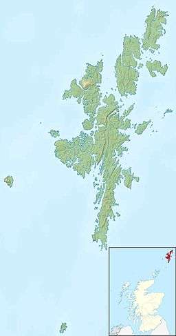
 Trondra Trondra shown within Shetland | |
| OS grid reference | HU398371 |
| Physical geography | |
| Island group | Shetland |
| Area | 275 hectares (1.06 sq mi) |
| Area rank | 90= [1] |
| Highest elevation | 60 metres (197 ft) |
| Administration | |
| Sovereign state | United Kingdom |
| Country | Scotland |
| Council area | Shetland Islands |
| Demographics | |
| Population | 135[2] |
| Population rank | 42 [1] |
| Pop. density | 49 people/km2[2][3] |
| References | [3][4][5] |
Trondra is one of the Scalloway Islands, a subgroup of the Shetland Islands in Scotland. It shelters the harbour of Scalloway and has an area of 275 hectares (1.06 sq mi).
History
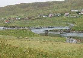
Trondra was becoming rapidly depopulated until 1970, when road bridges were built to neighbouring Burra (West and East) and to the southern peninsula of the Shetland Mainland.[5] Since then the population has recovered from a low of 20 in 1961.[3]
A local community hall was opened in 1986.
Composition
Settlements on the island include:
- Burland - Burland houses one of Shetland's most popular tourist attractions - the Burland Croft Trail.
- Cauldhame
- Cutts
- Glendale
- Scarfataing

Geology
Trondra is made up of old red sandstone.[3] The hills are covered in grass and heather, with trees being few and far between, much like the rest of the Shetland Islands.
The island lacks peat, but traditionally the islanders have had permission to cut it on nearby Papa.[3]
Wildlife
Trondra supports a number of seabirds including many gulls and black guillemots.[3]
There are many fields of sheep and a few of Shetland ponies throughout the island. There is a variety of other wildlife present on and around the isle, such as hedgehogs, sparrows, starlings, seals and porpoises.
Leisure activities
Trondra has 2 rowing teams, male and female, which compete in the summertime rowing regattas around Shetland and the annual 'Round Trondra Race'.
"Da Peerie Neep" ("The Wee Turnip") is a recently founded annual event which takes place in the Trondra hall and involves various neep related events such as "Toss the Neep".
Trondra usually enters a male and female squad in the Scalloway Fire Festival, which takes place in early January each year.
Footnotes
- 1 2 Area and population ranks: there are c. 300 islands over 20 ha in extent and 93 permanently inhabited islands were listed in the 2011 census.
- 1 2 National Records of Scotland (15 August 2013) (pdf) Statistical Bulletin: 2011 Census: First Results on Population and Household Estimates for Scotland - Release 1C (Part Two). "Appendix 2: Population and households on Scotland’s inhabited islands". Retrieved 17 August 2013.
- 1 2 3 4 5 6 Haswell-Smith, Hamish (2004). The Scottish Islands. Edinburgh: Canongate. ISBN 978-1-84195-454-7.
- ↑ Ordnance Survey. Get-a-map (Map). 1:25,000. Leisure. Ordinance Survey. Retrieved 21 August 2013.
- 1 2 Keay, J. & Keay, J. (1994) Collins Encyclopaedia of Scotland. London. HarperCollins.
External links
Coordinates: 60°07′N 1°17′W / 60.117°N 1.283°W
