U.S. Route 431 in Alabama
| |||||||
|---|---|---|---|---|---|---|---|
| State Route 1 | |||||||
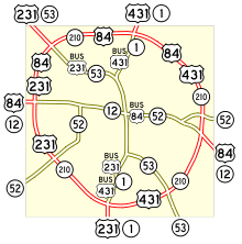
_map.svg.png) | |||||||
| Route information | |||||||
| Maintained by ALDOT | |||||||
| Length: | 352.958 mi[1] (568.031 km) | ||||||
| Existed: | 1954 – present | ||||||
| Major junctions | |||||||
| South end: |
| ||||||
|
| |||||||
| North end: |
| ||||||
| Location | |||||||
| Counties: | Houston, Henry, Barbour, Russell, Lee, Chambers, Randolph, Cleburne, Calhoun, Etowah, Marshall, Madison | ||||||
| Highway system | |||||||
| |||||||

U.S. Highway 431 (US-431), internally designated by the Alabama Department of Transportation as State Route 1 (SR-1), is a major north–south state highway across the eastern part of the U.S. state of Alabama. Although US-431's south end is in Dothan, SR-1 continues south for about 13 miles (21 km) along US-231 to the Florida state line.
Route description
State Route 1 is primarily the unsigned partner route assigned to U.S. Highway 431. The two routes are co-aligned from the southern terminus of US-431 at Dothan to the Tennessee state line. South of Dothan, State Route 1 is assigned to U.S. Highway 231. The two highways run north from Dothan through the Wiregrass region of southeastern Alabama through the towns of Headland and Abbeville en route to Eufaula, where it intersects U.S. Route 82. North of Eufaula, en route to Phenix City, the highway encounters some of the most sparsely populated parts of the state, only passing near the unincorporated communities of Pittsview, Glenville, and Seale in the 46 mile (74 km) drive between the two cities. In Phenix City, the highway junctions with U.S. Route 280 and U.S. Route 80. North of Phenix City, en route to Opelika, US 431 and US 280 join together for a concurrency, passing through the cities of Smiths Station and Salem on the way into Opelika. In Opelika, the two highways cross Interstate 85 and split in Opelika; US 431 continuing northeastward and US 280 northwestward. North of Opelika, the highway encounters rural terrain again, passing through the cities of LaFayette, Roanoke, and Wedowee en route to Anniston. In Oxford, just south of Anniston, the highway intersects Interstate 20, joining I-20 for an approximately three-mile concurrency, after which it goes through Anniston, northward into Gadsden, where it joins with US-278, crosses Interstate 59, and shares a brief wrong-way concurrency with US-11 in nearby Attalla, after which it continues northwestward, splitting from US-278 northwest of Attalla and later passing through Guntersville en route to Huntsville. In Huntsville, US-231 and US-431 (Governors Drive) junction again as Memorial Parkway, and State Route 1 is partnered with both U.S. Highways until they cross into Tennessee.
From its point of origin in Houston County, State Route 1 is aligned very close to the Alabama-Georgia border, coming within less than one mile (1.6 km) of the border at both Eufaula and Phenix City. At Phenix City, US-431 and unsigned State Route 1 begin a concurrency with U.S. Highway 280 and unsigned State Route 38 and turn to the northwest. At Opelika, US-431 and State Route 1 divert from US-280 and resume their northward orientation.
East of Oxford, State Route 1 and US-431 merge with westbound Interstate 20 and run concurrently with Interstate 20 from Exit 191 to Exit 188. At Oxford, State Route 1 and US-431 begin a gradual northwestward trajectory, passing through Anniston, Gadsden and Guntersville. The two routes resume their northward orientation upon merging with U.S. Highway 231 at Huntsville.
The portion through Oxford and Anniston is currently routed via Veterans Memorial Parkway as of December 21, 2015. Prior to this date, this portion was routed via Quintard Avenue, which constitutes the major north-south business and local route through these cities and is a congested route with many traffic signals and no room for widening. [2]
Four-lane routing
One of the criticisms of US-431 in its entirety from Kentucky to Alabama was that it was mainly a two-lane road. ALDOT has prioritized four-laning the route in Alabama as a viable north–south road corridor in the eastern part of the state.

Of particular concern was the segment from Seale south to the Barbour County line, where rolling hills along the original alignment limit the visibility of oncoming traffic, contributing to poor decisions by motorists to pass, resulting in numerous head-on collisions. In this segment alone, 31 people were killed in crashes between 1992 and 2006, leading Readers Digest to proclaim it one of "America's Deadliest Highways" in 2000.[3] After being contacted by and subsequently meeting the family of a fatal crash victim in 2003, ALDOT Director Joe McInnes decided to expedite the construction on the last remaining stretch of two-lane road between Seale and the Barbour County line.[4] This 16-mile section was completed and opened in late 2010. The old alignment in Russell County is still open to traffic and is now labeled County Route 137.
Traveling south from Tennessee, as of mid-2009, US-431 is a four-lane route to Oxford, Alabama. Then, after diverting from I-20 east of Oxford at Exit 191, it reverts to a two-lane highway southward to Opelika, Alabama, with a brief four-lane stretch just south of Wedowee, Alabama. From Opelika southward to its southern terminus in Dothan, Alabama, US-431 is now open as a four-lane highway.
Major intersections
| County | Location | mi[1] | km | Destinations | Notes |
|---|---|---|---|---|---|
| Houston | Dothan | 0.000 | 0.000 | Southern end of US-431; SR-1 follows US-231 from this point southward | |
| 12.727 | 20.482 | ||||
| 14.458 | 23.268 | Southern end of concurrency with US-84 | |||
| 14.933 | 24.032 | ||||
| 17.838 | 28.707 | Northern end of concurrency with SR-210/US-84; SR-1 follows Bus 431 through Dothan; Southern end of concurrency with SR-1 | |||
| Henry | Headland | 25.754 | 41.447 | ||
| 26.270 | 42.277 | Southern terminus of SR-173 | |||
| Abbeville | 39.748 | 63.968 | |||
| 42.396 | 68.230 | ||||
| Barbour | | 59.970 | 96.512 | Northern terminus of SR-95 | |
| Eufaula | 61.908 | 99.631 | Northern terminus of SR-131 | ||
| 64.058 | 103.091 | Eastern terminus of SR-30 | |||
| 66.823 | 107.541 | Southern end of concurrency with US-82 | |||
| 68.307 | 109.929 | Northern end of concurrency with US-82 | |||
| | 74.949 | 120.619 | Southern terminus of SR-165 | ||
| Russell | Seale | 96.895 | 155.937 | Eastern terminus of SR-26 | |
| 99.105 | 159.494 | Southern terminus of SR-169 | |||
| | 109.155 | 175.668 | Northern terminus of SR-165 | ||
| Phenix City | 112.081 | 180.377 | Western end of concurrency with US-280 | ||
| 113.942 | 183.372 | Western end of concurrency with US-80 | |||
| 114.888 | 184.894 | Eastern end of concurrency with US-80 | |||
| Lee | Opelika | 137.253 | 220.887 | Western end of concurrency with US-280; I-85 Exit 62 | |
| Chambers | Waverly | 149.840 | 241.144 | Northern terminus of SR-147 | |
| Lafayette | 158.859 | 255.659 | |||
| 160.794 | 258.773 | Southern terminus of SR-77 | |||
| Randolph | Roanoke | 180.783 | 290.942 | ||
| Wedowee | 194.314 | 312.718 | Southern end of concurrency with SR-48 | ||
| 194.437 | 312.916 | Northern end of concurrency with SR-48 | |||
| Cleburne | Hollis Crossroads | 212.540 | 342.050 | ||
| | 217.805 | 350.523 | SR-281 crosses US-431 on an overpass, but the two routes do not actually intersect. SR-281 is accessible via a county road just south of the overpass. | ||
| Calhoun | Oxford | 221.328 | 356.193 | Eastern end of concurrency with I-20; I-20 Exit 191 | |
| 225.036 | 362.160 | Western end of concurrency with I-20; I-20 Exit 188 | |||
| 225.269 | 362.535 | Partial Interchange | |||
| Anniston | 232.534 | 374.227 | Partial cloverleaf/trumpet interchange | ||
| Alexandria | 240.300 | 386.725 | Eastern terminus of SR-144 | ||
| | 247.070 | 397.621 | Western terminus of SR-204 | ||
| Etowah | Gadsden | 258.458 | 415.948 | Eastern end of concurrency with US-278 | |
| 260.232 | 418.803 | Northern terminus of SR-291 | |||
| 260.519 | 419.265 | Partial cloverleaf interchange | |||
| 261.994 | 421.638 | Southern terminus of SR-211 | |||
| 265.274 | 426.917 | I-59 Exit 183 | |||
| Attalla | 266.117 | 428.274 | Southern end of concurrency with US-11 | ||
| 266.449 | 428.808 | Northern end of concurrency with US-11 | |||
| 268.363 | 431.888 | Western end of concurrency with US-278 | |||
| 268.829 | 432.638 | Northern terminus of SR-77 | |||
| Sardis City | 277.880 | 447.205 | Southern terminus of SR-205 | ||
| Marshall | Boaz | 280.544 | 451.492 | ||
| Albertville | 286.741 | 461.465 | |||
| Guntersville | 292.423 | 470.609 | Northern terminus of SR-205 | ||
| 294.742 | 474.341 | Southern end of concurrency with SR-79 | |||
| 295.822 | 476.079 | Northern terminus of SR-69 | |||
| 296.190 | 476.672 | Northern terminus of SR-227 | |||
| 302.114 | 486.205 | Northern end of concurrency with SR-79 | |||
| Madison | Huntsville | 333.702 | 537.041 | Southern end of northern concurrency with US-231; southern end of northern signed segment of SR-53 | |
| 334.700 | 538.647 | ||||
| 335.207 | 539.463 | Southern end of concurrency with US-72 | |||
| 336.884 | 542.162 | Northern end of concurrency with US-72 | |||
| Hazel Green | 352.958 | 568.031 | Continuation into Tennessee; northern terminus of SR-1 | ||
1.000 mi = 1.609 km; 1.000 km = 0.621 mi
| |||||
See also
-
 Alabama portal
 -
 U.S. Roads portal
References
- 1 2 Milepost Maps (PDF) (Map). Cartography by ALDOT Bureau of Transportation Planning, Survey & Mapping Division. Alabama Department of Transportation. 1999.
- ↑ Burkhalter, Eddie (27 September 2013). "Bids opened for final leg of Veterans Memorial Parkway". Anniston Star. Retrieved 21 February 2014.
- ↑ http://www.governorpress.alabama.gov/pr/co-2006-05-24-transportation.asp
- ↑ "Long road to rehabilitation nearly over for east Alabama's deadly U.S. 431". AL.com.
External links
-
 Media related to U.S. Route 431 in Alabama at Wikimedia Commons
| Previous state: Terminus |
Alabama | Next state: Tennessee |