U.S. Route 15 in Pennsylvania
| |||||||
|---|---|---|---|---|---|---|---|
|
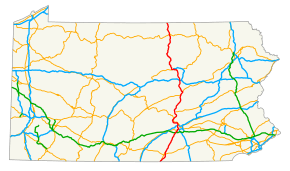
Route highlighted in red | |||||||
| Route information | |||||||
| Maintained by PennDOT | |||||||
| Length: | 194.89 mi[1] (313.65 km) | ||||||
| Major junctions | |||||||
| South end: |
| ||||||
|
| |||||||
| North end: |
| ||||||
| Location | |||||||
| Counties: | Adams, York, Cumberland, Perry, Juniata, Snyder, Union, Lycoming, Tioga | ||||||
| Highway system | |||||||
| |||||||

U.S. Route 15 is a north-south U.S. Highway in Pennsylvania.
Route description
US 15 enters Pennsylvania south of Gettysburg, Adams County, from Frederick County, Maryland, on a freeway alignment. The route heads to the north and bypasses Gettysburg, where the route interchanges with US 30. The freeway alignment ends temporarily at York Springs, carrying US 15 on a four-lane, divided alignment until the route upgrades to a freeway again in Dillsburg. The route continues toward Harrisburg, where the freeway terminates again as US 15 joins with US 11. The two routes follow the west shore of the Susquehanna River with limited-access sections until they split across the river from Sunbury. US 15 continues north into Williamsport, joining I-180 and US 220. At I-180's western terminus, US 220, signed south, heads due west toward Jersey Shore and Lock Haven, while US 15 turns due north through Mansfield and ends at the New York border near Lawrenceville, Tioga County.
The majority of US 15 is four lanes, alternating between limited and unlimited access. The one leg that is only two lanes is between White Deer and South Williamsport. The segment between Williamsport and the New York state line will eventually be designated Interstate 99.
History
| |
|---|---|
| Location: | Shamokin Dam – Williamsport |
| Existed: | 1928–1941 |
Prior to 1941, US 15 ran along the east bank of the Susquehanna River between Harrisburg and Williamsport while the road on the western bank of the river was PA 14 between Lemoyne and Duncannon, US 11 between Duncannon and Shamokin Dam, and PA 404 between Shamokin Dam and Williamsport.[2] In 1941, US 15 was rerouted to follow the western bank of the river between Harrisburg and Williamsport, replacing PA 14 between Lemoyne and Duncannon, running concurrent with US 11 between Lemoyne and Shamokin Dam, and replacing the entire length of PA 404. The former alignment of US 15 on the east side of the river became PA 14.[3][4]
Major intersections
| County | Location[5] | mi[1] | km | Destinations | Notes | |||
|---|---|---|---|---|---|---|---|---|
| Adams | Freedom Township | 0.0 | 0.0 | Continuation into Maryland | ||||
| 1.74 | 2.80 | Southern terminus of Gettysburg US 15 Bus. | ||||||
| Cumberland Township | 5.88 | 9.46 | ||||||
| Mount Joy Township | 8.15 | 13.12 | ||||||
| Straban Township | 10.01 | 16.11 | ||||||
| 11.52 | 18.54 | |||||||
| 14.71 | 23.67 | Northern terminus of Gettysburg US 15 Bus. | ||||||
| Tyrone Township | 19.59 | 31.53 | ||||||
| Latimore Township | 23.59 | 37.96 | ||||||
| North end of freeway | ||||||||
| York | Dillsburg–Carroll Township line | 32.51 | 52.32 | South end of PA 74 concurrency | ||||
| 32.72 | 52.66 | North end of PA 74 concurrency | ||||||
| Cumberland | Upper Allen Township | South end of freeway | ||||||
| 36.32 | 58.45 | Lisburn Road | ||||||
| 37.68 | 60.64 | |||||||
| 38.72 | 62.31 | Winding Hill Road / Cumberland Parkway | ||||||
| 39.29 | 63.23 | Exit 236 (Gettysburg Pike) on I-76 / Penna Turnpike | ||||||
| Lower Allen Township | 40.31 | 64.87 | Wesley Drive / Rossmoyne Road | |||||
| 41.03 | 66.03 | Slate Hill Road | ||||||
| 41.76 | 67.21 | Lower Allen Drive | ||||||
| Camp Hill | 42.49 | 68.38 | Exit 5 on PA 581, south end of US 11 concurrency | |||||
| North end of freeway | ||||||||
| 42.99 | 69.19 | Eastern terminus of PA 641 | ||||||
| Camp Hill–East Pennsboro Township line | M. Harvey Taylor Bridge – Harrisburg | Northbound exit and southbound entrance | ||||||
| East Pennsboro Township | 47.34 | 76.19 | Eastern terminus of PA 944 | |||||
| 50.35 | 81.03 | Exit 65 on I-81 | ||||||
| Perry | Marysville | 52.61 | 84.67 | Eastern terminus of PA 850 | ||||
| Penn Township | South end of freeway | |||||||
| Penn Township–Duncannon line | 60.10 | 96.72 | ||||||
| Dauphin | Reed Township | 62.59 | 100.73 | |||||
| Perry | Watts Township | North end of freeway | ||||||
| Buffalo Township | 72.78 | 117.13 | Northern terminus of PA 34 | |||||
| Liverpool | 74.54 | 119.96 | Eastern terminus of PA 17 | |||||
| Liverpool Township | 78.90 | 126.98 | Southern terminus of PA 104 | |||||
| Juniata |
No major junctions | |||||||
| Snyder | Penn Township | South end of freeway | ||||||
| 91.15 | 146.69 | Northern terminus of PA 35 | ||||||
| Monroe Township | 95.58 | 153.82 | Northern terminus of US 522 | |||||
| North end of freeway | ||||||||
| Shamokin Dam | 96.63 | 155.51 | Interchange, Northern terminus of PA 61 | |||||
| 96.98 | 156.07 | North end of US 11 concurrency | ||||||
| Union | Union Township | 101.83 | 163.88 | Eastern terminus of PA 304 | ||||
| East Buffalo Township–Lewisburg line | 105.79 | 170.25 | ||||||
| Lewisburg | 106.25 | 170.99 | Eastern terminus of PA 192 | |||||
| Kelly Township | South end of freeway | |||||||
| 110.21 | 177.37 | Western terminus of PA 642 | ||||||
| White Deer Township | 111.78 | 179.89 | New Columbia | |||||
| 112.57 | 181.16 | Exit 210 on I-80 | ||||||
| 114.29 | 183.93 | Watsontown, White Deer | ||||||
| North end of freeway | ||||||||
| Gregg Township | 116.81 | 187.99 | ||||||
| Lycoming | Clinton Township | 122.66 | 197.40 | Western terminus of PA 54 | ||||
| South Williamsport | 128.34 | 206.54 | Northern terminus of PA 554 | |||||
| 128.95 | 207.52 | Eastern terminus of PA 654 | ||||||
| Williamsport | 129.35 | 208.17 | South end of freeway | |||||
| Exit 27A on I-180, south end of I-180/U.S. 220 concurrency | ||||||||
| 129.85 | 208.97 | Hepburn Street | Exit 27B on I-180, eastbound exit and westbound entrance | |||||
| 130.53 | 210.07 | Maynard Street | Exit 28 on I-180 | |||||
| 131.67 | 211.90 | Exit 29 on I-180, north end of I-180/U.S. 220 concurrencies, western terminus of I-180, future south end of I-99 concurrency | ||||||
| 132.09 | 212.58 | Third Street | Northbound exit and entrance | |||||
| 132.37 | 213.03 | Fourth Street | Southbound exit and entrance | |||||
| Old Lycoming Township | 132.99 | 214.03 | Foy Avenue / High Street / Lycoming Creek Road | |||||
| Lycoming Township | 136.34 | 219.42 | Hepburnville | |||||
| 138.90 | 223.54 | Southbound exit | ||||||
| Lewis Township | 144.00 | 231.75 | Southern terminus of PA 14 | |||||
| Cogan House Township | 148.27 | 238.62 | Cogan House (Green Mountain Road)[6][7] | Southbound exit and entrance. Connected to Steam Valley Road via Quadrant Route 4011 | ||||
| 148.89 | 239.62 | Cogan House (Steam Valley Road)[6][7] | Northbound exit and entrance. Connected to Green Mountain Road via Quadrant Route 4011 | |||||
| 150.90 | 242.85 | Eastern terminus of PA 184 | ||||||
| Jackson Township | 153.68 | 247.32 | Eastern terminus of PA 284 | |||||
| Tioga | Liberty | 158.81 | 255.58 | |||||
| 160.96 | 259.04 | Sebring | ||||||
| Blossburg | 168.08 | 270.50 | Blossburg | |||||
| Richmond Township | 175.55 | 282.52 | Southern terminus of Mansfield US 15 Bus. Eastern terminus of PA 660 | |||||
| Mansfield | 177.82 | 286.17 | ||||||
| Richmond Township | 179.16 | 288.33 | Southbound exit, northbound entrance, Northern terminus of Mansfield US 15 Bus. | |||||
| Tioga Township | 187.65 | 301.99 | ||||||
| Lawrence Township | 192.46 | 309.73 | ||||||
| Lawrenceville | 194.89 | 313.65 | Continuation into New York as I-99 | |||||
1.000 mi = 1.609 km; 1.000 km = 0.621 mi
| ||||||||
See also
- Central Susquehanna Valley Transportation Project
 U.S. Roads portal
 Pennsylvania portal
References
- 1 2 "Annual Electronic Straight Line Diagrams by County". Pennsylvania Department of Transportation. 2013. Retrieved August 27, 2013.
- ↑ Official Road Map of Pennsylvania (PDF) (Map). Pennsylvania Department of Highways. 1940. Retrieved December 16, 2014.
- ↑ "Local Road Route Changes Affect Harrisburg Drivers". The Evening News. Harrisburg, PA. June 20, 1941. p. 18. Retrieved August 14, 2015 – via Newspapers.com.

- ↑ Official Road Map of Pennsylvania (PDF) (Map). Pennsylvania Department of Highways. 1950. Retrieved January 1, 2014.
- ↑ "Video Log". Pennsylvania Department of Transportation. Retrieved June 9, 2016.
- 1 2 3 Kitsko, Jeffrey J. (2011). "U.S. Route 15". Pennsylvania Highways. Retrieved February 25, 2013.
- 1 2 3 "Route 15 southbound lanes opened". The Wellsboro Gazette. November 18, 2009. Retrieved February 25, 2013.
External links
| Wikimedia Commons has media related to U.S. Route 15 in Pennsylvania. |
| Completed highways | ||
|---|---|---|
| Partially-completed highways | ||
| Tunnels and bridges | ||
| Aborted expansion plans | ||
| Historical structures | ||
| Tolling systems | ||
| Previous state: Maryland |
Pennsylvania | Next state: Terminus |