Union, Alabama
| Union, Alabama | |
|---|---|
| Town | |
 Location in Greene County and the state of Alabama | |
| Coordinates: 32°59′39″N 87°54′19″W / 32.99417°N 87.90528°W | |
| Country | United States |
| State | Alabama |
| County | Greene |
| Area | |
| • Total | 0.82 sq mi (2.13 km2) |
| • Land | 0.82 sq mi (2.13 km2) |
| • Water | 0 sq mi (0 km2) |
| Elevation | 305 ft (93 m) |
| Population (2010) | |
| • Total | 237 |
| • Density | 289/sq mi (111.4/km2) |
| Time zone | Central (CST) (UTC-6) |
| • Summer (DST) | CDT (UTC-5) |
| FIPS code | 01-77616 |
| GNIS feature ID | 0128262 |
Union is a town in Greene County, Alabama, United States. At the 2010 census the population was 237,[1] up from 227 in 2000. According to the 1980 U.S. Census, it was incorporated in the 1970s.
Geography
Union is located in northern Greene County at 32°59′39″N 87°54′19″W / 32.99417°N 87.90528°W (32.994164, -87.905313).[2] It is 11 miles (18 km) north of Eutaw, the county seat, via U.S. Route 11/43 and Martin Luther King Highway.
According to the U.S. Census Bureau, the town has a total area of 0.8 square miles (2.1 km2), all land.[1]
Demographics
| Historical population | |||
|---|---|---|---|
| Census | Pop. | %± | |
| 1970 | 231 | — | |
| 1980 | 358 | 55.0% | |
| 1990 | 321 | −10.3% | |
| 2000 | 227 | −29.3% | |
| 2010 | 237 | 4.4% | |
| Est. 2015 | 223 | [3] | −5.9% |
| U.S. Decennial Census[4] 2013 Estimate[5] | |||
As of the census[6] of 2000, there were 227 people, 85 households, and 53 families residing in the town. The population density was 276.8 people per square mile (106.9/km²). There were 103 housing units at an average density of 125.6 per square mile (48.5/km²). The racial makeup of the town was 7.93% White and 92.07% Black or African American.
There were 85 households out of which 32.9% had children under the age of 18 living with them, 41.2% were married couples living together, 18.8% had a female householder with no husband present, and 37.6% were non-families. 35.3% of all households were made up of individuals and 10.6% had someone living alone who was 65 years of age or older. The average household size was 2.67 and the average family size was 3.58.
In the town the population was spread out with 27.8% under the age of 18, 11.5% from 18 to 24, 27.3% from 25 to 44, 21.6% from 45 to 64, and 11.9% who were 65 years of age or older. The median age was 37 years. For every 100 females there were 106.4 males. For every 100 females age 18 and over, there were 92.9 males.
The median income for a household in the town was $22,031, and the median income for a family was $28,125. Males had a median income of $30,625 versus $17,083 for females. The per capita income for the town was $10,842. About 36.4% of families and 32.6% of the population were below the poverty line, including 42.5% of those under the age of eighteen and 60.0% of those sixty five or over.
References
- 1 2 "Geographic Identifiers: 2010 Demographic Profile Data (G001): Union town, Alabama". U.S. Census Bureau, American Factfinder. Retrieved October 28, 2016.
- ↑ "US Gazetteer files: 2010, 2000, and 1990". United States Census Bureau. 2011-02-12. Retrieved 2011-04-23.
- ↑ "Annual Estimates of the Resident Population for Incorporated Places: April 1, 2010 to July 1, 2015". Retrieved July 2, 2016.
- ↑ "U.S. Decennial Census". Census.gov. Retrieved June 6, 2013.
- ↑ "Annual Estimates of the Resident Population: April 1, 2010 to July 1, 2013". Retrieved June 3, 2014.
- ↑ "American FactFinder". United States Census Bureau. Retrieved 2008-01-31.
Coordinates: 32°59′39″N 87°54′19″W / 32.994164°N 87.905313°W
Municipalities and communities of Greene County, Alabama, United States | ||
|---|---|---|
| Cities | 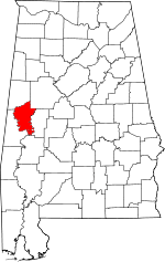 | |
| Towns | ||
| Unincorporated communities | ||