Valley of the Rogue State Park
| Valley of the Rogue State Park | |
|---|---|
|
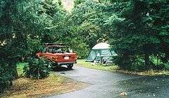
A campsite in the park in September 2005 | |
 | |
| Type | Public, state |
| Location | Jackson County, Oregon |
| Nearest city | Grants Pass |
| Coordinates | 42°24′39″N 123°08′59″W / 42.4109546°N 123.1497741°WCoordinates: 42°24′39″N 123°08′59″W / 42.4109546°N 123.1497741°W[1] |
| Elevation | 1,050 ft.[2] |
| Operated by | Oregon Parks and Recreation Department |
Valley of the Rogue State Park is a state park in west central Jackson County, Oregon, near Grants Pass and Medford, and is administered by the Oregon Parks and Recreation Department. It is located on the banks of the Rogue River, adjacent to Interstate 5.[3] The park offers a year-round, full-service campground, a nature trail, a day-use area, and river access for boating, fishing, and swimming.
Climate
| Climate data for Valley of the Rogue State Park | |||||||||||||
|---|---|---|---|---|---|---|---|---|---|---|---|---|---|
| Month | Jan | Feb | Mar | Apr | May | Jun | Jul | Aug | Sep | Oct | Nov | Dec | Year |
| Record high °F (°C) | 69 (21) |
76 (24) |
84 (29) |
94 (34) |
102 (39) |
108 (42) |
114 (46) |
108 (42) |
108 (42) |
98 (37) |
77 (25) |
68 (20) |
114 (46) |
| Average high °F (°C) | 47 (8) |
53 (12) |
59 (15) |
64 (18) |
72 (22) |
80 (27) |
89 (32) |
89 (32) |
82 (28) |
69 (21) |
52 (11) |
44 (7) |
67 (19) |
| Average low °F (°C) | 35 (2) |
36 (2) |
37 (3) |
40 (4) |
45 (7) |
50 (10) |
55 (13) |
54 (12) |
47 (8) |
41 (5) |
39 (4) |
35 (2) |
43 (6) |
| Record low °F (°C) | 1 (−17) |
5 (−15) |
18 (−8) |
24 (−4) |
26 (−3) |
30 (−1) |
37 (3) |
30 (−1) |
27 (−3) |
19 (−7) |
12 (−11) |
−1 (−18) |
−1 (−18) |
| Average precipitation inches (mm) | 4.77 (121.2) |
4.09 (103.9) |
3.38 (85.9) |
2.12 (53.8) |
1.36 (34.5) |
0.68 (17.3) |
0.32 (8.1) |
0.30 (7.6) |
0.64 (16.3) |
1.93 (49) |
5.04 (128) |
6.49 (164.8) |
31.12 (790.4) |
| Average snowfall inches (cm) | 0.30 (0.76) |
0.20 (0.51) |
0.10 (0.25) |
0 (0) |
0 (0) |
0 (0) |
0 (0) |
0 (0) |
0 (0) |
0 (0) |
0.10 (0.25) |
0.80 (2.03) |
1.50 (3.81) |
| Source: [4] | |||||||||||||
See also
References
- ↑ "Valley of the Rogue State Park". Geographic Names Information System. United States Geological Survey. Retrieved 2011-07-06.
- ↑ http://campingalongi-5.blogspot.com/2013/08/valley-of-rogue-state-park-campground.html?m=1
- ↑ Gumprecht Bannan, Jan (2002). Oregon State Parks. The Mountaineers Books. p. 150. ISBN 0-89886-794-0.
- ↑ http://wwworigin.weather.com/weather/wxclimatology/monthly/ORSPVOR:13
External links
- "Valley of the Rogue State Park". Oregon Parks and Recreation Department. Retrieved 2011-07-06.
This article is issued from Wikipedia - version of the 11/13/2016. The text is available under the Creative Commons Attribution/Share Alike but additional terms may apply for the media files.