Warren Township, Warren County, Indiana
| Warren Township | |
|---|---|
| Township | |
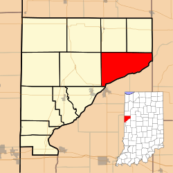 Location of Warren Township in Warren County | |
 Location of Indiana in the United States | |
| Coordinates: 40°20′56″N 87°11′22″W / 40.34889°N 87.18944°WCoordinates: 40°20′56″N 87°11′22″W / 40.34889°N 87.18944°W | |
| Country | United States |
| State | Indiana |
| County | Warren |
| Established | 1827 |
| Government | |
| • Type | Indiana township |
| Area | |
| • Total | 36.4 sq mi (94 km2) |
| • Land | 35.9 sq mi (93 km2) |
| • Water | 0.51 sq mi (1.3 km2) 1.40% |
| Elevation | 614 ft (187 m) |
| Population (2010) | |
| • Total | 806 |
| • Density | 22.5/sq mi (8.7/km2) |
| Time zone | Eastern (EST) (UTC-5) |
| • Summer (DST) | EDT (UTC-4) |
| GNIS feature ID | 453979 |
Warren Township is one of twelve townships in Warren County, Indiana, United States. According to the 2010 census, its population was 806 and it contained 324 housing units.[1]
History
Warren Township was one of the original four created when the county was organized in 1827.[2]
Geography
According to the 2010 census, the township has a total area of 36.4 square miles (94 km2), of which 35.9 square miles (93 km2) (or 98.63%) is land and 0.51 square miles (1.3 km2) (or 1.40%) is water.[1] Kates Pond is in this township, and the streams of Dry Branch, Kickapoo Creek, Little Pine Creek, Middle Branch and West Fork Kickapoo Creek run through it.
The small town of Independence is on the shores of the Wabash River in the southeastern part of the township. Winthrop is in the northeast portion of the township.
The original county seat of Warrenton was located in the far southwestern corner of what is now Warren Township, though at that time the township had not yet been created; no trace of Warrenton now exists. Other towns in this township that have ceased to exist include Banning Corner, Black Rock, and Glen Cliff.

Cemeteries
The township contains these three cemeteries: Bethel,[3] Independence[4] and James.[5]
Transportation
U.S. Route 41 passes through the far southwestern tip of the township on its way to Attica.[6] Indiana State Road 55 runs along the western border of the township, connecting Attica with Pine Village to the north in neighboring Adams Township.[7] The township contains Smith Brothers Airport.
Education
Warren Township is part of the Metropolitan School District of Warren County.[8]
Government
Warren Township has a trustee who administers rural fire protection and ambulance service, provides relief to the poor, manages cemetery care, and performs farm assessment, among other duties. The trustee is assisted in these duties by a three-member township board. The trustees and board members are elected to four-year terms.[9]
Warren Township is part of Indiana's 8th congressional district, Indiana House of Representatives District 26,[10] and Indiana State Senate District 23.[11]
References
- 1 2 "Population, Housing Units, Area, and Density: 2010 - County -- County Subdivision and Place -- 2010 Census Summary File 1". United States Census. Retrieved 2013-05-10.
- ↑ Goodspeed 1883, p. 61.
- ↑ "Bethel Cemetery". Geographic Names Information System. United States Geological Survey. Retrieved 2011-02-05.
- ↑ "Independence Cemetery". Geographic Names Information System. United States Geological Survey. Retrieved 2011-02-05.
- ↑ "James Cemetery". Geographic Names Information System. United States Geological Survey. Retrieved 2011-02-05.
- ↑ "U.S. Route 41". Highway Explorer. Retrieved 2010-09-21.
- ↑ "State Road 55". Highway Explorer. Retrieved 2010-09-21.
- ↑ "Corporation Snapshot, M S D Warren County #8115". Indiana Department of Education. Retrieved 2011-01-27.
- ↑ "Government". United Township Association of Indiana. Retrieved 2011-01-06.
- ↑ "Indiana Senate" (PDF). State of Indiana. Retrieved 2013-12-02.
- ↑ "Indiana House Districts" (PDF). State of Indiana. Retrieved 2013-12-02.
- "Warren Township, Warren County, Indiana". Geographic Names Information System. United States Geological Survey. Retrieved 2009-09-24.
- United States Census Bureau TIGER/Line Shapefiles
Bibliography
- Goodspeed, Weston A. (1883). "Part II. History of Warren County". Counties of Warren, Benton, Jasper and Newton, Indiana. Chicago: F. A. Battey and Company. pp. 31–156. Retrieved 2010-09-19.
- Clifton, Thomas, ed. (1913). Past and Present of Fountain and Warren Counties Indiana. Indianapolis: B. F. Bowen and Company. pp. 201–335. Retrieved 2010-09-19.
- Warren County Historical Society (1966). A History of Warren County, Indiana. Williamsport, Indiana.
- Warren County Historical Society (2002). A History of Warren County, Indiana (175th Anniversary Edition). Williamsport, Indiana.
External links

Municipalities and communities of Warren County, Indiana, United States | ||
|---|---|---|
| Towns | ||
| Townships | ||
| Unincorporated communities | ||
| Ghost towns | ||