Washington Street (Boston)

Washington Street is a street originating in downtown Boston, Massachusetts that extends southwestward to the Massachusetts-Rhode Island state line. The majority of it was built as the Norfolk and Bristol Turnpike in the early 19th century. It is the longest street in Boston, and it remains one of the longest streets in the state of Massachusetts.[1]
Washington Street, as the first street that connected peninsular Boston to the mainland, serves as a divide where a number of cross streets change name.
History
The part of Washington Street between downtown Boston and Dudley Square in Roxbury was the first road connecting the small town of Boston to the mainland, carrying the Boston Post Road to New York City. It was originally known by several names:
- Cornhill from Adams Square (now just south of Boston City Hall) south to School Street
- Marlborough Street from School Street south to Summer Street/Winter Street
- Newbury Street from Summer Street/Winter Street south to Essex Street/Boylston Street
- Orange Street from Essex Street/Boylston Street south to the fortification near East Berkeley Street (then Dover Street)
On July 4, 1788, the road south of the fortification, to the line with Roxbury, was given the name Washington Street. The name was extended north to Adams Square on July 6, 1824, and north on a new road to Haymarket Square on November 6, 1872.
The part north of Roxbury Street in Dudley Square, Roxbury was laid out as a public way on January 19, 1662, and given its name May 9, 1825. Additionally, the Washington Street name went west on Roxbury Street, Tremont Street, and Huntington Avenue (the path of the Boston Post Road) to the border with Brookline (which still has a Washington Street as an extension of this one).
The Norfolk and Bristol Turnpike was established in 1803, and built as a turnpike as a straighter alternate to two roads between Boston and Providence—the Lower Boston Post Road (via Norwood and Foxborough) and the road via Walpole and Wrentham. It ran from Dudley Square to the Rhode Island line and beyond to downtown Pawtucket. Coincidentally the only part not built as a new road was the part through North Attleborough that US 1 now bypasses.
The southern half of the turnpike got little use as it avoided all the towns, where travelers wanted to stop, and had some steep grades. In fact, until the 1930s, when the current highway (part of US 1) was built between Boston and Providence, the southern half remained a dirt road.
The part of the turnpike in Roxbury was laid out as a public road in June 1857. It was named Shawmut Avenue, as an extension of that road from Dudley Square. The portion in West Roxbury was named Shawmut Avenue February 3, 1858.
On July 2, 1860, Tremont Street was extended west from its former south end along former Washington Street to Brookline, and Washington Street now ended at Columbus Street (then Pynchon Street). The rest of the road west from Dudley Square became Roxbury Street on June 16, 1874, and, at the same time, Washington Street was extended south from Dudley Square along the former Shawmut Street to the line with Dedham.
South from downtown Dedham, the turnpike went not via the current Washington Street, but via School Street and Court Street.
The part of Washington Street north of Haymarket Square was known as Charlestown Street until around 1900.
The first state highway in Boston was the part of Washington Street from Dedham to West Roxbury Parkway (at Lagrange Street). It was taken over by the Massachusetts Department of Public Works in 1908.[2] The short piece in West Roxbury Parkway, to just north of the road through the parkway, was taken over in 1921;[3] the next state highway in Boston was the Southern Artery in 1926.[4]
Extent and description
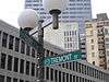
Washington Street begins at Keany Square, the intersection with Causeway Street and Commercial Street, at the south end of the Charlestown Bridge. This section of the street is known as North Washington Street or Joe Tecce's Way. The road ends north of Haymarket Square, where it joins the so-called Surface Artery (the road above the subterranean Big Dig.) Due to redevelopment, the original path of Washington Street has been pre-empted by Haymarket Square and Government Center (which used to be Scollay Square).
Washington Street begins once again at State and Court Streets as a one-way thoroughfare (for northbound traffic only). Through Downtown Crossing, from Milk Street south to Temple Place, Washington Street is closed to most vehicular traffic (and continues to be one-way northbound for authorized traffic only). South of Temple Place, Washington is, once again, one-way northbound, becoming two-way at Stuart Street and Kneeland Street. From Marginal Street, south to East Berkeley Street, including the bridge over the Massachusetts Turnpike and the adjacent Amtrak/Massachusetts Bay Transit Authority (MBTA) commuter rail tracks, the road is also one-way northbound, with a southbound contra-flowing bus lane for the Silver-Line bus.
At Dudley Square in Roxbury, Washington Street is southbound-only for several blocks, between Warren Street and Dudley Street. Northbound traffic bypasses this section to the east using those two streets. Just after passing under the Arborway in Jamaica Plain, Washington Street becomes Hyde Park Avenue, and traffic staying on Washington Street must turn west on Ukraine Way to cross over the Amtrak/MBTA Commuter Rail tracks, and then south at South Street, which becomes Washington Street again.
Southbound traffic must use short sections of South Street and Poplar Street at Roslindale Square. South of there, near the border between Roslindale and West Roxbury, Washington Street crosses West Roxbury Parkway and acquires a median strip. This median lasts until just before the Dedham city line, where the road continues as an undivided road.
Washington Street continues southwestward, through the center of Dedham, the outskirts of Westwood, the centers of Norwood, and East Walpole and South Walpole. At the Walpole-Foxborough line, it no longer crosses the railroad tracks (the old Mansfield and Framingham Railroad), and traffic must detour via Water Street and North Street. North Street connects to the Boston-Providence Turnpike, which carries US Route 1 (and was never actually a turnpike, a toll road). This road merges into the old path of Washington Street south of the railroad. From there to Rhode Island, except through North Attleborough center (which it bypasses using East Washington Street as opposed to North and South Washington Streets), US Route 1 stays with Washington, as it passes through the outskirts of Foxborough (past Gillette Stadium), Wrentham and Plainville, and then through South Attleboro.
Numbered routes
Washington Street currently has the following route numbers:
- Route 1A from Elm Street in Dedham south to the split with Walpole Street in Norwood (except in northern Norwood, where 1A uses Upland Road)
- US 1 from northern Foxborough near Gillette Stadium to Rhode Island, except through North Attleborough center, where US 1 uses East Washington Street
When the first numbered highways in Massachusetts, the New England Interstate Highways, were assigned in 1922, NE 1 used Washington Street through North Attleborough center and from Norwood center to Arborway in Boston. By 1927, US 1 (as the road was now known) split in Dedham center onto Court Street, using Ames Street and Bridge Street into Boston, where it used Spring Street and Centre Street to reach Arborway.
Soon after 1933, the new road (Boston-Providence Turnpike and Brook Farm Parkway) from Roslindale to Foxborough was finished, and it was around this time that the rest of the current alignment to Rhode Island was finished — using Washington Street from Foxborough to the state line, except through North Attleborough center. The old road became Route 1A north from North Attleborough center and through South Attleboro, ending at the rotary just north of Dedham center. For several years in between, the new road was only built south of Dedham, and US 1 once again used Washington Street from Dedham into West Roxbury, where it cut north to Centre Street via West Roxbury Parkway.
Between 1949 and 1961, 1A was truncated to end at US 1 via Elm Street south of Dedham center, probably to keep traffic out of Dedham center. US 1 was removed from that alignment in 1989, but 1A still ends at the old route.
Public transportation
As a main road, Washington Street has had its share of streetcar and later bus routes. It also had the Washington Street Elevated from south of downtown to Dudley and later Forest Hills.
An 1871 map shows streetcar tracks from Boylston Street south to Dudley Street. An 1874 map extends them south from Dudley to just north of Forest Hills, and north to Dock Square. By 1888, tracks also used Washington north to Haymarket Square, and by 1897 all the way to and over the Charlestown Bridge. A later, 1899 map, shows that tracks owned by the West Roxbury and Roslindale Street Railway continued southwest from Forest Hills via Dedham to Norwood. The Norfolk Southern Street Railway left Norfolk on the road to Walpole center, but used Washington Street from Common Street in Walpole to South Walpole. Except for the older section through North Attleborough center, used by the Interstate Consolidated Street Railway, none of the rest had streetcar tracks, due to its avoidance of populated areas. In 1925, yet another map still shows streetcar tracks on Washington Street within Boston, ending downtown at Essex Street. By 1953 they were only in use from Forest Hills to Egleston (by the 40 route, bus substituted December 18, 1955) and from Dudley to Northampton Street (by the 47 route, bustituted September 13, 1953, and the 10 route, bus substituted December 5, 1953).
The Washington Street Elevated, later part of the Orange Line, opened from south of downtown Boston to Dudley on June 10, 1901, and south to Forest Hills November 22, 1909. The Washington Street Tunnel downtown opened November 30, 1908. The Elevated closed on April 30, 1987, with the opening of the Southwest Corridor several days later.
Other Washington Streets in Boston
There are two significant and two minor streets in Boston with the same name. Addresses at these streets need to be distinguish by neighborhood names or ZIP codes.
- In Allston-Brighton neighborhoods, Washington Street begins at the boundary with Brookline and extends about 2 miles (3.2 km) to the boundary with Newton near Burton Street. As a whole, it begins in Brookline Village, and crosses Brookline, Allston, Brighton, Newton, and Wellesley, ending at Wellesley's boundary with Natick, a total of almost 13.5 miles (21.7 km). It is the main east-west street in Brighton (ZIP Codes: 02135 in City of Boston, as well as 02458, 02460, 02462, 02465-02466 in Newton, 02445-02446 in Brookline, 02481-02482 in Wellesley).
- In the Dorchester neighborhood, Washington Street extends approximately 2.8 miles (4.5 km) from Blue Hill Avenue near Geneva Avenue to Dorchester Avenue at the southern boundary of the city (ZIP Codes: 02121 and 02124)
- In Hyde Park neighborhood, Washington Street extends approximately seven blocks in the small portion of Hyde Park on the east side of the Neponset River (ZIP Code: 02136).
- In Charlestown neighborhood, Washington Street begins at a dead end near the intersection of Austin Street and New Rutherford Avenue and extends three blocks to Harvard Street. This is two blocks from the north end of the Charlestown Bridge and three blocks from the beginning of the Washington Street that is the subject of this article (ZIP Code: 02129)
Image gallery
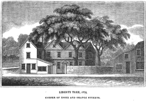 Liberty Tree, 1774
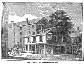 Lamb Tavern, 18th century
 Disbrow's Riding School, Washington St., 1850s
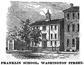 Franklin School, 1851
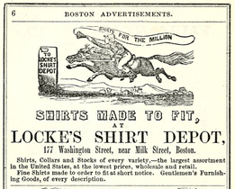 Locke's Shirt Depot, 1857
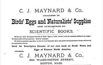 Advertisement for C.J. Maynard & Co., natural history supplies, 1882
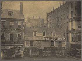 Hewes house, 1860
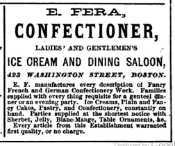 Advertisement for Fera's Ice Cream & Dining Saloon, 1868
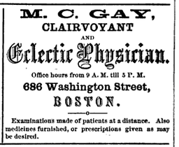 M.C. Gay, Clairvoyant and Ecelectic Physician, 1868
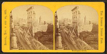 After fire of 1872
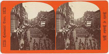 1875
1875 Boylston Market, 19th century
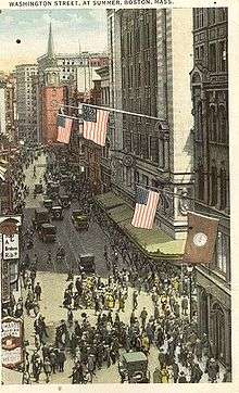
 Washington St., 19th century
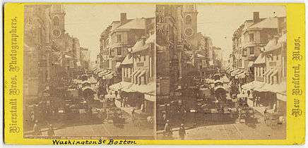 19th century
.jpg) 19th century
19th century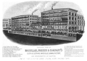 Macullar, Parker & Co., 1881
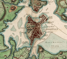
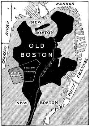 Washington St. As prominent fixture in Old Boston map
 Stereoscopic image by the Bierstadt Brothers
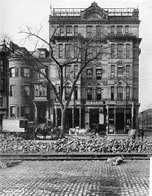 Alexandra Hotel in South end, Washington St. and Mass Ave. Taken in October, 1899.
See also
|
Former tenants
|
|
References
Notes
- ↑ Jamaica Plain Historical Society
- ↑ MassHighway state highway layout plan 1166
- ↑ MassHighway state highway layout plan 1915 (November 1, 1921)
- ↑ MassHighway state highway layout plan 2384 (November 3, 1926)
- ↑ James Redpath (1861), A Guide to Hayti, Boston: Haytian Bureau of Emigration, OCLC 2609119
- ↑ "Boston Pulpit". Gleasons Pictorial. Boston, Mass. 5. 1853.
Sources
- The Boston Atlas (Java)
- Washington Street, The Longest In Boston
- Washington Street: The Mystery is Solved(?)
- Changes to Transit Service in the MBTA district (PDF)
Further reading
- "West side of Washington Street". Gleason's Pictorial. Boston, Mass. 4. 1853.
- "East side of Washington Street". Gleason's Pictorial. Boston, Mass. 4. 1853.
- Edwin Monroe Bacon. Washington Street, old and new: a history in narrative form of the changes which this ancient street has undergone since the settlement of Boston. Boston: Macullar Parker Co., 1913.
External links
 Media related to Washington Street (Boston) at Wikimedia Commons