Wastella, Texas
| Wastella, Texas | |
|---|---|
| Ghost Town | |
|
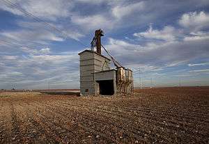
Wastella Granary | |
 Wastella  Wastella | |
| Coordinates: 32°30′37″N 100°38′58″W / 32.51028°N 100.64944°WCoordinates: 32°30′37″N 100°38′58″W / 32.51028°N 100.64944°W[1] | |
| Country |
|
| State |
|
| County | Nolan |
| Region | West Texas |
| Platted | 1908 |
| Founded by | Will Neeley |
| Elevation[1] | 2,392 ft (729 m) |
| Time zone | CST (UTC-6) |
| Area code | 806 |
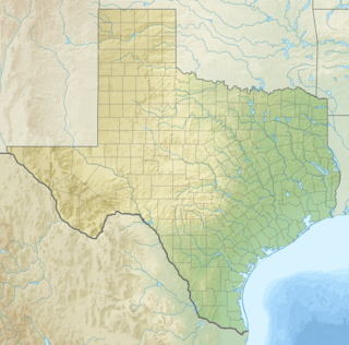
Wastella is a ghost town in northwest Nolan County, Texas, United States. Wastella is located at the intersection of U.S. Highway 84 and Farm to Market Road 1982 approximately 8 mi (13 km) northwest of Roscoe. It lies within the physiographic region known as the Rolling Plains to the southeast of the high plains of the Llano Estacado.
History
Wastella was platted eight miles northwest of Roscoe on land provided by Will Neeley when the Roscoe, Snyder and Pacific Railway was constructed in 1908.[2] Neely named the town site for his eldest daughter, Wastella.[3]
Wastella grew slowly and was never very large but at one time it had a couple of stores, a hotel, a school, and a post office that opened in 1907. Despite its key location along the Roscoe, Snyder and Pacific Railway, Wastella suffered from its close proximity to more significant towns such as Snyder, Roscoe, and Hermleigh. The post office closed in the early 1930s. In 1980 and 1990 the population was thirteen, and the population dropped to only four in 2000.[2]
See also
References
- 1 2 "Wastella". Geographic Names Information System. United States Geological Survey.
- 1 2 William R. Hunt. "Wastella, TX". Handbook of Texas Online. Texas State Historical Association. Retrieved 2014-07-05.
- ↑ E.L. Yeats and Hooper Shelton (1975). History of Nolan County. Sweetwater, Texas: Shelton.
External links
- U.S. Geological Survey Geographic Names Information System: Wastella
- Public domain photos of the Llano Estacado
- Painting of the Wastella Granary by Laura Lewis
- Sketch of Wastella Granary by Tim Oliver
Municipalities and communities of Nolan County, Texas, United States | ||
|---|---|---|
| Cities | 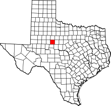 | |
| Unincorporated communities | ||
| Ghost towns | ||
| Footnotes | ‡This populated place also has portions in an adjacent county or counties | |