Waterperry with Thomley
Coordinates: 51°45′50″N 1°04′55″W / 51.764°N 1.082°W / 51.764; -1.082
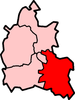
Waterperry with Thomley is a civil parish in South Oxfordshire. It includes the village of Waterperry (Ordnance Survey grid reference SP626066) and the abandoned former village of Thomley (OS Grid ref. SP629091). Thomley and Wateperry were separate civil parishes in 1957.[1] The current single civil parish was formed at some time thereafter, comprising 13.76km², having a population of 257 recorded in the United Kingdom Census 2011. The area is bisected by the M40 motorway, it is in the valley of the Thame and centred approximately 7 miles (11 km) east of the city of Oxford.
Sources
- Lobel, Mary D. (1957). Victoria County History: A History of the County of Oxford: Volume 5: Bullingdon Hundred. pp. 295–296.
References
- ↑ Lobel, 1957, pages 295-296
|
|---|
|
|
|
| Towns | | |
|---|
|
| Large villages | |
|---|
|
Other civil
parishes
(component
villages
and hamlets) |
- Adwell
- Aston Rowant
- Aston Tirrold
- Aston Upthorpe
- Baldons, (Baldon Row, Marsh Baldon, Toot Baldon)
- Beckley and Stowood (Beckley, Stowood)
- Berrick Salome (Berrick Prior, Roke, Rokemarsh)
- Binfield Heath
- Bix and Assendon (Bix, Bix Bottom, Lower Assendon, Middle Assendon)
- Brightwell Baldwin
- Britwell Salome
- Checkendon
- Clifton Hampden (Burcot)
- Crowell
- Cuddesdon and Denton (Cuddesdon, Denton)
- Culham
- Cuxham with Easington (Cuxham, Easington)
- Dorchester
- Drayton St. Leonard
- East Hagbourne (Coscote)
- Elsfield
- Eye and Dunsden (Sonning Eye, Dunsden Green, Playhatch)
- Forest Hill with Shotover (Forest Hill, Shotover)
- Goring Heath (Whitchurch Hill, Cray's Pond)
- Great Haseley (Latchford, Little Haseley, North Weston, Rycote)
- Harpsden
- Highmoor (Satwell)
- Holton
- Ipsden
- Kidmore End (Gallowstree Common)
- Lewknor (Postcombe, South Weston)
- Little Milton
- Little Wittenham
- Long Wittenham
- Mapledurham (Trench Green, Chazey Heath)
- Moulsford
- Nettlebed
- Newington (Great Holcombe)
- North Moreton
- Nuffield
- Nuneham Courtenay
- Pishill with Stonor (Pishill, Stonor, Maidensgrove, Russell's Water)
- Pyrton (Clare, Standhill)
- Rotherfield Greys
- Rotherfield Peppard
- Shirburn
- South Moreton (Fulscot)
- South Stoke (Littlestoke)
- Stadhampton (Chiselhampton, Brookhampton, Ascott)
- Stanton St. John (Woodperry)
- Stoke Row
- Stoke Talmage
- Swyncombe
- Sydenham (Kingston Stert)
- Tetsworth
- Tiddington-with-Albury (Tiddington, Albury)
- Towersey
- Warborough (Shillingford)
- Waterperry with Thomley (Waterperry, Thomley)
- Waterstock
- West Hagbourne
- Wheatfield
- Whitchurch-on-Thames
- Wilcote
- Woodeaton
|
|---|
|
Former districts
and boroughs | |
|---|
|
Former
constituencies | |
|---|
|
|