Sonning Common
| Sonning Common | |
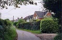 Homes at Chalkhouse Green, Sonning Common. |
|
 Sonning Common |
|
| Area | 3.66 km2 (1.41 sq mi) |
|---|---|
| Population | 3,784 (2011 census)[1] |
| – density | 1,034/km2 (2,680/sq mi) |
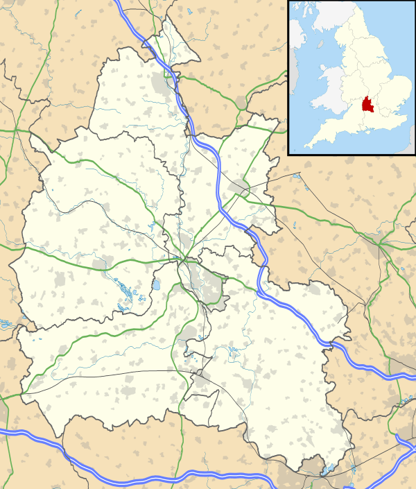
| OS grid reference | SU7180 |
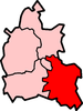
| Civil parish | Sonning Common |
| District | South Oxfordshire |
| Shire county | Oxfordshire |
| Region | South East |
| Country | England |
| Sovereign state | United Kingdom |
| Post town | READING |
| Postcode district | RG4 |
| Dialling code | 0118 |
| Police | Thames Valley |
| Fire | Oxfordshire |
| Ambulance | South Central |
| EU Parliament | South East England |
| UK Parliament | Henley constituency |
| Website | Sonning Common Parish |
|
|
Coordinates: 51°30′43″N 0°58′37″W / 51.512°N 0.977°W
Sonning Common is a village and civil parish in a relatively flat, former common land part of the Chiltern Hills in South Oxfordshire, centred 3.5 miles (6 km) west south-west of Henley-on-Thames and 2.5 miles (4 km) north of Reading.
History
During the English Civil War the village itself did not exist: being an area of open land east of the route between Reading – occupied alternately by the Parliamentarians and Royalists – and Oxford, which was the King's headquarters.[2] In 1647 after the end of the first civil war, the King was imprisoned at nearby Caversham House (now the location of BBC Monitoring in Caversham); however he was allowed out under escort to play bowls at an inn (latterly called "The King Charles Head") near Cane End, approximately one mile west of Sonning Common.[3][4] His route between these places would have brought him close to the present-day village.
The site of the village has been called "Sonning Common" since at least the 1640s, long before any fixed settlement existed. The name is literal, at the time gradually losing its earlier status of common grazing land belonging to Sonning Parish. Both places have intermittently been spelt 'Sunning' as seen on maps such as that of the A4 road from 1786, indicating contemporary pronunciation was as in the other three ancient parishes named after Sunna (Saxon chief) — the letter combination 'un' was avoided in Middle English as a result of Norman handwriting.[2]
Amenities

Serving as a meeting place to explore by footpaths the Chiltern Hills nearest to the large town of Reading, Sonning Common has a community of volunteers who guide regular Sonning Common Health Walks. Sonning Common has a Herb Farm (with a Saxon layout maze), Thames Valley Gymnastics Club and a health centre.[5] Two neighbouring parishes, Kidmore End and Rotherfield Peppard, have their war memorial halls on the parish boundaries.
The civil parish help maintain a pond with a duck-house in the middle called "Duckingham Palace", three children's playgrounds and a Millennium Green, public land, at the southern end of the village between Kennylands Road and Peppard Road.[6]
Wood Lane has the health centre, village hall and most shops including: an Indian restaurant,[7] a Chinese take-away, fish and chip shop, sandwich shop, post office, florist,[8] supermarkets, bank, petrol station, dental practice[9] and general/charity stores.
Public houses:
Churches
Churches are Christ the King (Church of England),[12] Saint Michael's (Roman Catholic),[13] and Sonning Common Free Church.
Education
Sonning Common has a primary school,[14] while Chiltern Edge School[15] is a secondary school in the village. Gillotts School, Henley-on-Thames, also serves the area. There is also Bishopswood School which is a special school serving the wider area.
Performing arts
The village has an amateur dramatic group, The Chiltern Players.[n 1]
Demography
| Output area | Population | Homes | % Owned outright | % Owned with a loan | % Socially rented | % Privately rented | km² | km² Greenspace[n 2] | km² gardens | km² road and rail[1] |
|---|---|---|---|---|---|---|---|---|---|---|
| Sonning Common (civil parish) | 3784 | 1547 | 45.4% | 34.5% | 12.8% | 5.7% | 3.66 | 2.46 | 0.74 | 0.17 |
The greenspace is mainly beech woodland with clearings and fields straddled by many paths.
The Sonning Common Magazine is a not-for-profit community digital and delivered magazine to 1,850 addresses in the village every other month.[16]
Nearest places
 |
Checkendon | Rotherfield Peppard | Binfield Heath (part of) | |
| Kidmore End | |
Binfield Heath | ||
| ||||
| | ||||
| Kidmore End | Emmer Green (traditionally in Caversham) |
Eye and Dunsden |
Notes and references
- Notes
- References
- 1 2 Key Statistics: Dwellings; Quick Statistics: Population Density; Physical Environment: Land Use Survey 2005
- 1 2 "Civil War". Sonning Common Parish. Retrieved 2013-04-09.
- ↑ "Village's part in civil war". Henley Standard. 2009-05-26. Retrieved 2009-05-26.
- ↑ The pub is at Collins End, between Cane End and Goring Heath. By 2008 it was closed and up for sale. geograph.org.uk. Accessed 28 August 2009.
- ↑ "Sonning Common Health Centre". Sonning Common Health Centre. 2013-03-26. Retrieved 2013-04-09.
- ↑ "Sonning Common Magazine June July 2013" (PDF). 2013-06-01. Retrieved 2014-04-18.
- ↑ "Tandoori Connoisseur restaurant". Tandooriconnoisseur.co.uk. Retrieved 2013-04-09.
- ↑ Brambles Floristry
- ↑ "Wood Lane Dentistry". Wood Lane Dentistry. 1969-09-08. Retrieved 2013-04-09.
- ↑ Bird In Hand
- ↑ The Butchers Arms
- ↑ A Church Near You. "Christ the King, Sonning Common". A Church Near You. Retrieved 2013-04-09.
- ↑ "St Michael's Catholic Church". Saintmichaelsonningcommon.org.uk. Retrieved 2013-04-09.
- ↑ Sonning Common Primary School
- ↑ "Chiltern Edge Secondary School". Chilternedge.oxon.sch.uk. Retrieved 2013-04-09.
- ↑ "Sonning Common Magazine". Sonning Common Magazine. Retrieved 2013-04-09.
| Wikimedia Commons has media related to Sonning Common. |