East Hagbourne
| East Hagbourne | |
 Houses at Upper Cross |
|
 East Hagbourne |
|
| Area | 3.90 km2 (1.51 sq mi) |
|---|---|
| Population | 1,882 (2011 Census) |
| – density | 483/km2 (1,250/sq mi) |
| OS grid reference | SU527883 |
| Civil parish | East Hagbourne |
| District | South Oxfordshire |
| Shire county | Oxfordshire |
| Region | South East |
| Country | England |
| Sovereign state | United Kingdom |
| Post town | Didcot |
| Postcode district | OX11 |
| Dialling code | 01235 |
| Police | Thames Valley |
| Fire | Oxfordshire |
| Ambulance | South Central |
| EU Parliament | South East England |
| UK Parliament | Wantage |
| Website | EastHagbourne.Net |
|
|
Coordinates: 51°35′28″N 1°14′20″W / 51.591°N 1.239°W
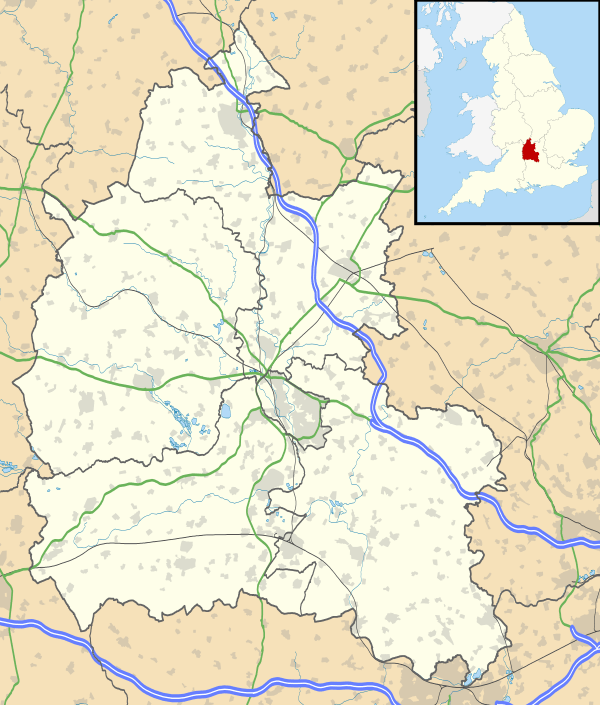
East Hagbourne is a village and civil parish about 1 mile (1.6 km) south of Didcot and 11 miles (18 km) south of Oxford. It was part of Berkshire until the 1974 boundary changes transferred it to Oxfordshire. The 2011 Census recorded the parish's population as 1,882.[1]
Manor
East Hagbourne's toponym is derived from Hacca's Brook, a stream that flows through the village. East Hagbourne was sometimes called Church Hagbourne.[2]
East and West Hagbourne have been separate villages since the time of Edward the Confessor, when Regenbald, a priest of Cirencester, held the manor of East Hagbourne. Regenbald continued to hold the manor after the Norman conquest of England in 1066 and compilation of the Domesday Book in 1086. Regenbald died in the reign of Henry I, who then granted East Hagbourne manor to the Augustinians Cirencester Abbey (founded 1117). The abbey continued to hold the manor until 1539, when it surrendered its lands to the Crown in the Dissolution of the Monasteries.[2]
Churches
Church of England

The nave of the Church of England parish church of Saint Andrew may have been built in the 12th century. The south aisle was added early in the 13th century. It is linked with the nave by a three-bays arcade. It was followed a few years later by the south chapel, which is alongside the chancel and linked to it by a two-bay arcade. The chancel arch was built in the middle of the 13th century. The north aisle, also of three bays, was added about 1340, followed by the Decorated Gothic north chapel, which is alongside the chancel and linked with it by a two-bay arcade.[2]
On the floor of the north chapel are monumental brasses commemorating Claricia Wyndesor - quare fieri fecit istam capellam (died 1403) and her husband John York fundator istius Ile (died 1404).[3] Nikolaus Pevsner takes this to mean that the north chapel was built early in the 15th century, which surprised him as its Decorated Gothic style had been succeeded by Perpendicular Gothic around 1350.[3] However, the south aisle and south chapel were rebuilt in the Perpendicular Gothic style early in the 15th century so Page and Ditchfield conclude that the brasses of Clarice Windsor and John York were formerly in the south chapel and moved at a later date.[3]
The south chapel has a squint into the chancel.[2] The chapel was re-roofed in the 17th century.[3]
The arch supporting the west bell tower is 14th-century Decorated Gothic but the style of the rest of the tower is Perpendicular Gothic.[2][3] A Perpendicular Gothic clerestory was added to the nave in the 15th century. The east window of the chancel is also Perpendicular, from late in the 15th century.[2] St Andrew's is a Grade I listed building.
The tower has a ring of eight bells.[2] Joseph Carter of Reading cast the third bell in 1602. Ellis I Knight of Reading cast the fifth and sixth bells in 1641, and Henry II Knight cast the fourth in 1670. Thomas Lester of the Whitechapel Bell Foundry cast the seventh bell in 1751. Robert I Wells of Aldbourne, Wiltshire cast the treble bell in 1770, and his son Robert II Wells of Aldbourne cast the tenor in 1781. Mears and Stainbank at the Whitechapel Bell Foundry cast the second bell in 1910. St Andrew's has also a Sanctus bell, cast by an unknown founder in about 1699.[4]
St Andrew's parish is part of the Benefice of the Churn.[5]
Primitive Methodist
A Primitive Methodist chapel was built in East Hagbourne in the 19th century.[2] It is a red brick building with Gothic Revival ashlar stone details. It is no longer a chapel but is now a private house.[6]
Secular buildings and structures

As well as the parish church, East Hagbourne has at least 45 listed buildings. The majority of East Hagbourne's listed buildings are individual houses and cottages, particularly on Main Road and Church Close, which are mid-17th century and are all Grade II listed.[7]
The Village Cross or Upper Cross, at the junction of Main Road and Church Close, is a 15th-century stone cross with an 18th-century sundiam, on a base of 5 deep stone steps. It is Grade II* listed.[8]
Hagbourne Mill Farm Mill is early 18th century with alterations from about 1828 and is Grade II* listed. It is some way south of the village and not generally open to the public. [9]
The Phillips family tomb is a chest tomb in white and grey marble in St Andrew's parish churchyard. It is Grade II* listed.[10] Matthew Phillips, carpenter to the King, is mentioned below.
The original part of Kings Holme, 5 Main Road, was built in 1591.[11]
Tudor House, 46 Main Road, is a three-storey farmhouse with thatched barn opposite the Village Cross. It has wooden panelling in the front room and an original corkscrew staircase to the rear.[12]
Economic and social history

In the English Civil War in 1644, the Parliamentarian army billetted 6,000 horsemen in East Hagbourne. During this time it is believed the parish church and Upper Cross were damaged. A tiny window, only three inches square, in a house on Main Road, is said to have been used to spy on the Parliamentarian troops.[13]
On 10 March 1659 fire spread through the village, burning down a considerable number of thatched houses.[2] In 1661 Charles II issued a proclamation requesting for aid to be sent to the village. A sum was received from Londoners and, in return, East Hagbourne sent money to London after the Great Fire of London in 1666.[14] The Hagbourne fire could explain the number of well-preserved houses from after this era. The village has numerous old timber-framed houses, both around the village cross and along the main street.[15] Coscote Manor, about 1⁄2 mile (800 m) west of the village, is a timber-framed 17th-century house with fretwork bargeboards and an Ipswich window.[16]
Hagbourne Church of England Primary School[17] is in East Hagbourne and was built in 1874.[2]
_(14580254298).jpg)
The Didcot, Newbury and Southampton Railway was built through the parish, passing west of the village and east of Coscote on the still extant Hagbourne Embankment – one of the line's most notable civil engineering features, built upon chalk dug from the route of the line through the Berkshire Downs. The line opened in 1881. There was no station in the parish; the nearest were at Upton and Didcot.
In 1911 the Great Western Railway renamed Upton station Upton and Blewbury. In 1942–43 the track was doubled to carry increased war traffic, and the bridges over the West Hagbourne Road and Lake Road were rebuilt. British Railways closed the line to passenger traffic in 1962 and freight in 1967.
Since December 2006 a South Didcot bypass road has been proposed. This would have required the demolition of part of East Hagbourne, particularly houses in the New Road area.[19] The proposal is in abeyance.
In 2014 the parish boundary with Didcot was moved and the land locally called Fleet Meadow was made part of the Millbrook ward of Didcot.[20]
In 2015 Grainger plc proposed a high-density housing estate of 170 homes on land south of this new boundary. East Hagbourne Parish Council and many Didcot and East Hagbourne residents oppose the development,[21] as does local MP Ed Vaizey.[22] The Mind the Green Gap Campaign formed in July 2015 to campaign against this and other proposals that are contrary to South Oxfordshire District Council's Core Strategy.[23]
Amenities and events
East Hagbourne has a 17th-century[24] public house, The Fleur de Lys.[25]
East Hagbourne has a Church of England Primary School on Main Road. Opposite the school is Hagbourne village hall, shared by East and West Hagbourne and used regularly for village events. In 2010 the building was extended with an additional meeting room, new toilets and storage.[26]
There is a small Post Office and a village shop in New Road, opened in 2001 and run by local volunteers.[27]
In 1996, 1999, 2003 and 2004 East Hagbourne was awarded the title of Best Kept Village in Oxfordshire. In 2009 the village was one of nine UK finalists in the Royal Horticultural Society’s Britain in Bloom competition.
The village holds several events each year. These include an annual fun run on the May Day bank holiday, typically of 4 1⁄2 miles (7 km) to 5 1⁄2 miles (9 km), which involves a run around the surrounding area, including the villages of Blewbury and Upton. There is an annual "scarecrow trail", a village fête and, in August, a duck race on Hacca's Brook. In recent years a Mummers Play has toured the village in December.
Film and television
Location scenes for three of the four episodes of the BBC television Doctor Who serial The Android Invasion were filmed in the village in July 1975.[28] Star Tom Baker returned to the village to be interviewed by Nick Briggs about his time on Doctor Who for the Reeltime Pictures Myth Makers series in 1989. Briggs returned to the village again to interview villagers for The Village That Came to Life, a making-of documentary featured on the DVD release of the serial in 2012.
In 2015, two television channels featured East Hagbourne in reports about the Mind the Green Gap Campaign.[29][30]
Notable residents
- Thomas Phillips (about 1689–1736), carpenter to kings George I and George II, lived in East Hagbourne and is buried in St Andrew's parish churchyard.[10]
- Television chef Keith Floyd married in East Hagbourne and lived in a cottage in the village for a short time.[31][32]
References
- ↑ "Area: East Hagbourne (Parish): Parish Headcounts". Neighbourhood Statistics. Office for National Statistics. Retrieved 24 November 2015.
- 1 2 3 4 5 6 7 8 9 10 Page & Ditchfield 1923, pp. 475–484.
- 1 2 3 4 5 Pevsner 1966, p. 132.
- ↑ Smith, Martin; Davies, Peter (14 July 2014). "East Hagbourne S Andrew". Dove's Guide for Church Bell Ringers. Central Council for Church Bell Ringers. Retrieved 24 November 2006.
- ↑ Archbishops' Council. "Benefice of The Churn". A Church Near You. Church of England. Retrieved 24 November 2015.
- ↑ "East Hagbourne". Oxfordshire Churches & Chapels. Brian Curtis.
- ↑ "Listed Buildings in East Hagbourne, Oxfordshire, England". British Listed Buildings. Retrieved 17 September 2011.
- ↑ Historic England. "Village Cross (Grade II*) (1180947)". National Heritage List for England. Retrieved 24 November 2015.
- ↑ Historic England. "Hagbourne Mill Farm Mill (Grade II*) (1368811)". National Heritage List for England. Retrieved 24 November 2015.
- 1 2 Historic England. "Chest tomb to Phillips family and railings approximately 10 metres north of Church of St Andrew (Grade II*) (1180853)". National Heritage List for England. Retrieved 24 November 2015.
- ↑ Historic England. "Kings Holme (Grade II) (1285251)". National Heritage List for England. Retrieved 24 November 2015.
- ↑ Historic England. "Number 46 (Tudor House) and attached wing and barn (Grade II) (1047892)". National Heritage List for England. Retrieved 24 November 2015.
- ↑ Clare 1995
- ↑ Clare 1995, p. 12.
- ↑ Pevsner 1966, pp. 132–133.
- ↑ Pevsner 1966, p. 133.
- ↑ Hagbourne Primary School
- ↑ Fae 1913, pp. 196–7
- ↑ Buratta, Chris (20 December 2006). "Homes shock for south and west Didcot". Oxford Mail. Newsquest. Retrieved 20 September 2011.
- ↑ "CGR 9" (PDF). South Oxfordshire District Council.
- ↑ Keown, Callum (12 August 2015). "'Don't let them build on our green gap'". Oxford Mail. Newsquest. Retrieved 29 September 2015.
- ↑ "Ed Vaizey calls on SODC to reject proposed plans for development in East Hagbourne". Ed Vaizey.
- ↑ "Adopted core strategy". South Oxfordshire District Council.
- ↑ Historic England. "Fleur de Lys public house (Grade II) (1047890)". National Heritage List for England. Retrieved 24 November 2015.
- ↑ Fleur de Lys
- ↑ "Hagbourne Village Hall Annual General Meeting Minutes" (PDF). 30 November 2010. Retrieved 20 September 2011.
- ↑ "Community shop postmaster calls it a day". Oxford Mail. Newsquest. 10 October 2013.
- ↑ "Dr. Who". East Hagbourne Community Website. Retrieved 17 April 2013.
- ↑ "Families fight to save Oxfordshire green gap". ITV News Meridian. 25 August 2015.
- ↑ "Mind The Green Gap". That's Oxford TV. 27 August 2015.
- ↑ "Chefs remember Keith Floyd". Oxford Mail. Newsquest. 15 September 2009. Retrieved 16 September 2011.
- ↑ "Telly Floyd's best booze is pinched; Raiders even grabbed his 100-year-old Glenfiddich". Daily Record. Trinity Mirror. 30 August 1996. Retrieved 16 September 2011 – via thefreelibrary.com.
Sources
- Clare, B; et al. (1995). East Hagbourne Times: Portrait of an English Village.
- Fae, Allan (1913). Quiet roads and sleepy villages. London: E Nash. pp. 196–7 – via Internet Archive.
- Page, W.H.; Ditchfield, P.H., eds. (1923). A History of the County of Berkshire. Victoria County History. 3. assisted by John Hautenville Cope. London: The St Katherine Press. pp. 475–484.
- Pevsner, Nikolaus (1966). Berkshire. The Buildings of England. Harmondsworth: Penguin Books. pp. 132–133.
External links
| Wikimedia Commons has media related to East Hagbourne. |