Wayne Township, Fulton County, Indiana
| Wayne Township | |
|---|---|
| Township | |
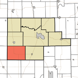 Location of Wayne Township in Fulton County | |
| Coordinates: 40°57′11″N 86°23′41″W / 40.95306°N 86.39472°WCoordinates: 40°57′11″N 86°23′41″W / 40.95306°N 86.39472°W | |
| Country | United States |
| State | Indiana |
| County | Fulton |
| Government | |
| • Type | Indiana township |
| Area | |
| • Total | 46.82 sq mi (121.3 km2) |
| • Land | 46.74 sq mi (121.1 km2) |
| • Water | 0.07 sq mi (0.2 km2) |
| Elevation[1] | 774 ft (236 m) |
| Population (2010) | |
| • Total | 569 |
| • Density | 12.2/sq mi (4.7/km2) |
| FIPS code | 18-81692[2] |
| GNIS feature ID | 454029 |
Wayne Township is one of eight townships in Fulton County, Indiana. As of the 2010 census, its population was 569 and it contained 253 housing units.[3]
Geography
According to the 2010 census, the township has a total area of 46.82 square miles (121.3 km2), of which 46.74 square miles (121.1 km2) (or 99.83%) is land and 0.07 square miles (0.18 km2) (or 0.15%) is water.[3]
Unincorporated towns
(This list is based on USGS data and may include former settlements.)
Adjacent townships
- Union Township (north)
- Rochester Township (northeast)
- Liberty Township (east)
- Bethlehem Township, Cass County (southeast)
- Harrison Township, Cass County (south)
- Boone Township, Cass County (southwest)
- Van Buren Township, Pulaski County (west)
- Harrison Township, Pulaski County (northwest)
Major highways
Cemeteries
The township contains eight cemeteries: Reed, Fletcher's Lake, Grass Creek, St. Anne, Bauman, Old Allison Farm, Hizer, Old A. D. Toner
References
- ↑ "US Board on Geographic Names". United States Geological Survey. 2007-10-25. Retrieved 2008-01-31.
- ↑ "American FactFinder". United States Census Bureau. Retrieved 2008-01-31.
- 1 2 "Population, Housing Units, Area, and Density: 2010 - County -- County Subdivision and Place -- 2010 Census Summary File 1". United States Census. Retrieved 2013-05-10.
External links
Municipalities and communities of Fulton County, Indiana, United States | ||
|---|---|---|
| City | ||
| Towns | ||
| Townships | ||
| Unincorporated communities | ||
| Footnotes | ‡This populated place also has portions in an adjacent county or counties | |
This article is issued from Wikipedia - version of the 9/4/2016. The text is available under the Creative Commons Attribution/Share Alike but additional terms may apply for the media files.