Aubbeenaubbee Township, Fulton County, Indiana
| Aubbeenaubbee Township | |
|---|---|
| Township | |
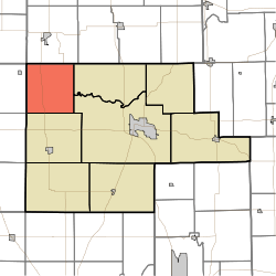 Location of Aubbeenaubbee Township in Fulton County | |
| Coordinates: 41°09′00″N 86°25′00″W / 41.15000°N 86.41667°WCoordinates: 41°09′00″N 86°25′00″W / 41.15000°N 86.41667°W | |
| Country | United States |
| State | Indiana |
| County | Fulton |
| Government | |
| • Type | Indiana township |
| Area | |
| • Total | 34.69 sq mi (89.8 km2) |
| • Land | 34.49 sq mi (89.3 km2) |
| • Water | 0.2 sq mi (0.5 km2) |
| Elevation[1] | 741 ft (226 m) |
| Population (2010) | |
| • Total | 1,448 |
| • Density | 42/sq mi (16/km2) |
| FIPS code | 18-02656[2] |
| GNIS feature ID | 453053 |
Aubbeenaubbee Township is one of eight townships in Fulton County, Indiana. As of the 2010 census, its population was 1,448 and it contained 728 housing units.[3]
Geography
According to the 2010 census, the township has a total area of 34.69 square miles (89.8 km2), of which 34.49 square miles (89.3 km2) (or 99.42%) is land and 0.2 square miles (0.52 km2) (or 0.58%) is water.[3] King Lake is in this township.
Unincorporated towns
(This list is based on USGS data and may include former settlements.)
Adjacent townships
- Union Township, Marshall County (north)
- Richland Township (east)
- Rochester Township (southeast)
- Union Township (south)
- Harrison Township, Pulaski County (southwest)
- Tippecanoe Township, Pulaski County (west)
- North Bend Township, Starke County (northwest)
Major highways
Cemeteries
The township contains two cemeteries: Independent Order of Odd Fellows and Moon.
References
- "Aubbeenaubbee Township, Fulton County, Indiana". Geographic Names Information System. United States Geological Survey. Retrieved 2009-09-24.
- United States Census Bureau cartographic boundary files
- ↑ "US Board on Geographic Names". United States Geological Survey. 2007-10-25. Retrieved 2008-01-31.
- ↑ "American FactFinder". United States Census Bureau. Archived from the original on September 11, 2013. Retrieved 2008-01-31.
- 1 2 "Population, Housing Units, Area, and Density: 2010 - County -- County Subdivision and Place -- 2010 Census Summary File 1". United States Census. Retrieved 2013-05-10.
External links
Municipalities and communities of Fulton County, Indiana, United States | ||
|---|---|---|
| City | ||
| Towns | ||
| Townships | ||
| Unincorporated communities | ||
| Footnotes | ‡This populated place also has portions in an adjacent county or counties | |
This article is issued from Wikipedia - version of the 9/4/2016. The text is available under the Creative Commons Attribution/Share Alike but additional terms may apply for the media files.