Fulton County, Indiana
| Fulton County, Indiana | |
|---|---|
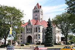 Fulton County courthouse in Rochester | |
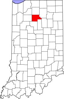 Location in the U.S. state of Indiana | |
 Indiana's location in the U.S. | |
| Founded | 1836 |
| Named for | Robert Fulton |
| Seat | Rochester |
| Largest city | Rochester |
| Area | |
| • Total | 371.26 sq mi (962 km2) |
| • Land | 368.39 sq mi (954 km2) |
| • Water | 2.88 sq mi (7 km2), 0.78% |
| Population | |
| • (2010) | 20,836 |
| • Density | 56/sq mi (21/km²) |
| Congressional district | 2nd |
| Time zone | Eastern: UTC-5/-4 |
| Website |
www |
| Footnotes: Indiana county number 25 | |
Fulton County is a county located in the U.S. state of Indiana. As of 2010, the population was 20,836.[1] The county seat is Rochester.[2]
History
The first non-Native Americans to ever set foot in what is now Fulton County, Indiana were French fur traders. Few of them remained permanently as year-round residents of the area and by the 1830s there were was no French population of what is now Fulton County.
In the 1820s and 1830s migrants from New England began moving to what is now Indiana in large numbers (though there was a trickle of New England settlers who arrived before this date). These were “Yankee” settlers, that is to say they were descended from the English Puritans who settled New England during the colonial era. While most of them came to Indiana directly from New England, there were many who came from upstate New York. These were people whose parents had moved from New England to upstate New York in the immediate aftermath of the American Revolution. Due to the prevalence of New Englanders and New England transplants from upstate New York, the northern third of Indiana was very culturally contiguous with early New England culture for much of its early history.[3]
The Yankee migration to Indiana was a result of several factors, one of which was the overpopulation of New England. The old stock Yankee population had large families, often bearing up to ten children in one household. Most people were expected to have their own piece of land to farm, and due to the massive and nonstop population boom, land in New England became scarce as every son claimed his own farmstead. As a result, there was not enough land for every family to have a self-sustaining farm, and Yankee settlers began leaving New England for the Midwestern United States.[3]
They were aided in this effort by the construction and completion of the Erie Canal which made traveling to the region much easier, causing an additional surge in migrants coming from New England. Added to this was the end of the Black Hawk War, which made the region much safer to travel through and settle in for white settlers.[4]
In the case of Fulton County, there were no attempts by United States settlers to permanently settle the area until the conclusion of the Blackhawk War. Fulton County's first permanent non-Native American settlers arrived in September and October 1832, most of whom came from New England though some of whom were New England transplants from upstate New York. Most of Fulton County's New England settlers came from Franklin County, Massachusetts, Grafton County, New Hampshire and Orange County, Vermont, as well as several farming families from Maine and the rural northern region of Connecticut. At first, virtually all of these settlers farmers.[5]
These settlers were primarily members of the Congregational Church, though due to the Second Great Awakening, many of them had converted to Methodism, and some had become Baptists before coming to what is now Cook County. The Congregational Church has subsequently gone through many divisions, and some factions, including those in Cook County, are now known as the Church of Christ and the United Church of Christ.[6]
When the New Englanders arrived, there was nothing but dense virgin forest and wild prairie. They laid out farms, constructed roads, erected government buildings and established post routes. By the spring of 1833 the settlement was a successful and thriving farming community. Rochester was laid out in 1835. The founder Alexander Chamberlain named it for his former hometown of Rochester, New York.[7] The Rochester post office was established in 1836.[8]
Fulton County was formed in 1836. It was named for Robert Fulton, inventor of the steamboat.[9] Native Americans in the county believed that a terrible monster lived in Lake Manitou and for that reason they never lived around the lake. Early settlers called it the Devil's Lake and there were many reported sightings of a monster.[10]
The Potawatomi Trail of Death came though the town in 1838.[11]
Geography
According to the 2010 census, the county has a total area of 371.26 square miles (961.6 km2), of which 368.39 square miles (954.1 km2) (or 99.23%) is land and 2.88 square miles (7.5 km2) (or 0.78%) is water.[12]
Cities and towns
Townships
Major highways
Railroads
Adjacent counties
- Marshall County (north)
- Kosciusko County (northeast)
- Wabash County (east)
- Miami County (southeast)
- Cass County (south)
- Pulaski County (west)
- Starke County (northwest)
Climate and weather
| Rochester, Indiana | ||||||||||||||||||||||||||||||||||||||||||||||||||||||||||||
|---|---|---|---|---|---|---|---|---|---|---|---|---|---|---|---|---|---|---|---|---|---|---|---|---|---|---|---|---|---|---|---|---|---|---|---|---|---|---|---|---|---|---|---|---|---|---|---|---|---|---|---|---|---|---|---|---|---|---|---|---|
| Climate chart (explanation) | ||||||||||||||||||||||||||||||||||||||||||||||||||||||||||||
| ||||||||||||||||||||||||||||||||||||||||||||||||||||||||||||
| ||||||||||||||||||||||||||||||||||||||||||||||||||||||||||||
In recent years, average temperatures in Rochester have ranged from a low of 15 °F (−9 °C) in January to a high of 84 °F (29 °C) in July, although a record low of −25 °F (−32 °C) was recorded in January 1985 and a record high of 103 °F (39 °C) was recorded in July 1980. Average monthly precipitation ranged from 1.74 inches (44 mm) in February to 4.16 inches (106 mm) in May.[13]
Government
The county government is a constitutional body, and is granted specific powers by the Constitution of Indiana, and by the Indiana Code.
County Council: The county council is the legislative branch of the county government and controls all the spending and revenue collection in the county. Representatives are elected from county districts. The council members serve four-year terms. They are responsible for setting salaries, the annual budget, and special spending. The council also has limited authority to impose local taxes, in the form of an income and property tax that is subject to state level approval, excise taxes, and service taxes.[14][15]
Board of Commissioners: The executive body of the county is made of a board of commissioners. The commissioners are elected county-wide, in staggered terms, and each serves a four-year term. One of the commissioners, typically the most senior, serves as president. The commissioners are charged with executing the acts legislated by the council, collecting revenue, and managing the day-to-day functions of the county government.[14][15]
Court: The county maintains a small claims court that can handle some civil cases. The judge on the court is elected to a term of four years and must be a member of the Indiana Bar Association. The judge is assisted by a constable who is also elected to a four-year term. In some cases, court decisions can be appealed to the state level circuit court.[15]
County Officials: The county has several other elected offices, including sheriff, coroner, auditor, treasurer, recorder, surveyor, and circuit court clerk. Each of these elected officers serves a term of four years and oversees a different part of county government. Members elected to county government positions are required to declare party affiliations and to be residents of the county.[15]
Fulton County is part of Indiana's 2nd congressional district and in 2015 was represented by Jackie Walorski in the United States Congress.[16] It is also part of Indiana Senate district 18;[17] and Indiana House of Representatives districts 16 and 23.[18]
Demographics
| Historical population | |||
|---|---|---|---|
| Census | Pop. | %± | |
| 1840 | 1,993 | — | |
| 1850 | 5,982 | 200.2% | |
| 1860 | 9,422 | 57.5% | |
| 1870 | 12,726 | 35.1% | |
| 1880 | 14,301 | 12.4% | |
| 1890 | 16,746 | 17.1% | |
| 1900 | 17,453 | 4.2% | |
| 1910 | 16,879 | −3.3% | |
| 1920 | 16,478 | −2.4% | |
| 1930 | 15,038 | −8.7% | |
| 1940 | 15,577 | 3.6% | |
| 1950 | 16,565 | 6.3% | |
| 1960 | 16,957 | 2.4% | |
| 1970 | 16,984 | 0.2% | |
| 1980 | 19,335 | 13.8% | |
| 1990 | 18,840 | −2.6% | |
| 2000 | 20,511 | 8.9% | |
| 2010 | 20,836 | 1.6% | |
| Est. 2015 | 20,315 | [19] | −2.5% |
| U.S. Decennial Census[20] 1790-1960[21] 1900-1990[22] 1990-2000[23] 2010-2013[1] | |||
As of the 2010 United States Census, there were 20,836 people, 8,237 households, and 5,736 families residing in the county.[24] The population density was 56.6 inhabitants per square mile (21.9/km2). There were 9,708 housing units at an average density of 26.4 per square mile (10.2/km2).[12] The racial makeup of the county was 95.0% white, 0.7% black or African American, 0.5% Asian, 0.5% American Indian, 2.2% from other races, and 1.1% from two or more races. Those of Hispanic or Latino origin made up 4.2% of the population.[24] In terms of ancestry, 28.7% were German, 19.0% were American, 10.9% were Irish, and 10.0% were English.[25] Those citing "American" ancestry in Fulton County are of overwhelmingly English extraction, however most English Americans identify simply as having American ancestry because their roots have been in North America for so long, in some cases since the 1600s.[26][27][28][29][30]
Of the 8,237 households, 32.2% had children under the age of 18 living with them, 54.2% were married couples living together, 10.2% had a female householder with no husband present, 30.4% were non-families, and 25.8% of all households were made up of individuals. The average household size was 2.50 and the average family size was 2.97. The median age was 40.3 years.[24]
The median income for a household in the county was $47,697 and the median income for a family was $47,972. Males had a median income of $40,110 versus $28,417 for females. The per capita income for the county was $21,119. About 8.5% of families and 11.3% of the population were below the poverty line, including 15.1% of those under age 18 and 6.9% of those age 65 or over.[31]
Education
Public schools in Fulton County are administered by the Caston School Corporation, the Rochester Community School Corporation, Culver Community School Corporation, and the Tippecanoe Valley School Corporation.
High Schools and Middle Schools
- Caston Junior-Senior High School
- Rochester Community High School
- Rochester Middle School
- Tippecanoe Valley High School
- Tippecanoe Valley Middle School
Elementary Schools
- Akron Elementary
- Caston Elementary School
- Columbia Elementary School
- Riddle Elementary School
See also
External links
- Caston School Corporation
- Rochester Community School Corporation
- Tippecanoe Valley School Corporation
References
- 1 2 "Fulton County QuickFacts". United States Census Bureau. Retrieved 2011-09-17.
- ↑ "Find a County". National Association of Counties. Retrieved 2011-06-07.
- 1 2 Brief County History of Fulton County, Indiana, Its County Offices, and 1942 Inventory of Its County Archives by WPA Field Workers ; Prepared by the Indiana Historical Records Survey, Division of Community Service Programs, Work Projects Administration ; Sponsored by Indiana Historical Bureau -- The Bookmark, 1942 -- page 199
- ↑ Brief County History of Fulton County, Indiana, Its County Offices, and 1942 Inventory of Its County Archives by WPA Field Workers ; Prepared by the Indiana Historical Records Survey, Division of Community Service Programs, Work Projects Administration ; Sponsored by Indiana Historical Bureau -- The Bookmark, 1942 -- page 200
- ↑ Brief County History of Fulton County, Indiana, Its County Offices, and 1942 Inventory of Its County Archives by WPA Field Workers ; Prepared by the Indiana Historical Records Survey, Division of Community Service Programs, Work Projects Administration ; Sponsored by Indiana Historical Bureau -- The Bookmark, 1942 -- page 209
- ↑ Brief County History of Fulton County, Indiana, Its County Offices, and 1942 Inventory of Its County Archives by WPA Field Workers ; Prepared by the Indiana Historical Records Survey, Division of Community Service Programs, Work Projects Administration ; Sponsored by Indiana Historical Bureau -- The Bookmark, 1942 -- page 211
- ↑ Baker, Ronald L. (October 1995). From Needmore to Prosperity: Hoosier Place Names in Folklore and History. Indiana University Press. p. 283. ISBN 978-0-253-32866-3.
Alexander Chamberlain...came here from the area around Rochester, New York...
- ↑ "Fulton County". Jim Forte Postal History. Retrieved 10 September 2014.
- ↑ Gannett, Henry (1905). The Origin of Certain Place Names in the United States. Govt. Print. Off. p. 133.
- ↑ De Witt Clinton Goodrich & Charles Richard Tuttle (1875). An Illustrated History of the State of Indiana. Indiana: R. S. Peale & co. p. 559.
- ↑ "Places to see, things to do in Fulton Co.". The Rochester Sentinel. Archived from the original on November 27, 2013. Retrieved 10 September 2014.
- 1 2 "Population, Housing Units, Area, and Density: 2010 - County". United States Census Bureau. Retrieved 2015-07-10.
- 1 2 "Monthly Averages for Rochester, Indiana". The Weather Channel. Retrieved 2011-01-27.
- 1 2 Indiana Code. "Title 36, Article 2, Section 3". IN.gov. Retrieved 2008-09-16.
- 1 2 3 4 Indiana Code. "Title 2, Article 10, Section 2" (PDF). IN.gov. Retrieved 2008-09-16.
- ↑ "US Congressman Joe Donnelly". US Congress. Retrieved 2008-10-08.
- ↑ "Indiana Senate Districts". State of Indiana. Retrieved 2011-01-23.
- ↑ "Indiana House Districts". State of Indiana. Retrieved 2011-01-23.
- ↑ "County Totals Dataset: Population, Population Change and Estimated Components of Population Change: April 1, 2010 to July 1, 2015". Retrieved July 2, 2016.
- ↑ "U.S. Decennial Census". United States Census Bureau. Retrieved July 10, 2014.
- ↑ "Historical Census Browser". University of Virginia Library. Retrieved July 10, 2014.
- ↑ "Population of Counties by Decennial Census: 1900 to 1990". United States Census Bureau. Retrieved July 10, 2014.
- ↑ "Census 2000 PHC-T-4. Ranking Tables for Counties: 1990 and 2000" (PDF). United States Census Bureau. Retrieved July 10, 2014.
- 1 2 3 "DP-1 Profile of General Population and Housing Characteristics: 2010 Demographic Profile Data". United States Census Bureau. Retrieved 2015-07-10.
- ↑ "DP02 SELECTED SOCIAL CHARACTERISTICS IN THE UNITED STATES – 2006-2010 American Community Survey 5-Year Estimates". United States Census Bureau. Retrieved 2015-07-10.
- ↑ "Ancestry of the Population by State: 1980 - Table 3" (PDF). Retrieved 2012-02-10.
- ↑ Sharing the Dream: White Males in a Multicultural America By Dominic J. Pulera.
- ↑ Reynolds Farley, 'The New Census Question about Ancestry: What Did It Tell Us?', Demography, Vol. 28, No. 3 (August 1991), pp. 414, 421.
- ↑ Stanley Lieberson and Lawrence Santi, 'The Use of Nativity Data to Estimate Ethnic Characteristics and Patterns', Social Science Research, Vol. 14, No. 1 (1985), pp. 44-6.
- ↑ Stanley Lieberson and Mary C. Waters, 'Ethnic Groups in Flux: The Changing Ethnic Responses of American Whites', Annals of the American Academy of Political and Social Science, Vol. 487, No. 79 (September 1986), pp. 82-86.
- ↑ "DP03 SELECTED ECONOMIC CHARACTERISTICS – 2006-2010 American Community Survey 5-Year Estimates". United States Census Bureau. Retrieved 2015-07-10.
 |
Starke County | Marshall County | Kosciusko County | |
| Pulaski County | |
Wabash County | ||
| ||||
| | ||||
| Cass County | Miami County |
Municipalities and communities of Fulton County, Indiana, United States | ||
|---|---|---|
| City | ||
| Towns | ||
| Townships | ||
| Unincorporated communities | ||
| Footnotes | ‡This populated place also has portions in an adjacent county or counties | |

Coordinates: 41°02′N 86°16′W / 41.04°N 86.26°W