We`a
| We`a وع Oueah | |
|---|---|
| Town | |
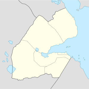 We`a وع Location in Djibouti | |
| Coordinates: 11°30′06″N 42°51′37″E / 11.50167°N 42.86028°ECoordinates: 11°30′06″N 42°51′37″E / 11.50167°N 42.86028°E | |
| Country |
|
| Region | Arta |
| Elevation | 1,493 ft (455 m) |
| Population | |
| • Total | 3,167 |
| Time zone | EAT (UTC+3) |
We`a or Wê‘a is a town in the Arta Region of Djibouti. It is located on the N1 road, which connects it to Djibouti City, located some 33 kilometres (20 miles) to the east.[1][2] We`a is the second largest city in the Arta Region after Arta and before Damerjog. It is the primary transportation hub in western Djibouti via highway. The town is sits in a small valley.
History
We`a's place-name literally means "turn" in the Afro-Asiatic Somali language. It later formed a part of the French Somaliland protectorate in the first half of the 20th century.
Overview
We`a lies on the National Highway 1.
Nearby towns and villages include Djibouti City, Arta and Holhol. Public buses go from Djibouti City to We`a, taking about half an hour to get to the town. The ride itself costs around 350 Djiboutian franc. Arta is situated just up the mountain around 3 kilometres (2 miles) to the north.
Additionally, We`a serves as a commercial transit point for goods from Ethiopia. Ethiopian trucks and traders frequently pass through the town.
Demographics
As of 2012, the population of We`a has been estimated to be 3,167. The town inhabitants belong to various mainly Afro-Asiatic-speaking ethnic groups, with the Issa Somali predominant.
Geography
The hills form a valley, which constitutes an extension of a wadi. We`a sits at an altitude of 455 metres (1,493 feet) above sea level in low-shrouded mountains and hills. The outskirts of the town have served as a local agricultural center.
Climate
We`a climate is semi-desert hot during summer and cold during winter. The warmest month of the year is June with an average temperature of 33.9 °C (93.0 °F). In January, the average temperature is 21.8 °C (71.2 °F). It is the lowest average temperature of the whole year and the driest month is June with 2 mm (0.1 in). Most precipitation falls in November, with an average of 34 mm (1.3 in).[3]
| Climate data for We`a | |||||||||||||
|---|---|---|---|---|---|---|---|---|---|---|---|---|---|
| Month | Jan | Feb | Mar | Apr | May | Jun | Jul | Aug | Sep | Oct | Nov | Dec | Year |
| Average high °C (°F) | 25.9 (78.6) |
26.1 (79) |
28.1 (82.6) |
30.6 (87.1) |
34.3 (93.7) |
38.4 (101.1) |
39.0 (102.2) |
38.1 (100.6) |
35.7 (96.3) |
31.4 (88.5) |
28.3 (82.9) |
26.6 (79.9) |
31.88 (89.38) |
| Daily mean °C (°F) | 21.8 (71.2) |
22.5 (72.5) |
24.2 (75.6) |
26.6 (79.9) |
30.1 (86.2) |
33.9 (93) |
33.4 (92.1) |
32.8 (91) |
31.7 (89.1) |
27.1 (80.8) |
24.1 (75.4) |
22.5 (72.5) |
27.56 (81.61) |
| Average low °C (°F) | 17.8 (64) |
18.9 (66) |
20.3 (68.5) |
22.6 (72.7) |
25.9 (78.6) |
29.4 (84.9) |
27.9 (82.2) |
27.5 (81.5) |
27.7 (81.9) |
22.8 (73) |
20.0 (68) |
18.4 (65.1) |
23.27 (73.87) |
| Average rainfall mm (inches) | 24 (0.94) |
18 (0.71) |
20 (0.79) |
26 (1.02) |
8 (0.31) |
2 (0.08) |
8 (0.31) |
17 (0.67) |
11 (0.43) |
10 (0.39) |
34 (1.34) |
12 (0.47) |
190 (7.46) |
| Source: Climate-Data.org, altitude: 455m[3] | |||||||||||||
Sister towns
Notes
- ↑ Google Maps (Map). Google.
- ↑ Bing Maps (Map). Microsoft and Harris Corporation Earthstar Geographics LLC.
- 1 2 "Climate: We`a - Climate graph, Temperature graph, Climate table". Climate-Data.org. Retrieved 25 September 2013.