West Amwell Township, New Jersey
| West Amwell Township, New Jersey | |
|---|---|
| Township | |
| Township of West Amwell | |
|
West Amwell Township Municipal Building | |
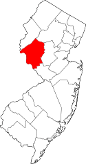
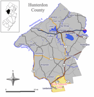 Map of West Amwell Township in Hunterdon County. Inset: Location of Hunterdon County highlighted in the State of New Jersey. | |
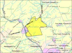 Census Bureau map of West Amwell Township, New Jersey | |
| Coordinates: 40°22′45″N 74°53′16″W / 40.379051°N 74.887735°WCoordinates: 40°22′45″N 74°53′16″W / 40.379051°N 74.887735°W[1][2] | |
| Country |
|
| State |
|
| County | Hunterdon |
| Incorporated | April 6, 1846 |
| Named for | Amwell Township / Amwell, Hertfordshire |
| Government[3][4] | |
| • Type | Township |
| • Body | Township Committee |
| • Mayor | Zachary T. Rich (R, term ends December 31, 2016)[4][5] |
| • Clerk | Lora L. Olsen[6] |
| Area[1] | |
| • Total | 21.776 sq mi (56.398 km2) |
| • Land | 21.581 sq mi (55.894 km2) |
| • Water | 0.195 sq mi (0.505 km2) 0.89% |
| Area rank |
129th of 566 in state 12th of 26 in county[1] |
| Elevation[7] | 315 ft (96 m) |
| Population (2010 Census)[8][9][10] | |
| • Total | 3,840 |
| • Estimate (2015)[11] | 2,780 |
| • Rank |
420th of 566 in state 15th of 26 in county[12] |
| • Density | 177.9/sq mi (68.7/km2) |
| • Density rank |
517th of 566 in state 22nd of 26 in county[12] |
| Time zone | Eastern (EST) (UTC-5) |
| • Summer (DST) | Eastern (EDT) (UTC-4) |
| ZIP code | 08530 - Lambertville[13] |
| Area code(s) | 609[14] |
| FIPS code | 3401978230[1][15][16] |
| GNIS feature ID | 0882181[1][17] |
| Website |
www |

West Amwell Township is a township in Hunterdon County, New Jersey, United States. As of the 2010 United States Census, the township's population was 3,840,[8][9][10] reflecting an increase of 1,457 (+61.1%) from the 2,383 counted in the 2000 Census, which had in turn increased by 132 (+5.9%) from the 2,251 counted in the 1990 Census.[18]
West Amwell was incorporated as a township by an act of the New Jersey Legislature on April 6, 1846, when Amwell Township was split, also creating East Amwell Township at the same time. Portions of the township were taken to form Lambertville town on March 1, 1849.[19] In 1896, the township annexed portions of Delaware Township, East Amwell Township and Raritan Township.[20] The township was named for Amwell Township, which in turn was named for Amwell, Hertfordshire in England.[21]
The Delaware Native Americans had a path through the woods from Lambertville through Mount Airy, Ringoes and Reaville to Newark upon which the Old York Road was subsequently laid.[22]
Geography
The northern areas of West Amwell are in Amwell Valley, while the southern sections are in The Sourlands region. The Delaware River separates West Amwell from the Commonwealth of Pennsylvania.
According to the United States Census Bureau, the township had a total area of 21.776 square miles (56.398 km2), including 21.581 square miles (55.894 km2) of land and 0.195 square miles (0.505 km2) of water (0.89%).[1][2]
The township borders Alexandria Township, Bethlehem Township, Clinton, Clinton Township, Franklin Township and Lebanon Township.[23]
Unincorporated communities, localities and place names located partially or completely within the township include Alexauken, Bowlryville, Bowne, Linvale, Mount Airy, Oakdale and Rocktown.[24]
Demographics
| Historical population | |||
|---|---|---|---|
| Census | Pop. | %± | |
| 1850 | 1,175 | * | — |
| 1860 | 1,089 | −7.3% | |
| 1870 | 1,030 | −5.4% | |
| 1880 | 1,039 | 0.9% | |
| 1890 | 866 | −16.7% | |
| 1900 | 839 | −3.1% | |
| 1910 | 866 | 3.2% | |
| 1920 | 735 | −15.1% | |
| 1930 | 788 | 7.2% | |
| 1940 | 975 | 23.7% | |
| 1950 | 1,213 | 24.4% | |
| 1960 | 1,683 | 38.7% | |
| 1970 | 2,142 | 27.3% | |
| 1980 | 2,299 | 7.3% | |
| 1990 | 2,251 | −2.1% | |
| 2000 | 2,383 | 5.9% | |
| 2010 | 3,840 | 61.1% | |
| Est. 2015 | 2,780 | [11][25] | −27.6% |
| Population sources: 1850-1920[26] 1850-1870[27] 1850[28] 1870[29] 1880-1890[30] 1890-1910[31] 1910-1930[32] 1930-1990[33] 2000[34][35] 2010[8][9][10] * = Lost territory in previous decade.[19] | |||
Census 2010
The 2010 United States Census counted 3,840 people, 1,102 households, and 838.6 families residing in the township. The population density was 177.9 per square mile (68.7/km2). The township contained 1,157 housing units at an average density of 53.6 per square mile (20.7/km2). The racial makeup of the township was 82.58% (3,171) White, 13.39% (514) Black or African American, 0.05% (2) Native American, 1.46% (56) Asian, 0.05% (2) Pacific Islander, 1.12% (43) from other races, and 1.35% (52) from two or more races. Hispanics or Latinos of any race were 4.84% (186) of the population.[8]
Out of a total of 1,102 households, 30.9% had children under the age of 18 living with them, 66.9% were married couples living together, 5.2% had a female householder with no husband present, and 23.9% were non-families. 19.5% of all households were made up of individuals, and 9.2% had someone living alone who was 65 years of age or older. The average household size was 2.58 and the average family size was 2.95.[8]
In the township, 16.5% of the population were under the age of 18, 11.8% from 18 to 24, 30.1% from 25 to 44, 30.2% from 45 to 64, and 11.4% who were 65 years of age or older. The median age was 40.8 years. For every 100 females the census counted 155.1 males, but for 100 females at least 18 years old, it was 165.5 males.[8]
The Census Bureau's 2006-2010 American Community Survey showed that (in 2010 inflation-adjusted dollars) median household income was $101,094 (with a margin of error of +/- $16,403) and the median family income was $115,595 (+/- $19,328). Males had a median income of $86,875 (+/- $26,080) versus $53,438 (+/- $17,350) for females. The per capita income for the borough was $54,485 (+/- $9,741). About 4.2% of families and 4.4% of the population were below the poverty line, including 3.2% of those under age 18 and 4.9% of those age 65 or over.[36]
Census 2000
As of the 2000 United States Census[15] there were 2,383 people, 949 households, and 696 families residing in the township. The population density was 109.7 people per square mile (42.4/km²). There were 984 housing units at an average density of 45.3 per square mile (17.5/km²). The racial makeup of the township was 98.07% White, 0.63% African American, 0.08% Native American, 0.71% Asian, 0.04% from other races, and 0.46% from two or more races. Hispanic or Latino of any race were 0.71% of the population.[34][35]
There were 949 households out of which 29.1% had children under the age of 18 living with them, 65.3% were married couples living together, 5.1% had a female householder with no husband present, and 26.6% were non-families. 21.3% of all households were made up of individuals and 8.7% had someone living alone who was 65 years of age or older. The average household size was 2.51 and the average family size was 2.93.[34][35]
In the township the population was spread out with 21.1% under the age of 18, 4.5% from 18 to 24, 28.3% from 25 to 44, 32.1% from 45 to 64, and 13.8% who were 65 years of age or older. The median age was 43 years. For every 100 females there were 100.3 males. For every 100 females age 18 and over, there were 101.2 males.[34][35]
The median income for a household in the township was $73,380, and the median income for a family was $79,605. Males had a median income of $49,539 versus $33,333 for females. The per capita income for the township was $33,877. About 0.6% of families and 1.6% of the population were below the poverty line, including none of those under age 18 and 1.2% of those age 65 or over.[34][35]
Government
Local government
West Amwell Township is governed under the Township form of government. The governing body is a three-member Township Committee, whose members are elected directly by the voters at-large in partisan elections to serve three-year terms of office on a staggered basis, with either one or two seats coming up for election each year as part of the November general election in a three-year cycle.[3][37] At an annual reorganization meeting, the Township Committee selects one of its members to serve as Mayor and another as Deputy Mayor.
As of 2016, members of the West Amwell Township Committee are Mayor Zachary T. Rich (R, term on committee and as mayor ends December 31, 2016), Deputy Mayor John C. Dale (R, term on committee ends 2017; term as deputy mayor ends 2016) and Bergenfeld (R, 2018).[4][38][38][39][40][41][42][43][44]
After voters passed a non-binding referendum in November 2014 supporting the expansion of the Township Committee from three to five members, the Township Committee addressed the process of following through with the expansion, which would involve gathering petitions of 147 voters after which the committee could approve the expansion or a bing referendum could be put on the ballot.[45]
Federal, state and county representation
West Amwell Township is located in the 7th Congressional District[46] and is part of New Jersey's 15th state legislative district.[9][47][48] Prior to the 2011 reapportionment following the 2010 Census, West Amwell Township had been in the 23rd state legislative district.[49] Prior to the 2010 Census, West Amwell Township had been part of the 12th Congressional District, a change made by the New Jersey Redistricting Commission that took effect in January 2013, based on the results of the November 2012 general elections.[49]
New Jersey's Seventh Congressional District is represented by Leonard Lance (R, Clinton Township).[50] New Jersey is represented in the United States Senate by Cory Booker (D, Newark, term ends 2021)[51] and Bob Menendez (D, Paramus, 2019).[52][53]
For the 2016–2017 session (Senate, General Assembly), the 15th Legislative District of the New Jersey Legislature is represented in the State Senate by Shirley Turner (D, Lawrence Township, Mercer County) and in the General Assembly by Reed Gusciora (D, Trenton) and Elizabeth Maher Muoio (D, Pennington).[54] The Governor of New Jersey is Chris Christie (R, Mendham Township).[55] The Lieutenant Governor of New Jersey is Kim Guadagno (R, Monmouth Beach).[56]
Hunterdon County is governed by a five-member Board of Chosen Freeholders, who serve three-year terms of office at-large on a staggered basis, with either one or two seats up for election each year on a partisan basis as part of the November general election. At an annual reorganization meeting held each January, the freeholders select one member to serve as the board's Director and another to serve as Deputy Director.[57] As of 2015, Hunterdon County's Freeholders are Freeholder Director John King (R; Raritan Township, 2015),[58] Freeholder Deputy Director Suzanne Lagay (R; Holland Township, 2016),[59] J. Matthew Holt (R; Clinton Town, 2015),[60] John E. Lanza (R; Flemington, 2016)[61] and Robert G. Walton (R; Hampton, 2017).[62][63] Constitutional officers elected on a countywide basis are County Clerk Mary H. Melfi (R; Flemington, 2017),[64] Sheriff Fredrick W. Brown (R; Alexandria Township, 2016)[65] and Surrogate Susan J. Hoffman (R; Kingwood Township, 2018).[66][67][68]
Politics
As of March 23, 2011, there were a total of 2,071 registered voters in West Amwell Township, of which 498 (24.0%) were registered as Democrats, 830 (40.1%) were registered as Republicans and 741 (35.8%) were registered as Unaffiliated. There were 2 voters registered to other parties.[69]
In the 2012 presidential election, Republican Mitt Romney received 52.3% of the vote (827 cast), ahead of Democrat Barack Obama with 46.4% (733 votes), and other candidates with 1.3% (20 votes), among the 1,587 ballots cast by the township's 2,178 registered voters (7 ballots were spoiled), for a turnout of 72.9%.[70][71] In the 2008 presidential election, Republican John McCain received 50.8% of the vote (878 cast), ahead of Democrat Barack Obama with 47.1% (814 votes) and other candidates with 1.4% (24 votes), among the 1,730 ballots cast by the township's 2,101 registered voters, for a turnout of 82.3%.[72] In the 2004 presidential election, Republican George W. Bush received 55.6% of the vote (899 ballots cast), outpolling Democrat John Kerry with 43.2% (698 votes) and other candidates with 1.1% (22 votes), among the 1,616 ballots cast by the township's 1,940 registered voters, for a turnout percentage of 83.3.[73]
In the 2013 gubernatorial election, Republican Chris Christie received 70.9% of the vote (675 cast), ahead of Democrat Barbara Buono with 26.2% (249 votes), and other candidates with 2.9% (28 votes), among the 979 ballots cast by the township's 2,149 registered voters (27 ballots were spoiled), for a turnout of 45.6%.[74][75] In the 2009 gubernatorial election, Republican Chris Christie received 56.7% of the vote (764 ballots cast), ahead of Democrat Jon Corzine with 34.3% (462 votes), Independent Chris Daggett with 6.6% (89 votes) and other candidates with 0.4% (6 votes), among the 1,348 ballots cast by the township's 2,074 registered voters, yielding a 65.0% turnout.[76]
Surrounding communities
 |
Delaware Township | East Amwell Township | | |
| Lambertville New Hope, PA |
|
|||
| ||||
| | ||||
| Solebury Township, PA | Hopewell Township |
Education
The West Amwell Township School District serves public school students in Kindergarten through sixth grade at West Amwell Township Elementary School. As of the 2011-12 school year, the district's one school had an enrollment of 244 students and 23.6 classroom teachers (on an FTE basis), for a student–teacher ratio of 10.34:1.[77]
Public school students in seventh through twelfth grades attend the South Hunterdon Regional High School in Lambertville, part of the South Hunterdon Regional School District, which serves students from Lambertville, Stockton and West Amwell Township.[78][79]
In a special election held in September 2013, voters from Lambertville, Stockton and West Amwell Township passed referenda to dissolve the South Hunterdon Regional High School District and to combine the three existing school districts from each municipality (Lambertville City School District, Stockton Borough School District and West Amwell Township School District), with majorities in each community passing both ballot items. A single combined regional district would be created, serving students in pre-Kindergarten through twelfth grade, in which property taxes would be levied under a formula in which 57% is based on property values and 43% on the number of students. The executive county superintendent will appoint an interim board of education for the new regional district, which will be responsible for implementing the merger.[80]
Transportation
Roads and highways
As of May 2010, the township had a total of 56.52 miles (90.96 km) of roadways, of which 37.75 miles (60.75 km) were maintained by the municipality, 8.43 miles (13.57 km) by Hunterdon County and 10.34 miles (16.64 km) by the New Jersey Department of Transportation.[81]
Route 29 passes through the southwestern part of the municipality, but without any roads that connect to the heart of the township. Route 31 passes along the eastern border with East Amwell. Route 179 and U.S. Route 202 pass though around the northwestern part of the municipality. Two major county roads that go through are CR 518 and CR 579. The closest limited access road is Interstate 95 which is outside the township in neighboring Hopewell.
Public transportation
New Jersey Transit offers bus service to Trenton on the 608 route.[82]
References
- 1 2 3 4 5 6 2010 Census Gazetteer Files: New Jersey County Subdivisions, United States Census Bureau. Accessed May 21, 2015.
- 1 2 US Gazetteer files: 2010, 2000, and 1990, United States Census Bureau. Accessed September 4, 2014.
- 1 2 2012 New Jersey Legislative District Data Book, Rutgers University Edward J. Bloustein School of Planning and Public Policy, March 2013, p. 103.
- 1 2 3 Township Committee, West Amwell Township. Accessed October 30, 2014.
- ↑ 2016 New Jersey Mayors Directory, New Jersey Department of Community Affairs. Accessed June 14, 2016.
- ↑ Clerk's Office, West Amwell Township. Accessed July 11, 2016.
- ↑ U.S. Geological Survey Geographic Names Information System: Township of West Amwell, Geographic Names Information System. Accessed March 14, 2013.
- 1 2 3 4 5 6 DP-1 - Profile of General Population and Housing Characteristics: 2010 for West Amwell township, Hunterdon County, New Jersey, United States Census Bureau. Accessed November 15, 2012.
- 1 2 3 4 Municipalities Grouped by 2011-2020 Legislative Districts, New Jersey Department of State, p. 8. Accessed January 6, 2013.
- 1 2 3 Profile of General Demographic Characteristics: 2010 for West Amwell township, New Jersey Department of Labor and Workforce Development. Accessed November 15, 2012.
- 1 2 PEPANNRES - Annual Estimates of the Resident Population: April 1, 2010 to July 1, 2015 - 2015 Population Estimates for New Jersey municipalities, United States Census Bureau. Accessed May 22, 2016.
- 1 2 GCT-PH1 Population, Housing Units, Area, and Density: 2010 - State -- County Subdivision from the 2010 Census Summary File 1 for New Jersey, United States Census Bureau. Accessed November 15, 2012.
- ↑ Look Up a ZIP Code for Lambertville, NJ, United States Postal Service. Accessed November 15, 2012.
- ↑ Area Code Lookup - NPA NXX for West Amwell, NJ, Area-Codes.com. Accessed October 30, 2014.
- 1 2 American FactFinder, United States Census Bureau. Accessed September 4, 2014.
- ↑ A Cure for the Common Codes: New Jersey, Missouri Census Data Center. Accessed October 31, 2012.
- ↑ US Board on Geographic Names, United States Geological Survey. Accessed September 4, 2014.
- ↑ Table 7. Population for the Counties and Municipalities in New Jersey: 1990, 2000 and 2010, New Jersey Department of Labor and Workforce Development, February 2011. Accessed November 15, 2012.
- 1 2 Snyder, John P. The Story of New Jersey's Civil Boundaries: 1606-1968, Bureau of Geology and Topography; Trenton, New Jersey; 1969. p. 158. Accessed October 25, 2012.
- ↑ Honeyman, Abraham Van Doren. Index-analysis of the Statutes of New Jersey, 1896-1909: Together with References to All Acts, and Parts of Acts, in the 'General Statutes' and Pamphlet Laws Expressly Repealed: and the Statutory Crimes of New Jersey During the Same Period, p. 313. New Jersey Law Journal Publishing Company, 1910. Accessed October 25, 2015.
- ↑ Hutchinson, Viola L. The Origin of New Jersey Place Names, New Jersey Public Library Commission, May 1945. Accessed August 29, 2015.
- ↑ Webpage for West Amwell Township, Hunterdon County, New Jersey, United States. Accessed July 30, 2013.
- ↑ Areas touching Union Township, MapIt. Accessed July 11, 2016.
- ↑ Locality Search, State of New Jersey. Accessed May 21, 2015.
- ↑ Census Estimates for New Jersey April 1, 2010 to July 1, 2015, United States Census Bureau. Accessed May 22, 2016.
- ↑ Compendium of censuses 1726-1905: together with the tabulated returns of 1905, New Jersey Department of State, 1906. Accessed July 19, 2013.
- ↑ Raum, John O. The History of New Jersey: From Its Earliest Settlement to the Present Time, Volume 1, p. 268, J. E. Potter and company, 1877. Accessed July 22, 2013. "West Amwell township was formed from Amwell in 1856 [sic] and contained in 1860, 1,089 inhabitants; and in 1870, 4,872."
- ↑ Debow, James Dunwoody Brownson. The Seventh Census of the United States: 1850, p. 137. R. Armstrong, 1853. Accessed July 22, 2013. Shown combined with East Amwell as part of Amwell.
- ↑ Walker, Francis A. A Compendium of the Ninth Census, 1870, United States Census Bureau, 1872. Accessed July 22, 2013. Source lists total of 4,872 for West Amwell Township, including 3,842 for Lambertville, with number shown in table calculated via subtraction.
- ↑ Porter, Robert Percival. Preliminary Results as Contained in the Eleventh Census Bulletins: Volume III - 51 to 75, p. 98. United States Census Bureau, 1890. Accessed November 15, 2012.
- ↑ Thirteenth Census of the United States, 1910: Population by Counties and Minor Civil Divisions, 1910, 1900, 1890, United States Census Bureau, p. 337. Accessed November 15, 2012.
- ↑ Fifteenth Census of the United States : 1930 - Population Volume I, United States Census Bureau, p. 716. Accessed November 15, 2012.
- ↑ Table 6. New Jersey Resident Population by Municipality: 1930 - 1990, New Jersey Department of Labor and Workforce Development. Accessed June 28, 2015.
- 1 2 3 4 5 Census 2000 Profiles of Demographic / Social / Economic / Housing Characteristics for West Amwell township, Hunterdon County, New Jersey, United States Census Bureau. Accessed November 15, 2012.
- 1 2 3 4 5 DP-1: Profile of General Demographic Characteristics: 2000 - Census 2000 Summary File 1 (SF 1) 100-Percent Data for West Amwell township, Hunterdon County, New Jersey, United States Census Bureau. Accessed November 15, 2012.
- ↑ DP03: Selected Economic Characteristics from the 2006-2010 American Community Survey 5-Year Estimates for West Amwell township, Hunterdon County, New Jersey, United States Census Bureau. Accessed November 15, 2012.
- ↑ "Forms of Municipal Government in New Jersey", p. 7. Rutgers University Center for Government Studies. Accessed June 3, 2015.
- 1 2 Township of West Amwell, Hunterdon County, New Jersey. Accessed July 7, 2016.
- ↑ Township Committee Directory, West Amwell Township. Accessed July 11, 2016.
- ↑ 2016 County and Municipal Directory, Hunterdon County, New Jersey. Accessed July 7, 2016.
- ↑ 2016 Municipal Data Sheet, West Amwell Township. Accessed July 11, 2016.
- ↑ Hunterdon County District Canvass November 3, 2015, Hunterdon County, New Jersey, updated November 5, 2015. Accessed July 7, 2016.
- ↑ Hunterdon County Statement of Vote November 4, 2014, Hunterdon County, New Jersey, updated November 6, 2014. Accessed July 7, 2016.
- ↑ Hunterdon County Statement of Vote November 5, 2013, Hunterdon County, New Jersey, updated November 12, 2013. Accessed July 7, 2016.
- ↑ Tredrea, John. "WEST AMWELL: Petition is next step to expanded Township Committee", The Beacon, February 4, 2015. Accessed February 9, 2015.
- ↑ Plan Components Report, New Jersey Redistricting Commission, December 23, 2011. Accessed January 6, 2013.
- ↑ 2016 New Jersey Citizen's Guide to Government, p. 66, New Jersey League of Women Voters. Accessed July 20, 2016.
- ↑ Districts by Number for 2011-2020, New Jersey Legislature. Accessed January 6, 2013.
- 1 2 2011 New Jersey Citizen's Guide to Government, p. 66, New Jersey League of Women Voters. Accessed May 22, 2015.
- ↑ Directory of Representatives: New Jersey, United States House of Representatives. Accessed January 5, 2012.
- ↑ About Cory Booker, United States Senate. Accessed January 26, 2015. "He now owns a home and lives in Newark's Central Ward community."
- ↑ Biography of Bob Menendez, United States Senate, January 26, 2015. "He currently lives in Paramus and has two children, Alicia and Robert."
- ↑ Senators of the 114th Congress from New Jersey. United States Senate. Accessed January 26, 2015. "Booker, Cory A. - (D - NJ) Class II; Menendez, Robert - (D - NJ) Class I"
- ↑ Legislative Roster 2016-2017 Session, New Jersey Legislature. Accessed January 17, 2016.
- ↑ "About the Governor". State of New Jersey. Retrieved 2010-01-21.
- ↑ "About the Lieutenant Governor". State of New Jersey. Retrieved 2010-01-21.
- ↑ About the Board, Hunterdon County, New Jersey. Accessed January 8, 2015.
- ↑ John King, Hunterdon County, New Jersey. Accessed January 8, 2015.
- ↑ Suzanne Lagay, Hunterdon County, New Jersey. Accessed January 8, 2015.
- ↑ J. Matthew Holt, Hunterdon County, New Jersey. Accessed January 8, 2015.
- ↑ John E. Lanza, Hunterdon County, New Jersey. Accessed January 8, 2015.
- ↑ Robert G. Walton, Hunterdon County, New Jersey. Accessed January 8, 2015.
- ↑ Hunterdon County Board of Chosen Freeholders, Hunterdon County, New Jersey. Accessed January 8, 2015.
- ↑ Hunterdon County Clerk Mary H. Melfi, Hunterdon County, New Jersey. Accessed January 8, 2015.
- ↑ Frederick W. Brown; Hunterdon County Sheriff, Hunterdon County, New Jersey. Accessed January 8, 2015.
- ↑ Surrogate Susan J. Hoffman, Hunterdon County, New Jersey. Accessed January 8, 2015.
- ↑ 2014 Elected Officials, Hunterdon County, New Jersey. Accessed January 8, 2015.
- ↑ 2014 County and Municipal Guide ... Hunterdon County Now, Hunterdon County, New Jersey. Accessed January 8, 2015.
- ↑ Voter Registration Summary - Hunterdon, New Jersey Department of State Division of Elections, March 23, 2011. Accessed November 15, 2012.
- ↑ "Presidential General Election Results - November 6, 2012 - Hunterdon County" (PDF). New Jersey Department of Elections. March 15, 2013. Retrieved December 24, 2014.
- ↑ "Number of Registered Voters and Ballots Cast - November 6, 2012 - General Election Results - Hunterdon County" (PDF). New Jersey Department of Elections. March 15, 2013. Retrieved December 24, 2014.
- ↑ 2008 Presidential General Election Results: Hunterdon County, New Jersey Department of State Division of Elections, December 23, 2008. Accessed November 15, 2012.
- ↑ 2004 Presidential Election: Hunterdon County, New Jersey Department of State Division of Elections, December 13, 2004. Accessed November 15, 2012.
- ↑ "Governor - Hunterdon County" (PDF). New Jersey Department of Elections. January 29, 2014. Retrieved December 24, 2014.
- ↑ "Number of Registered Voters and Ballots Cast - November 5, 2013 - General Election Results - Hunterdon County" (PDF). New Jersey Department of Elections. January 29, 2014. Retrieved December 24, 2014.
- ↑ 2009 Governor: Hunterdon County, New Jersey Department of State Division of Elections, December 31, 2009. Accessed November 15, 2012.
- ↑ District information for West Amwell Township School District, National Center for Education Statistics. Accessed October 30, 2014.
- ↑ South Hunterdon Regional School District 2015 Report Card Narrative, New Jersey Department of Education. Accessed June 2, 2016. "Bordering the Delaware River and located in the culturally rich and rural region of Southern Hunterdon County, South Hunterdon Regional School District serves the communities of Lambertville, Stockton, and West Amwell."
- ↑ Public School Directory 2012-2013, p. 59. Hunterdon County Department of Education. Accessed October 15, 2013.
- ↑ Tredrea, John. "LAMBERTVILLE: Schools turn how to make merger work; After historic vote, decisions on buildings, contracts need to be made", The Beacon, October 2, 2013. Accessed October 15, 2013. "Now that the two referendum questions on merging the Stockton, West Amwell, Lambertville and South Hunterdon Regional High School districts into one pre-k to grade 12 district have been overwhelmingly approved, the process of implementing the regionalization can begin."
- ↑ Hunterdon County Mileage by Municipality and Jurisdiction, New Jersey Department of Transportation, May 2010. Accessed July 18, 2014.
- ↑ Hunterdon County Bus / Rail Connections, New Jersey Transit, backed up by the Internet Archive as of July 26, 2010. Accessed November 15, 2012.
External links
- West Amwell Township website
- West Amwell Township School
- West Amwell Township School's 2014–15 School Report Card from the New Jersey Department of Education
- School Data for the West Amwell Township School, National Center for Education Statistics
- South Hunterdon Regional High School
- Hunterdon Land Trust Alliance