West Fairlee, Vermont
| West Fairlee, Vermont | |
|---|---|
| Town | |
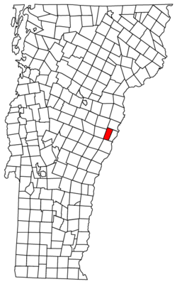 Located in Orange County, Vermont | |
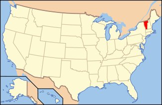 Location of Vermont with the U.S.A. | |
| Coordinates: 43°55′20″N 72°14′4″W / 43.92222°N 72.23444°WCoordinates: 43°55′20″N 72°14′4″W / 43.92222°N 72.23444°W | |
| Country | United States |
| State | Vermont |
| County | Orange |
| Chartered | 1797 |
| Area | |
| • Total | 22.8 sq mi (59.1 km2) |
| • Land | 22.6 sq mi (58.5 km2) |
| • Water | 0.2 sq mi (0.6 km2) |
| Elevation | 752 ft (223 m) |
| Population (2000) | |
| • Total | 726 |
| • Density | 32.1/sq mi (12.4/km2) |
| • Households | 278 |
| • Families | 197 |
| Time zone | EST (UTC-5) |
| • Summer (DST) | EDT (UTC-4) |
| ZIP code | 05083 |
| Area code(s) | 802 |
| FIPS code | 50-79975[1] |
| GNIS feature ID | 1462249[2] |
West Fairlee is a town in Orange County, Vermont, United States. The population was 726 at the 2000 census.
Geography
According to the United States Census Bureau, the town has a total area of 22.8 square miles (59.1 km2), of which 22.6 square miles (58.5 km2) is land and 0.2 square mile (0.6 km2) (0.96%) is water. The Ompompanoosuc River flows through the southwestern part of the town.[3]
Demographics
| Historical population | |||
|---|---|---|---|
| Census | Pop. | %± | |
| 1800 | 391 | — | |
| 1810 | 983 | 151.4% | |
| 1820 | 1,143 | 16.3% | |
| 1830 | 841 | −26.4% | |
| 1840 | 824 | −2.0% | |
| 1850 | 696 | −15.5% | |
| 1860 | 830 | 19.3% | |
| 1870 | 833 | 0.4% | |
| 1880 | 1,038 | 24.6% | |
| 1890 | 561 | −46.0% | |
| 1900 | 531 | −5.3% | |
| 1910 | 446 | −16.0% | |
| 1920 | 387 | −13.2% | |
| 1930 | 405 | 4.7% | |
| 1940 | 428 | 5.7% | |
| 1950 | 363 | −15.2% | |
| 1960 | 333 | −8.3% | |
| 1970 | 337 | 1.2% | |
| 1980 | 427 | 26.7% | |
| 1990 | 633 | 48.2% | |
| 2000 | 726 | 14.7% | |
| 2010 | 652 | −10.2% | |
| Est. 2014 | 657 | [4] | 0.8% |
| U.S. Decennial Census[5] | |||
As of the census[1] of 2000, there were 726 people, 278 households, and 197 families residing in the town. The population density was 32.1 people per square mile (12.4/km2). There were 340 housing units at an average density of 15.0 per square mile (5.8/km2). The racial makeup of the town was 98.76% White, 0.14% African American, 0.55% Native American, 0.41% Asian, 0.14% from other races.
There were 278 households out of which 36.3% had children under the age of 18 living with them, 56.8% were married couples living together, 7.9% had a female householder with no husband present, and 29.1% were non-families. 20.9% of all households were made up of individuals and 5.4% had someone living alone who was 65 years of age or older. The average household size was 2.61 and the average family size was 3.02.
In the town the population was spread out with 27.8% under the age of 18, 7.0% from 18 to 24, 32.4% from 25 to 44, 24.4% from 45 to 64, and 8.4% who were 65 years of age or older. The median age was 35 years. For every 100 females there were 102.8 males. For every 100 females age 18 and over, there were 100.0 males.
The median income for a household in the town was $40,667, and the median income for a family was $42,500. Males had a median income of $27,200 versus $22,788 for females. The per capita income for the town was $18,011. About 8.0% of families and 10.7% of the population were below the poverty line, including 16.1% of those under age 18 and 8.7% of those age 65 or over.
Notable people
- Asa L. Baldwin, Wisconsin state assemblyman
- Nathaniel Niles, US congressman
External links
References
- 1 2 "American FactFinder". United States Census Bureau. Retrieved 2008-01-31.
- ↑ "US Board on Geographic Names". United States Geological Survey. 2007-10-25. Retrieved 2008-01-31.
- ↑ DeLorme (1996). Vermont Atlas & Gazetteer. Yarmouth, Maine: DeLorme. ISBN 0-89933-016-9
- ↑ "Annual Estimates of the Resident Population for Incorporated Places: April 1, 2010 to July 1, 2014". Retrieved June 4, 2015.
- ↑ "U.S. Decennial Census". United States Census Bureau. Retrieved May 16, 2015.
Municipalities and communities of Orange County, Vermont, United States | ||
|---|---|---|
| Towns | 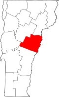 | |
| Villages | ||
| CDPs | ||
| Other communities | ||