Yellow Pine, Idaho
| Yellow Pine, Idaho | |
|---|---|
| unincorporated census-designated place | |
|
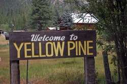
Sign seen when entering town | |
| Country | United States |
| State | Idaho |
| County | Valley |
| Area | |
| • Total | 0.995 sq mi (2.58 km2) |
| • Land | 0.984 sq mi (2.55 km2) |
| • Water | 0.011 sq mi (0.03 km2) |
| Population (2010) | |
| • Total | 32 |
| Time zone | Mountain (MST) (UTC-7) |
| • Summer (DST) | MDT (UTC-6) |
| ZIP code | 83677 |
| Area code(s) | 208 |
| GNIS feature ID | 0393748 |
Yellow Pine is an unincorporated census-designated place in Valley County, Idaho, United States. As of the 2010 census, its population was 32.[1] Yellow Pine has an area of 0.995 square miles (2.58 km2); 0.984 square miles (2.55 km2) of this is land, and 0.011 square miles (0.028 km2) is water.
Although unincorporated, the community has its own zip code, 83677, where overall 44 people live on a total land area of 174.269 square miles (451.35 km2), according to the 2010 Census.[2]

Yellow Pine is a 247-acre (1.00 km2) "inholder" community in eastern Valley Co., located on the East Fork of the South Fork of the Salmon River, approximately half a mile upstream from its confluence with Johnson Creek. It is bounded on the north by the Payette National Forest and on the south by the Boise National Forest. Located at 4,802 feet (1,464 m), Yellow Pine has historically served as the trade center for the larger Yellow Pine basin mining area, including Stibnite. Many of the early miner-settlers came from Warren.
In 1906 Albert Behne established the first post office and mail service. Behne had a dream. A grower of roses who loved classical music and opera, he envisioned a thriving city complete with street cars. In 1924 he received the patent on the 47½ acres where the village presently exists. In 1930, at the age of 76, he platted the original Yellow Pine townsite.
Other original patentees were Oscar Ray Call, Behne's former mining partner, and Henry Abstein. Abstein, the first patentee in the area, homesteaded 160 acres (0.65 km2) north and east of the present townsite. Although his primary interest was mining, he was also an active horticulturist and many of the apple trees that he planted are still living today. His original holdings have since been subdivided.
Yellow Pine is located 50 miles (80 km) east of McCall, via the Lick Creek road (open seasonally); 65 miles (105 km) from Cascade, via the Warm Lake and Johnson Creek Roads (open seasonally); and 70 miles (110 km) from Cascade via the Warm Lake and South Fork Roads (open year around).
It is home to the Yellow Pine Harmonica Festival, which is held the first weekend in August of each year and draws two to three thousand fans and musicians to the remote back-country of central Idaho where they enjoy music at the outdoor stage, auction of donated items, and vendor booths along the dirt street through the center of the village.It is located near Forest camp grounds, rivers and lakes. There are yearly snowmobile trips from Warm Lake to Yellow Pine with overnight accommodations.The Frank Church Wilderness Area about twenty miles away has excellent hiking areas. The community is surrounded by Unit 25 for Elk, deer, bear, and cougar hunting.
Climate
Yellow Pine has a dry-summer humid continental climate (Köppen Dsb).
| Climate data for Yellow Pine (1970-2007) | |||||||||||||
|---|---|---|---|---|---|---|---|---|---|---|---|---|---|
| Month | Jan | Feb | Mar | Apr | May | Jun | Jul | Aug | Sep | Oct | Nov | Dec | Year |
| Record high °F (°C) | 55 (13) |
63 (17) |
75 (24) |
85 (29) |
89 (32) |
92 (33) |
101 (38) |
96 (36) |
93 (34) |
83 (28) |
69 (21) |
51 (11) |
101 (38) |
| Average high °F (°C) | 33.3 (0.7) |
38.6 (3.7) |
45 (7) |
51.7 (10.9) |
61.3 (16.3) |
69.8 (21) |
80.2 (26.8) |
80.1 (26.7) |
70.1 (21.2) |
57.8 (14.3) |
40.1 (4.5) |
32.3 (0.2) |
55 (13) |
| Average low °F (°C) | 9.1 (−12.7) |
11.1 (−11.6) |
18.1 (−7.7) |
23.9 (−4.5) |
30.3 (−0.9) |
35.5 (1.9) |
39.3 (4.1) |
37.3 (2.9) |
30.5 (−0.8) |
24.7 (−4.1) |
18.2 (−7.7) |
9.6 (−12.4) |
24 (−4) |
| Record low °F (°C) | −35 (−37) |
−33 (−36) |
−20 (−29) |
−4 (−20) |
16 (−9) |
22 (−6) |
26 (−3) |
21 (−6) |
13 (−11) |
−5 (−21) |
−20 (−29) |
−33 (−36) |
−35 (−37) |
| Average precipitation inches (mm) | 3.22 (81.8) |
2.58 (65.5) |
2.4 (61) |
1.97 (50) |
2 (50) |
1.93 (49) |
1.05 (26.7) |
1.01 (25.7) |
1.57 (39.9) |
1.73 (43.9) |
3.48 (88.4) |
3.77 (95.8) |
26.71 (678.4) |
| Average snowfall inches (cm) | 24.8 (63) |
17.3 (43.9) |
11 (28) |
5.8 (14.7) |
0.9 (2.3) |
0.1 (0.3) |
0 (0) |
0 (0) |
0.1 (0.3) |
2.3 (5.8) |
16 (41) |
25.6 (65) |
103.9 (263.9) |
| Average precipitation days | 14 | 11 | 11 | 11 | 10 | 10 | 5 | 6 | 6 | 7 | 13 | 14 | 118 |
| Source: WRCC[3] | |||||||||||||
References
- ↑ "American FactFinder". U.S. Census Bureau. Retrieved 23 March 2011.
- ↑ zip-codes.com 83677
- ↑ "YELLOW PINE 7 S, ID (109951)". Western Regional Climate Center. Retrieved November 27, 2015.
Local histories
- Cox, Lafe & Emma. Idaho Mountains/Our Home, Life in the Idaho's Back County. VO Ranch Books, 1997.
- Sumner, Nancy. Yellow Pine, Idaho, (printed privately).
External links
Municipalities and communities of Valley County, Idaho, United States | ||
|---|---|---|
| Cities | ||
| CDPs | ||
| Unincorporated community | ||
Coordinates: 44°57′54″N 115°29′37″W / 44.96500°N 115.49361°W