Şiran
| Şiran | |
|---|---|
| District | |
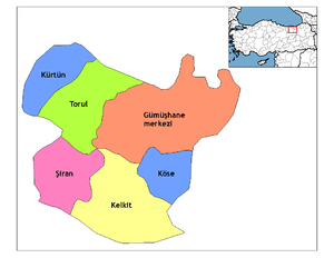 Location of Şiran within Turkey. | |
 Şiran Location of Şiran | |
| Coordinates: 40°11′N 39°08′E / 40.183°N 39.133°E | |
| Country |
|
| Region | Black Sea |
| Province | Gümüşhane |
| Government | |
| • Mayor | Yavuz Altıparmak (AKP) |
| Area[1] | |
| • District | 927.91 km2 (358.27 sq mi) |
| Elevation | 1,457 m (4,780 ft) |
| Population (2012)[2] | |
| • Urban | 9,483 |
| • District | 17,775 |
| • District density | 19/km2 (50/sq mi) |
| Time zone | EET (UTC+2) |
| • Summer (DST) | EEST (UTC+3) |
| Postal code | 29xxx |
| Area code(s) | 406 |
| Licence plate | 29 |
| Climate | Dsb |
| Website | www.siran.bel.tr |
Şiran, also Karaca, is a town and district of Gümüşhane Province in the Black Sea region of Turkey. It is one of the points of passage between Eastern Anatolia and Black Sea regions of Turkey, in the sense that the western road departing from Erzincan towards the Zigana Pass (the key pass between the two geographies) has its last urban stop in Şiran. According to the 2010 census, population of the district is 17,600 of which 8,207 live in the town of Şiran.[3] The district covers an area of 928 km2 (358 sq mi),[4] and the town lies at an elevation of 1,457 m (4,780 ft).
Name
The name comes from Persian and means "the lions", although it is most likely to be an adaptation of the former Greek name of Cheriana (Χερίανα) adopted after the Turkish settlement in the region after and possibly even slightly before the Battle of Manzikert.
History
Many of the northern villages of the district was home to minority populations of Pontic Greeks until the 1922 Exchange of Greek and Turkish Populations, constituting the southern fringes of that community's extension. Some among the present population can also trace their roots to Greeks who had converted to Islam until as late as the end of the 19th century, as indicated by the Ottoman census and changed village names (for example, the present village of "Evren" was formerly called "Sefker").
Places to see
- Tomara Şelalesi = Tomara waterfalls
- Yukarıkulaca Alabalık Tesisleri = Yukarıkulaca Trout Plant
References
- ↑ "Area of regions (including lakes), km²". Regional Statistics Database. Turkish Statistical Institute. 2002. Retrieved 2013-03-05.
- ↑ "Population of province/district centers and towns/villages by districts - 2012". Address Based Population Registration System (ABPRS) Database. Turkish Statistical Institute. Retrieved 2013-02-27.
- ↑ Statistical Institute
- ↑ Statoids. "Statistical information on districts of Turkey". Archived from the original on 2010-05-26. Retrieved 2008-12-04.
External links
![]() Media related to Gümüşhane Province at Wikimedia Commons
Media related to Gümüşhane Province at Wikimedia Commons
- District governor's official website (Turkish)
- Road map of Şiran and environs
- Local city forum website (Turkish)
Coordinates: 40°11′22″N 39°07′36″E / 40.18944°N 39.12667°E