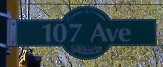
107 Avenue, Edmonton

107 Avenue
Avenue of Nations, 107A Avenue, Stadium Road
Maintained by the City of Edmonton
Length 12.2 km (7.6 mi)
Location Edmonton
Jasper Place
West end Poundmaker Industrial
(0.4 km (0.25 mi) west of 186 Street)
Major
junctions
184 Street, 170 Street, Mayfield Road, 156 Street, 142 Street, Groat Road, 124 Street, 109 Street, 97 Street, 112 Avenue
East end 112 Avenue / 86 Street (Fort Road)

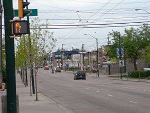
107 Avenue is a major arterial road in west-central Edmonton, Alberta, Canada. It serves Edmonton's west side industrial distract, the old town of Jasper Place, the multicultural area north of Downtown Edmonton, Commonwealth Stadium, and adjacent park & ride transit centre. The portion between 95 and 116 Streets has been dubbed "Avenue of Nations", as immigrants from around the world live in this area, including African Nations, Arabic Nations, Cambodia, China, First Nations, Italy, Japan, Latin American, Poland, Ukraine, and Vietnam.[1] Also, Chinatown lies just south of Avenue of Nations. 107 Avenue changes names at 101 Street to 107A Avenue. 107A Avenue changes names at 92 Street to Stadium Road. Stadium Road changes names at 112 Avenue to 86 Street (Fort Road).

Neighbourhoods

107 Avenue in the neighbourhood of Queen Mary Park (May 2008).

List of neighbourhoods 107 Avenue runs through, in order from west to east.[2]

Interchanges and intersections

This is a list of major intersections, starting at the west end of 107 Avenue.[2]

Direction Intersecting road Current intersection type Coordinates
West-East 186 Street At-grade 53°33′12″N 113°38′38″W / 53.55333°N 113.64389°W / 53.55333; -113.64389 (107 x 186)
184 Street At-grade (traffic lights) 53°33′12″N 113°38′23″W / 53.55333°N 113.63972°W / 53.55333; -113.63972 (107 x 184)
178 Street At-grade (traffic lights) 53°33′12″N 113°37′39″W / 53.55333°N 113.62750°W / 53.55333; -113.62750 (107 x 178)
170 Street At-grade (traffic lights) 53°33′12″N 113°36′55″W / 53.55333°N 113.61528°W / 53.55333; -113.61528 (107 x 170)
Mayfield Road At-grade (traffic lights) 53°33′7″N 113°36′30″W / 53.55194°N 113.60833°W / 53.55194; -113.60833 (107 x Mayfield)
163 Street At-grade (traffic lights) 53°33′5″N 113°36′10″W / 53.55139°N 113.60278°W / 53.55139; -113.60278 (107 x 163)
156 Street At-grade (traffic lights) 53°33′4″N 113°35′25″W / 53.55111°N 113.59028°W / 53.55111; -113.59028 (107 x 156)
149 Street At-grade (traffic lights) 53°33′4″N 113°34′41″W / 53.55111°N 113.57806°W / 53.55111; -113.57806 (107 x 149)
142 Street Roundabout 53°33′4″N 113°33′57″W / 53.55111°N 113.56583°W / 53.55111; -113.56583 (107 x 142)
Groat Road Diamond interchange 53°33′3″N 113°32′59″W / 53.55083°N 113.54972°W / 53.55083; -113.54972 (107 x Groat)
124 Street At-grade (traffic lights) 53°33′3″N 113°32′9″W / 53.55083°N 113.53583°W / 53.55083; -113.53583 (107 x 124)
116/117 Street Diamond interchange at-grade 53°33′5″N 113°31′20″W / 53.55139°N 113.52222°W / 53.55139; -113.52222 (107 x 116)
109 Street At-grade (traffic lights) 53°33′5″N 113°30′30″W / 53.55139°N 113.50833°W / 53.55139; -113.50833 (107 x 109)
105 Street At-grade (traffic lights) 53°33′5″N 113°30′4″W / 53.55139°N 113.50111°W / 53.55139; -113.50111 (107 x 105)
101 Street At-grade (traffic lights) 53°33′5″N 113°29′37″W / 53.55139°N 113.49361°W / 53.55139; -113.49361 (107A x 101)
Southwest-Northeast 97 Street At-grade (traffic lights) 53°33′10″N 113°29′23″W / 53.55278°N 113.48972°W / 53.55278; -113.48972 (107A x 97)
West-East 95 Street At-grade (traffic lights) 53°33′14″N 113°29′1″W / 53.55389°N 113.48361°W / 53.55389; -113.48361 (107A x 95)
92 Street At-grade 53°33′17″N 113°28′45″W / 53.55472°N 113.47917°W / 53.55472; -113.47917 (Stadium x 92)
South-North 112 Avenue At-grade (traffic lights) 53°33′40″N 113°28′24″W / 53.56111°N 113.47333°W / 53.56111; -113.47333 (Stadium x 112)

References

  1. The Edmonton Journal. "Avenue of Nations a crossroad of many cultures". Archived from the original on 2009-05-29. Retrieved 2009-05-27.
  2. 1 2 "City of Edmonton map utility". Archived from the original on 2009-06-25. Retrieved 2009-06-23.


This article is issued from Wikipedia - version of the 9/8/2016. The text is available under the Creative Commons Attribution/Share Alike but additional terms may apply for the media files.