Alberta Highway 628

Highway 628
Whitemud Drive
Route information
Maintained by Alberta Transportation
West section
Length: 19 km (12 mi)
West end: Hwy 779 in Stony Plain
Major
junctions:
Hwy 60 in Stony Plain 135
East end: Edmonton City Limits
East section
Length: 6 km (4 mi)
West end: Hwy 14 / Hwy 216 south of Sherwood Park
East end: Hwy 21 south of Sherwood Park
Location
Specialized
and rural
municipalities:
Parkland County, Strathcona County
Major cities: Stony Plain 135, Edmonton
Highway system

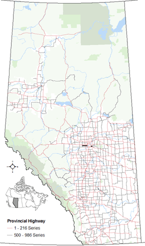
Provincial highways in Alberta

Hwy 627Hwy 629

Alberta Provincial Highway No. 628[1] is a highway in the province of Alberta, Canada. It runs west-east through the Edmonton Capital Region in two sections. The first 19 km section runs from the town of Stony Plain to the Edmonton city limits at 231 Street (Range Road 261). The second 6 km section runs from Highway 216 (Anthony Henday Drive) to Highway 21 just south of Sherwood Park, here it is also known as a Whitemud Extension. It continues further past Half Moon Lake to Wye Road (Highway 630) near North Cooking Lake.

Whitemud Drive (79 Avenue west of Winterburn Road) connects both sections directly through Edmonton city limits, though it is not signed as Highway 628. It is also known as 79 Avenue in Stony Plain.

Km by km description

Starting from the west end of Highway 628:

County km Intersecting road Notes Coordinates
Parkland County -8.1 Range Road 15 As Township Road 524
Spring Lake
53°30′43″N 114°7′28″W / 53.51194°N 114.12444°W / 53.51194; -114.12444 (628 km -8)
0.0 Hwy 779, Range Road 10 Stony Plain 53°30′44″N 114°0′7″W / 53.51222°N 114.00194°W / 53.51222; -114.00194 (628 km 00)
6 Range Road 273 (Golden Spike Road) North to Spruce Grove 53°30′43″N 113°54′36″W / 53.51194°N 113.91000°W / 53.51194; -113.91000 (628 km 06)
15 Hwy 60, Range Road 263 North to Acheson & Hwy 16
South to Stony Plain 135 & Devon
53°30′45″N 113°45′45″W / 53.51250°N 113.76250°W / 53.51250; -113.76250 (628 km 15)
City of Edmonton 19 Range Road 261, 231 Street End of Highway 628 53°30′44″N 113°42′48″W / 53.51222°N 113.71333°W / 53.51222; -113.71333 (628 km 19)
22 Hwy 216, Anthony Henday Drive Grade separated
As Whitemud Drive
Begin 2 south concurrency
53°30′44″N 113°39′33″W / 53.51222°N 113.65917°W / 53.51222; -113.65917 (628 km 22)
37 Hwy 2, Calgary Trail, Gateway Boulevard Grade separated
End 2 south concurrency
Begin 14 east concurrency
53°28′49″N 113°29′37″W / 53.48028°N 113.49361°W / 53.48028; -113.49361 (628 km 37)
Strathcona County 47 Hwy 216, Anthony Henday Drive, Range Road 234 Grade separated
End 14 east concurrency
Start of Highway 628
53°28′58″N 113°20′34″W / 53.48278°N 113.34278°W / 53.48278; -113.34278 (628 km 47)
53 Hwy 21, Range Road 230 End of Highway 628
North to Sherwood Park
53°28′58″N 113°14′45″W / 53.48278°N 113.24583°W / 53.48278; -113.24583 (628 km 53)
65 Range Road 215 As Township Road 552
South to Half Moon Lake
53°28′59″N 113°4′28″W / 53.48306°N 113.07444°W / 53.48306; -113.07444 (628 km 65)
71 Hwy 630 North Cooking Lake 53°29′0″N 112°59′44″W / 53.48333°N 112.99556°W / 53.48333; -112.99556 (628 km 71)

References

  1. Provincial Highways Designation Order, Alberta Transportation, p. 20


This article is issued from Wikipedia - version of the 10/28/2016. The text is available under the Creative Commons Attribution/Share Alike but additional terms may apply for the media files.