109th meridian west

109°
109th meridian west

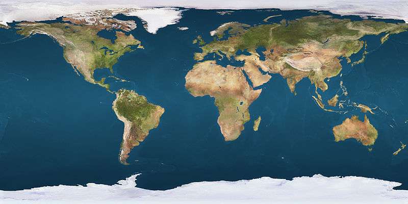
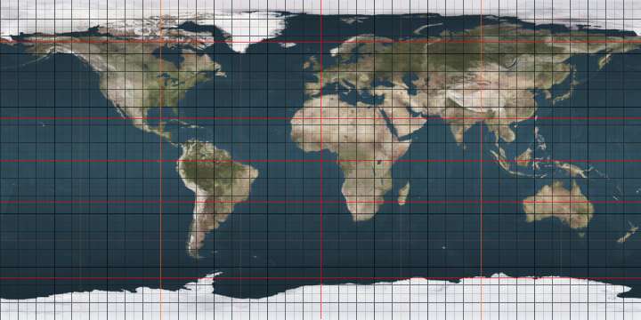
The meridian 109° west of Greenwich is a line of longitude that extends from the North Pole across the Arctic Ocean, North America, the Pacific Ocean, the Southern Ocean, and Antarctica to the South Pole.

The 109th meridian west forms a great circle with the 71st meridian east.

In the United States, the western boundaries of Colorado and New Mexico and the eastern boundaries of Utah and Arizona lie on the 32nd meridian west from Washington, which is approximately 3 minutes of longitude west of the 109th meridian west of Greenwich, or approximately 2.5 miles or 4.0 km.

From Pole to Pole

Starting at the North Pole and heading south to the South Pole, the 109th meridian west passes through:

Co-ordinates Country, territory or sea Notes
90°0′N 109°0′W / 90.000°N 109.000°W / 90.000; -109.000 (Arctic Ocean) Arctic Ocean Passing just east of Borden Island, Nunavut,  Canada (at 78°28′N 109°13′W / 78.467°N 109.217°W / 78.467; -109.217 (Borden Island))
Passing just east of Vesey Hamilton Island, Nunavut,  Canada (at 76°54′N 109°2′W / 76.900°N 109.033°W / 76.900; -109.033 (Vesey Hamilton Island))
76°49′N 109°0′W / 76.817°N 109.000°W / 76.817; -109.000 (Canada)  Canada NunavutMelville Island
75°53′N 109°0′W / 75.883°N 109.000°W / 75.883; -109.000 (Sabine Bay) Sabine Bay
75°29′N 109°0′W / 75.483°N 109.000°W / 75.483; -109.000 (Canada)  Canada NunavutMelville Island
74°59′N 109°0′W / 74.983°N 109.000°W / 74.983; -109.000 (Parry Channel) Parry Channel Viscount Melville Sound
72°46′N 109°0′W / 72.767°N 109.000°W / 72.767; -109.000 (Canada)  Canada NunavutVictoria Island
68°44′N 109°0′W / 68.733°N 109.000°W / 68.733; -109.000 (Dease Strait) Dease Strait
68°19′N 109°0′W / 68.317°N 109.000°W / 68.317; -109.000 (Bathurst Inlet) Bathurst Inlet
68°0′N 109°0′W / 68.000°N 109.000°W / 68.000; -109.000 (Canada)  Canada NunavutLewes Island, the Stockport Islands and the mainland
Northwest Territories — from 64°48′N 109°13′W / 64.800°N 109.217°W / 64.800; -109.217 (Northwest Territories), passing through the Great Slave Lake
Saskatchewan — from 60°0′N 109°13′W / 60.000°N 109.217°W / 60.000; -109.217 (Saskatchewan), passing through Lake Athabasca
49°0′N 109°0′W / 49.000°N 109.000°W / 49.000; -109.000 (United States)  United States Montana
Wyoming — from 45°0′N 109°13′W / 45.000°N 109.217°W / 45.000; -109.217 (Wyoming)
Colorado — from 41°0′N 109°13′W / 41.000°N 109.217°W / 41.000; -109.217 (Colorado)
New Mexico — from 37°0′N 109°13′W / 37.000°N 109.217°W / 37.000; -109.217 (New Mexico)
31°20′N 109°0′W / 31.333°N 109.000°W / 31.333; -109.000 (Mexico)  Mexico Sonora
Sonora / Chihuahua border — from 28°17′N 109°13′W / 28.283°N 109.217°W / 28.283; -109.217 (Sonora/Chuhuahua border)
Sonora — from 28°0′N 109°13′W / 28.000°N 109.217°W / 28.000; -109.217 (Sonora)
Sinaloa — from 26°26′N 109°13′W / 26.433°N 109.217°W / 26.433; -109.217 (Sinaloa), passing through Los Mochis
25°26′N 109°0′W / 25.433°N 109.000°W / 25.433; -109.000 (Pacific Ocean) Pacific Ocean Passing just east of Clipperton Island (an overseas possession of  France, at 10°17′N 109°12′W / 10.283°N 109.200°W / 10.283; -109.200 (Clipperton Island))
Passing just east of Easter Island,  Chile (at 27°6′S 109°14′W / 27.100°S 109.233°W / -27.100; -109.233 (Clipperton Island))
60°0′S 109°0′W / 60.000°S 109.000°W / -60.000; -109.000 (Southern Ocean) Southern Ocean
73°29′S 109°0′W / 73.483°S 109.000°W / -73.483; -109.000 (Antarctica) Antarctica Unclaimed territory

See also

This article is issued from Wikipedia - version of the 12/19/2014. The text is available under the Creative Commons Attribution/Share Alike but additional terms may apply for the media files.