A50 motorway (Netherlands)
| ||||
|---|---|---|---|---|
| Rijksweg 50 | ||||
|
Motorways in the Netherlands with A50 and N50 bolt | ||||
| Route information | ||||
|
Part of | ||||
| Maintained by Rijkswaterstaat[1] | ||||
| Major junctions | ||||
| South end: |
| |||
| North end: |
| |||
| Location | ||||
| Provinces: | North Brabant, Gelderland | |||
| Highway system | ||||
| ||||

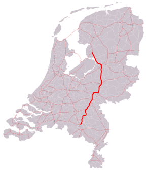
A50, the section of Rijksweg 50 that is constructed as controlled-access highway, is a north–south motorway in the Netherlands, running from Eindhoven in the province of North Brabant, northwards passing by the cities of Oss, Nijmegen, Arnhem and Apeldoorn, to its northern terminus in the province of Gelderland near the city of Zwolle.
The highway is maintained by Rijkswaterstaat.[1]
Route description
It passes the cities of Eindhoven, Den Bosch, Oss, Nijmegen, Arnhem, Apeldoorn and Zwolle.
History
During the Second World War the Highway was known as Highway 69. Since 1969 it is known as N69, and now remains so named only between the border of Noord-Brabant province and the E34 Freeway.
The highway was an important and only avenue of advance during Operation Market Garden, and after the fighting along its length between Allied and Wehrmacht forces it was named "Hell's Highway"[2] so named because of the effective artillery fire directed at it by the German forces in the area.[3] During the fighting some 16 kilometres (9.9 mi) of the highway south of Eindhoven was jammed with wrecks of vehicles being attacked by up to 200 Luftwaffe bombers[4] requiring bulldozers and blade-equipped tanks to roam the length, pushing them off the surface to keep traffic moving. The wrecks on the soft shoulders of the highway prevented its use by other vehicles,[5] in effect converting the highway into a narrow corridor, and slowing the movement on it to a crawl for the Allied drivers.
The fighting along N69 is depicted in a recent computer game Brothers in Arms: Hell's Highway.
Exit list
| Province | Municipality | km | mi | Exit | Destinations | Notes |
|---|---|---|---|---|---|---|
| North Brabant | Eindhoven | 0.000 | 0.000 | — | ||
| 6 | Ekkersrijt | |||||
| Son en Beugel | 7 | John F. Kennedylaan | ||||
| 8 | ||||||
| Sonse Heide rest area Southbound exit and entrance | ||||||
| Sint-Oedenrode | 9 | |||||
| Veghel | 10 | |||||
| Zuid-Willemsvaart | Julian J. Ewellbrug | |||||
| North Brabant | Veghel | 11 | ||||
| 12 | Driehuizen / Udenseweg | |||||
| Uden | 13 | |||||
| 14 | Rondweg / Looweg | |||||
| Bernheze | 15 | |||||
| 16 | ||||||
| Oss | — | |||||
| Ganzenven rest area southbound De Gagel rest area northbound | ||||||
| 17 | ||||||
| Meuse | Maasbrug Ravenstein | |||||
| Gelderland | Wijchen | — | ||||
| Beuningen | — | Southern end of E 31 concurrency | ||||
| Waal | Tracitusbrug | |||||
| Gelderland | Overbetuwe | — | Northern end of E 31 concurrency | |||
| Weerbroek rest area southbound Meilanden rest area northbound | ||||||
| 18 | ||||||
| Nederrijn | Rijnbrug Heteren | |||||
| Gelderland | Renkum | 19 | ||||
| Arnhem | De Slenk rest area Northbound exit and entrance | |||||
| — | Western end of A12 / E 35 concurrency | |||||
| De Schaars rest area Westbound exit and entrance | ||||||
| — | Eastern end of A12 / E 35 concurrency | |||||
| 20 | ||||||
| 21 | ||||||
| North and southbound rest area Transit buses and vehicle breakdown only | ||||||
| Apeldoorn | North and southbound rest area Transit buses and vehicle breakdown only | |||||
| North and southbound rest area Transit buses and vehicle breakdown only | ||||||
| 22 | ||||||
| 23 | ||||||
| De Brink rest area southbound De Somp rest area northbound | ||||||
| — | ||||||
| 24 | ||||||
| 25 | Oost Veluweweg | |||||
| Epe | 26 | |||||
| 27 | ||||||
| Heerde | 28 | |||||
| Het Veen rest area southbound Kolthoorn rest area northbound | ||||||
| 29 | Kamperweg | |||||
| Hattem | 30 | Hessenweg / Keizersweg | ||||
| — | ||||||
1.000 mi = 1.609 km; 1.000 km = 0.621 mi
| ||||||
See also
- List of motorways in the Netherlands
- List of E-roads in the Netherlands
 Netherlands portal
 Roads portal
References
Footnotes
Works cited
- Koskimaki, George E., Hell's highway: chronicle of the 101st Airborne Division in the Holland Campaign, September - November 1944, Casemate, Havertown, 2003
- Ambrose, Stephen E., Citizen Soldiers: The U. S. Army from the Normandy Beaches to the Bulge to the Surrender of Germany, Part One, Chapter 4, Touchstone, New York, 1997
External links
![]() Media related to A50 motorway (Netherlands) at Wikimedia Commons
Media related to A50 motorway (Netherlands) at Wikimedia Commons
Coordinates: 51°58′12″N 5°46′4″E / 51.97000°N 5.76778°E