Ardres
| Ardres | ||
|---|---|---|
|
Lakes north of Ardres | ||
| ||
 Ardres | ||
|
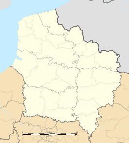
Location within Hauts-de-France region  Ardres | ||
| Coordinates: 50°51′20″N 1°58′42″E / 50.8556°N 1.9783°ECoordinates: 50°51′20″N 1°58′42″E / 50.8556°N 1.9783°E | ||
| Country | France | |
| Region | Hauts-de-France | |
| Department | Pas-de-Calais | |
| Arrondissement | Saint-Omer | |
| Canton | Ardres | |
| Area1 | 13.52 km2 (5.22 sq mi) | |
| Population (2009)2 | 4,213 | |
| • Density | 310/km2 (810/sq mi) | |
| Time zone | CET (UTC+1) | |
| • Summer (DST) | CEST (UTC+2) | |
| INSEE/Postal code | 62038 / 62610 | |
| Elevation |
2–17 m (6.6–55.8 ft) (avg. 11 m or 36 ft) | |
|
1 French Land Register data, which excludes lakes, ponds, glaciers > 1 km² (0.386 sq mi or 247 acres) and river estuaries. 2 Population without double counting: residents of multiple communes (e.g., students and military personnel) only counted once. | ||
Ardres is a commune in the Pas-de-Calais department in northern France.
Geography
Ardres is located 10.1 mi by rail (station is at Pont-d'Ardres, a few km from Ardres) S.S.E. of Calais, with which it is also connected by a canal (very limited turning space). It is one of three towns known as the Les Trois Pays ("the Three Countries"), the other two being Guînes and Licques.
History
Ardes, the first town in the French king's land, has a rich and vibrant history as a military and trading post for the English from 1347 to 1558.
The "Field of the Cloth of Gold", where Henry VIII of England and Francis I of France met in 1520, was at Balinghem in the immediate neighbourhood. The town is an important market for cattle.
Population
The inhabitants are called Ardrésiens.
| Historical population | ||
|---|---|---|
| Year | Pop. | ±% |
| 1793 | 1,596 | — |
| 1800 | 1,466 | −8.1% |
| 1806 | 1,645 | +12.2% |
| 1821 | 1,844 | +12.1% |
| 1831 | 2,016 | +9.3% |
| 1836 | 2,150 | +6.6% |
| 1841 | 2,195 | +2.1% |
| 1846 | 2,112 | −3.8% |
| 1851 | 2,071 | −1.9% |
| 1856 | 2,031 | −1.9% |
| 1861 | 2,277 | +12.1% |
| 1866 | 2,189 | −3.9% |
| 1872 | 2,143 | −2.1% |
| 1876 | 2,223 | +3.7% |
| 1881 | 2,293 | +3.1% |
| 1886 | 2,274 | −0.8% |
| 1891 | 2,473 | +8.8% |
| 1896 | 2,522 | +2.0% |
| 1901 | 2,597 | +3.0% |
| 1906 | 2,717 | +4.6% |
| 1911 | 2,785 | +2.5% |
| 1921 | 2,839 | +1.9% |
| 1926 | 2,708 | −4.6% |
| 1931 | 2,625 | −3.1% |
| 1936 | 2,719 | +3.6% |
| 1946 | 2,901 | +6.7% |
| 1954 | 2,939 | +1.3% |
| 1962 | 2,997 | +2.0% |
| 1968 | 3,195 | +6.6% |
| 1975 | 3,126 | −2.2% |
| 1982 | 3,390 | +8.4% |
| 1990 | 3,936 | +16.1% |
| 1999 | 4,153 | +5.5% |
| 2006 | 4,191 | +0.9% |
| 2009 | 4,213 | +0.5% |
Sights
Major tourist attractions at Ardres include the Chapelle des Carmes and the Eglise Notre Dame de Grâce.
There are also some lakes (created when peat was removed) which provide fishing and sailing.
Personalities
- Jean-Marie Dorsenne (1773–1812), a French military commander of the Revolutionary and Napoleonic Wars, was born in Ardres
See also
References
- INSEE commune file
 This article incorporates text from a publication now in the public domain: Chisholm, Hugh, ed. (1911). "Ardres". Encyclopædia Britannica (11th ed.). Cambridge University Press.
| Wikimedia Commons has media related to Ardres. |

.svg.png)