Rivière, Pas-de-Calais
| Rivière | ||
|---|---|---|
 | ||
| ||
 Rivière | ||
|
Location within Hauts-de-France region  Rivière | ||
| Coordinates: 50°14′00″N 2°41′25″E / 50.2333°N 2.6903°ECoordinates: 50°14′00″N 2°41′25″E / 50.2333°N 2.6903°E | ||
| Country | France | |
| Region | Hauts-de-France | |
| Department | Pas-de-Calais | |
| Arrondissement | Arras | |
| Canton | Beaumetz-lès-Loges | |
| Intercommunality | Vertes vallées | |
| Government | ||
| • Mayor (2008–2014) | Jean-Claude Desailly | |
| Area1 | 11.9 km2 (4.6 sq mi) | |
| Population (2006)2 | 1,151 | |
| • Density | 97/km2 (250/sq mi) | |
| Time zone | CET (UTC+1) | |
| • Summer (DST) | CEST (UTC+2) | |
| INSEE/Postal code | 62712 / 62173 | |
| Elevation |
75–131 m (246–430 ft) (avg. 107 m or 351 ft) | |
|
1 French Land Register data, which excludes lakes, ponds, glaciers > 1 km² (0.386 sq mi or 247 acres) and river estuaries. 2 Population without double counting: residents of multiple communes (e.g., students and military personnel) only counted once. | ||

Rivière is a commune in the Pas-de-Calais department in the Hauts-de-France region of France.
Geography
Rivière is a farming and light industrial village 6 miles (10 km) southwest of Arras, at the junction of the D7, D30 and D34 roads.
History
The five hamlets of Bellacourt, Bellacordelle, Brétencourt, Grosville and Le Fermont became the commune of Rivière in 1789.
Population
The inhabitants are called Riviérois.
| 1962 | 1968 | 1975 | 1982 | 1990 | 1999 | 2006 |
|---|---|---|---|---|---|---|
| 934 | 963 | 963 | 1102 | 1142 | 1122 | 1151 |
| Census count starting from 1962: Population without duplicates | ||||||
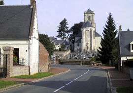
Places of interest
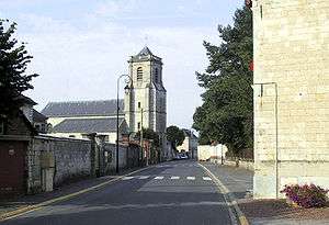
The church
- The church of St.Vaast, dating from the eighteenth century.
- The eighteenth-century château de Grosville and its parkland.
- Traces of a 13th-century castle at Brétencourt.
- The Commonwealth War Graves Commission cemeteries.
See also
References
External links
| Wikimedia Commons has media related to Rivière (Pas-de-Calais). |
- The CWGC cemetery at Bellacourt
- The CWGC cemetery at Le Fremont
- Official website of the commune of Rivière (French)
- Rivière on the Quid website (French)
This article is issued from Wikipedia - version of the 11/8/2016. The text is available under the Creative Commons Attribution/Share Alike but additional terms may apply for the media files.