Haisnes
| Haisnes | ||
|---|---|---|
|
Town hall | ||
| ||
 Haisnes | ||
|
Location within Hauts-de-France region  Haisnes | ||
| Coordinates: 50°30′31″N 2°48′09″E / 50.5086°N 2.8025°ECoordinates: 50°30′31″N 2°48′09″E / 50.5086°N 2.8025°E | ||
| Country | France | |
| Region | Hauts-de-France | |
| Department | Pas-de-Calais | |
| Arrondissement | Béthune | |
| Canton | Douvrin | |
| Intercommunality | Artois | |
| Government | ||
| • Mayor (2008–2014) | Frederic Wallet | |
| Area1 | 5.58 km2 (2.15 sq mi) | |
| Population (1999)2 | 4,357 | |
| • Density | 780/km2 (2,000/sq mi) | |
| Time zone | CET (UTC+1) | |
| • Summer (DST) | CEST (UTC+2) | |
| INSEE/Postal code | 62401 / 62138 | |
| Elevation |
22–47 m (72–154 ft) (avg. 26 m or 85 ft) | |
|
1 French Land Register data, which excludes lakes, ponds, glaciers > 1 km² (0.386 sq mi or 247 acres) and river estuaries. 2 Population without double counting: residents of multiple communes (e.g., students and military personnel) only counted once. | ||


Haisnes is a commune in the Pas-de-Calais department in the Hauts-de-France region of France.
Geography
Haisnes is a former coalmining town, now a light industrial and farming commune, situated some 9 miles (14.5 km) east of Béthune and 16 miles (25.7 km) southwest of Lille, at the junction of the D163 and the D947 roads.
Population
| Year | 1962 | 1968 | 1975 | 1982 | 1990 | 1999 |
|---|---|---|---|---|---|---|
| Population | 2696 | 2709 | 3106 | 3970 | 4525 | 4357 |
| From the year 1962 on: No double counting—residents of multiple communes (e.g. students and military personnel) are counted only once. | ||||||
Places of interest
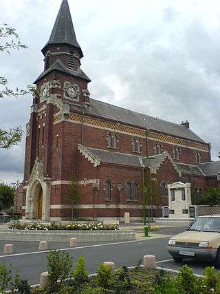
St.Nicaise church
- The churches of St.Nicaise and St.Elie, both dating from the twentieth century.
- The Commonwealth War Graves Commission cemeteries.
See also
References
External links
| Wikimedia Commons has media related to Haisnes. |
- Official website of Haisnes (French)
- St.Mary’s CWGC cemetery
- Bois-Carré CWGC cemetery
- Haisnes on the Quid website (French)
This article is issued from Wikipedia - version of the 11/6/2016. The text is available under the Creative Commons Attribution/Share Alike but additional terms may apply for the media files.