Avoca, Wisconsin
| Avoca, Wisconsin | |
|---|---|
| Village | |
 Location of Avoca, Wisconsin | |
| Coordinates: 43°11′2″N 90°19′31″W / 43.18389°N 90.32528°WCoordinates: 43°11′2″N 90°19′31″W / 43.18389°N 90.32528°W | |
| Country | United States |
| State | Wisconsin |
| County | Iowa |
| Area[1] | |
| • Total | 2.44 sq mi (6.32 km2) |
| • Land | 2.31 sq mi (5.98 km2) |
| • Water | 0.13 sq mi (0.34 km2) |
| Elevation[2] | 699 ft (213 m) |
| Population (2010)[3] | |
| • Total | 637 |
| • Estimate (2012[4]) | 636 |
| • Density | 275.8/sq mi (106.5/km2) |
| Time zone | Central (CST) (UTC-6) |
| • Summer (DST) | CDT (UTC-5) |
| Area code(s) | 608 |
| FIPS code | 55-04025[5] |
| GNIS feature ID | 1561035[2] |
| Website | http://www.villageofavoca.com |
Avoca is a village in Iowa County, Wisconsin, United States. The population was 637 at the 2010 census. It is part of the Madison Metropolitan Statistical Area. It is named after Avoca in Ireland.
Geography
Avoca is located at 43°11′2″N 90°19′31″W / 43.18389°N 90.32528°W (43.183853, -90.325388).[6]
According to the United States Census Bureau, the village has a total area of 2.44 square miles (6.32 km2), of which, 2.31 square miles (5.98 km2) of it is land and 0.13 square miles (0.34 km2) is water.[1]
Demographics
| Historical population | |||
|---|---|---|---|
| Census | Pop. | %± | |
| 1870 | 418 | — | |
| 1880 | 362 | −13.4% | |
| 1890 | 278 | −23.2% | |
| 1900 | 406 | 46.0% | |
| 1910 | 436 | 7.4% | |
| 1920 | 432 | −0.9% | |
| 1930 | 342 | −20.8% | |
| 1940 | 417 | 21.9% | |
| 1950 | 424 | 1.7% | |
| 1960 | 363 | −14.4% | |
| 1970 | 421 | 16.0% | |
| 1980 | 505 | 20.0% | |
| 1990 | 474 | −6.1% | |
| 2000 | 608 | 28.3% | |
| 2010 | 637 | 4.8% | |
| Est. 2015 | 627 | [7] | −1.6% |
2010 census
As of the census[3] of 2010, there were 637 people, 261 households, and 169 families residing in the village. The population density was 275.8 inhabitants per square mile (106.5/km2). There were 347 housing units at an average density of 150.2 per square mile (58.0/km2). The racial makeup of the village was 96.4% White, 0.3% African American, 1.7% Asian, 0.5% from other races, and 1.1% from two or more races. Hispanic or Latino of any race were 1.9% of the population.
There were 261 households of which 32.6% had children under the age of 18 living with them, 48.7% were married couples living together, 10.0% had a female householder with no husband present, 6.1% had a male householder with no wife present, and 35.2% were non-families. 28.4% of all households were made up of individuals and 11.8% had someone living alone who was 65 years of age or older. The average household size was 2.42 and the average family size was 2.95.
The median age in the village was 39.4 years. 24.8% of residents were under the age of 18; 6.5% were between the ages of 18 and 24; 26.8% were from 25 to 44; 25.5% were from 45 to 64; and 16.6% were 65 years of age or older. The gender makeup of the village was 50.5% male and 49.5% female.
2000 census
As of the census[5] of 2000, there were 608 people, 257 households, and 159 families residing in the village. The population density was 267.8 people per square mile (103.4/km²). There were 328 housing units at an average density of 144.5 per square mile (55.8/km²). The racial makeup of the village was 98.19% White, 0.16% Native American, 1.15% Asian, 0.16% from other races, and 0.33% from two or more races. Hispanic or Latino of any race were 0.49% of the population.
There were 257 households out of which 29.2% had children under the age of 18 living with them, 43.2% were married couples living together, 13.2% had a female householder with no husband present, and 38.1% were non-families. 32.3% of all households were made up of individuals and 15.6% had someone living alone who was 65 years of age or older. The average household size was 2.37 and the average family size was 2.99.
In the village the population was spread out with 25.2% under the age of 18, 7.9% from 18 to 24, 27.6% from 25 to 44, 22.5% from 45 to 64, and 16.8% who were 65 years of age or older. The median age was 37 years. For every 100 females there were 93.6 males. For every 100 females age 18 and over, there were 92.8 males.
The median income for a household in the village was $28,625, and the median income for a family was $31,786. Males had a median income of $25,795 versus $21,750 for females. The per capita income for the village was $16,758. About 12.2% of families and 17.3% of the population were below the poverty line, including 23.9% of those under age 18 and 14.6% of those age 65 or over.
Media
- Voice of the River Valley magazine, a guide to people and events that inspire, inform and enrich life in the Lower Wisconsin and Sugar-Pecatonica River Basins
References
- 1 2 "US Gazetteer files 2010". United States Census Bureau. Archived from the original on 2012-01-24. Retrieved 2012-11-18.
- 1 2 "US Board on Geographic Names". United States Geological Survey. 2007-10-25. Retrieved 2008-01-31.
- 1 2 "American FactFinder". United States Census Bureau. Retrieved 2012-11-18.
- ↑ "Population Estimates". United States Census Bureau. Archived from the original on 2013-06-17. Retrieved 2013-06-24.
- 1 2 "American FactFinder". United States Census Bureau. Archived from the original on 2013-09-11. Retrieved 2008-01-31.
- ↑ "US Gazetteer files: 2010, 2000, and 1990". United States Census Bureau. 2011-02-12. Retrieved 2011-04-23.
- ↑ "Annual Estimates of the Resident Population for Incorporated Places: April 1, 2010 to July 1, 2015". Retrieved July 2, 2016.
- ↑ "Census of Population and Housing". Census.gov. Archived from the original on May 11, 2015. Retrieved June 4, 2015.
Municipalities and communities of Iowa County, Wisconsin, United States | ||
|---|---|---|
| Cities | 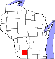 | |
| Villages | ||
| Towns | ||
| CDP | ||
| Unincorporated communities | ||
| Ghost towns | ||
| Footnotes | ‡This populated place also has portions in an adjacent county or counties | |