Bad Axe, Michigan
| Bad Axe, Michigan | |
|---|---|
| City | |
| Motto: "...the hub of the Thumb"[1] | |
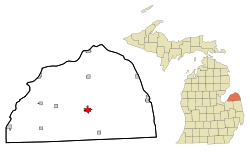 Location of Bad Axe, Michigan | |
| Coordinates: 43°48′10″N 82°59′59″W / 43.80278°N 82.99972°W | |
| Country | United States |
| State | Michigan |
| County | Huron |
| Area[2] | |
| • Total | 2.26 sq mi (5.85 km2) |
| • Land | 2.26 sq mi (5.85 km2) |
| • Water | 0 sq mi (0 km2) |
| Elevation | 758 ft (231 m) |
| Population (2010)[3] | |
| • Total | 3,129 |
| • Estimate (2012[4]) | 3,070 |
| • Density | 1,384.5/sq mi (534.6/km2) |
| Time zone | Eastern (EST) (UTC-5) |
| • Summer (DST) | EDT (UTC-4) |
| ZIP code | 48413 |
| Area code(s) | 989 |
| FIPS code | 26-04740[5] |
| GNIS feature ID | 0620421[6] |
| Website | City of Bad Axe,Michigan |
Bad Axe is a city in the U.S. state of Michigan and the county seat of Huron County[7] located in the Thumb region of the Lower Peninsula. The population was 3,129 at the 2010 census. The population was 3,462 at the 2000 census, making it the largest community in Huron County and second largest in the Thumb, after Caro (if Lapeer and St. Clair counties, part of Metro Detroit, are not included).
History
The city was established in 1905.[8] The city's unusual name[9] dates to the time of its settlement. While surveying the first state road through the Huron County wilderness in 1861, Rudolph Papst and George Willis Pack made camp at the future site of the city and found a much-used and badly damaged axe. At Pack’s suggestion, Papst used the name “Bad Axe Camp” in the minutes of the survey and on a sign he placed along the main trail.[10][11] The first post office in Bad Axe was established in 1870.[12]
Geography
According to the United States Census Bureau, the city has a total area of 2.26 square miles (5.85 km2), all land.[2]
Climate
This climatic region has large seasonal temperature differences, with warm to hot (and often humid) summers and cold (sometimes severely cold) winters. According to the Köppen Climate Classification system, Bad Axe has a humid continental climate, abbreviated "Dfb" on climate maps.[13]
| Climate data for Bad Axe, Michigan | |||||||||||||
|---|---|---|---|---|---|---|---|---|---|---|---|---|---|
| Month | Jan | Feb | Mar | Apr | May | Jun | Jul | Aug | Sep | Oct | Nov | Dec | Year |
| Average high °F (°C) | 29 (−2) |
31 (−1) |
40 (4) |
54 (12) |
67 (19) |
77 (25) |
82 (28) |
80 (27) |
72 (22) |
60 (16) |
46 (8) |
33 (1) |
56 (13) |
| Average low °F (°C) | 15 (−9) |
15 (−9) |
23 (−5) |
33 (1) |
43 (6) |
53 (12) |
58 (14) |
57 (14) |
50 (10) |
40 (4) |
31 (−1) |
20 (−7) |
36 (2) |
| Average precipitation inches (mm) | 1.8 (46) |
1.8 (46) |
2 (50) |
2.6 (66) |
2.9 (74) |
3 (80) |
2.8 (71) |
2.9 (74) |
3.1 (79) |
2.5 (64) |
2.5 (64) |
2.1 (53) |
29.9 (759) |
| Source: Weatherbase [14] | |||||||||||||
Demographics
| Historical population | |||
|---|---|---|---|
| Census | Pop. | %± | |
| 1880 | 190 | — | |
| 1890 | 842 | 343.2% | |
| 1900 | 1,241 | 47.4% | |
| 1910 | 1,559 | 25.6% | |
| 1920 | 2,140 | 37.3% | |
| 1930 | 2,332 | 9.0% | |
| 1940 | 2,624 | 12.5% | |
| 1950 | 2,973 | 13.3% | |
| 1960 | 2,998 | 0.8% | |
| 1970 | 2,999 | 0.0% | |
| 1980 | 3,184 | 6.2% | |
| 1990 | 3,484 | 9.4% | |
| 2000 | 3,462 | −0.6% | |
| 2010 | 3,129 | −9.6% | |
| Est. 2015 | 3,011 | [15] | −3.8% |
2010 census
As of the census[3] of 2010, there were 3,129 people, 1,358 households, and 760 families residing in the city. The population density was 1,384.5 inhabitants per square mile (534.6/km2). There were 1,546 housing units at an average density of 684.1 per square mile (264.1/km2). The racial makeup of the city was 95.1% White, 0.8% African American, 0.9% Native American, 1.5% Asian, 0.4% from other races, and 1.2% from two or more races. Hispanic or Latino of any race were 2.4% of the population.
There were 1,358 households of which 27.5% had children under the age of 18 living with them, 36.8% were married couples living together, 14.7% had a female householder with no husband present, 4.4% had a male householder with no wife present, and 44.0% were non-families. 38.7% of all households were made up of individuals and 17% had someone living alone who was 65 years of age or older. The average household size was 2.16 and the average family size was 2.81.
The median age in the city was 42.9 years. 21.3% of residents were under the age of 18; 8.3% were between the ages of 18 and 24; 23.2% were from 25 to 44; 26.6% were from 45 to 64; and 20.5% were 65 years of age or older. The gender makeup of the city was 46.5% male and 53.5% female.
2000 census
As of the census[5] of 2000, there were 3,462 people, 1,418 households, and 877 families residing in the city. The population density was 1,617.3 per square mile (624.6/km²). There were 1,545 housing units at an average density of 721.8 per square mile (278.8/km²). The racial makeup of the city was 97.57% White, 0.26% African American, 0.26% Native American, 0.58% Asian, 0.38% from other races, and 0.95% from two or more races. Hispanic or Latino of any race were 1.53% of the population.
There were 1,418 households out of which 31.7% had children under the age of 18 living with them, 45.3% were married couples living together, 12.9% had a female householder with no husband present, and 38.1% were non-families. 33.5% of all households were made up of individuals and 15.1% had someone living alone who was 65 years of age or older. The average household size was 2.31 and the average family size was 2.95.
In the city the population was spread out with 24.2% under the age of 18, 8.5% from 18 to 24, 27.5% from 25 to 44, 21.6% from 45 to 64, and 18.3% who were 65 years of age or older. The median age was 39 years. For every 100 females there were 87.5 males. For every 100 females age 18 and over, there were 85.1 males.
The median income for a household in the city was $32,125, and the median income for a family was $42,650. Males had a median income of $34,758 versus $20,288 for females. The per capita income for the city was $17,465. About 9.3% of families and 14.1% of the population were below the poverty line, including 16.1% of those under age 18 and 14.3% of those age 65 or over.
Education
Bad Axe is served by Bad Axe Public Schools, which consist of:[17]
- Bad Axe Elementary.
- Bad Axe Middle School
- Bad Axe High School (the "Hatchets")
The district's George E. Greene Elementary School was shut down in 2011; its former building is now occupied by an alternative high school, Ascent High School. The Bad Axe Elementary School is now located in the building that previously housed the district's Intermediate School.
Media
Radio
The thumb area is an unranked radio area. Local radio in Bad Axe includes WLEW (AM) and WLEW-FM.
Newspapers
- Bad Axe and the northern thumb area are served by a daily newspaper, the Huron Daily Tribune and the Huron County View.
- Daily editions of the Detroit Free Press and The Detroit News, as well as thrice-weekly editions of the Bay City Times and Saginaw News, are also available.
Broadcast television
Huron County lies inside the Flint/Tri-Cities Television Market. Only stations available on Comcast in the Bad Axe area are listed below.
- WNEM 5 (CBS/MyNetworkTV)
- WJRT 12 (ABC)
- WDCQ 19 (PBS)
- WEYI 25 (NBC)
- WCMZ-TV 28 (PBS)
- WBSF 46 (The CW)
- WAQP 49 (Religious)
- WSMH 66 (Fox)
WDCQ is the Thumb's only television station, licensed to Bad Axe, and owned and operated by Delta College, near Bay City. The station's studios are located at Delta College, with its digital transmitter in Quanicassee, in northwestern Tuscola County. The station's analog transmitter was based near Bad Axe, but went dark in June 2009.
Infrastructure
Transportation
Notable people
- Allen James Babcock, Roman Catholic bishop; born in Bad Axe
- Lilian Jackson Braun, mystery writer; lived in Bad Axe
- David C. Clark, Florida state judge and legislator; born in Bad Axe
- George M. Clark, Chief Justice of the Michigan Supreme Court, lived in Bad Axe
- Brad Guigar, cartoonist; grew up in Bad Axe
- Bob Murawski, 2009 Academy Award winning film editor (The Hurt Locker); high school valedictorian from Bad Axe
- William Potts, who added the yellow light to create the modern, three-lens traffic light; born in Bad Axe
References
Notes
- ↑ "Bad Axe Chamber of Commerce". Bad Axe Chamber of Commerce. Retrieved August 24, 2012.
- 1 2 "US Gazetteer files 2010". United States Census Bureau. Retrieved 2012-11-25.
- 1 2 "American FactFinder". United States Census Bureau. Retrieved 2012-11-25.
- ↑ "Population Estimates". United States Census Bureau. Archived from the original on 2013-06-17. Retrieved 2013-06-03.
- 1 2 "American FactFinder". United States Census Bureau. Archived from the original on 2013-09-11. Retrieved 2008-01-31.
- ↑ U.S. Geological Survey Geographic Names Information System: Bad Axe, Michigan
- ↑ "Find a County". National Association of Counties. Archived from the original on 2011-05-31. Retrieved 2011-06-07.
- ↑ "City of Bad Axe, Michigan". City of Bad Axe, Michigan. Retrieved August 25, 2012.
- ↑ Don Voorhees (4 October 2011). The Super Book of Useless Information: The Most Powerfully Unnecessary Things You Never Need to Know. Penguin Group US. p. 67. ISBN 978-1-101-54513-3.
- ↑ Local History – How Bad Axe got its Name
- ↑ "Profile for Bad Axe, Michigan, MI". ePodunk. Retrieved August 24, 2012.
- ↑ Romig 1986, p. 38.
- ↑ Climate Summary for Bad Axe, Michigan
- ↑ "Weatherbase.com". Weatherbase. 2013. Retrieved on September 21, 2013.
- ↑ "Annual Estimates of the Resident Population for Incorporated Places: April 1, 2010 to July 1, 2015". Retrieved July 2, 2016.
- ↑ "Census of Population and Housing". Census.gov. Archived from the original on May 11, 2015. Retrieved June 4, 2015.
- ↑ Bad Axe Public Schools > Home
Sources
- Romig, Walter (October 1, 1986) [1973]. Michigan Place Names: The History of the Founding and the Naming of More Than Five Thousand Past and Present Michigan Communities. Great Lakes Books Series (Paperback). Detroit, Michigan: Wayne State University Press. ISBN 081431838X. ISBN 978-0814318386.
External links
Coordinates: 43°48′07″N 83°00′03″W / 43.80194°N 83.00083°W
 |
Caseville | Port Austin | Port Hope | |
| Pigeon, Sebewaing | |
Harbor Beach, Lake Huron | ||
| ||||
| | ||||
| Saginaw, Caro | Sandusky, Detroit | Minden City, Port Huron |
Municipalities and communities of Huron County, Michigan, United States | ||
|---|---|---|
| Cities | 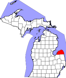 | |
| Villages | ||
| Townships | ||
| CDP | ||
| Other unincorporated communities | ||