Bald Point State Park
| Bald Point State Park | |
|---|---|
|
IUCN category Ib (wilderness area) | |
 | |
| Location | Franklin County, Florida, USA |
| Nearest city | Alligator Point, Florida |
| Coordinates | 29°56′51″N 84°20′29″W / 29.94750°N 84.34139°WCoordinates: 29°56′51″N 84°20′29″W / 29.94750°N 84.34139°W |
| Governing body | Florida Department of Environmental Protection |
Bald Point State Park Some of the most picturesque scenic areas along north Florida's Gulf Coast are found within the park which supports 4,065 upland acres. Located on Alligator Point, where Ochlockonee Bay meets Apalachee Bay, Bald Point offers a multitude of land and water activities. Coastal marshes, pine flatwoods, and oak thickets foster a diversity of biological communities that make the park a popular destination for birding and wildlife viewing. Each fall, bald eagles and other migrating raptors, along with monarch butterflies, are commonly seen heading south for the winter. Bald Point offers access to two Apalachee Bay beaches for swimming, sunbathing, fishing, canoeing, kayaking and windsurfing. Facilities include a fishing dock and picnic pavilions.
Recreational Activities
The park has such amenities as beaches, bicycling, birding, canoeing, fishing, hiking, kayaking, swimming and wildlife viewing.
Hours of Operation and Admission Fees
The park is open from 8:00 a.m. until sundown, 365 days a year.
Admissions Fees: $4.00 per vehicle. Please use the honor box to pay fees. Correct change is required. Limit eight people per vehicle.
$2.00 Pedestrians, bicyclists, extra passengers, passengers in vehicle with holder of Annual Individual Entrance Pass.
History & Culture
Norwood pottery, the earliest known pottery in North America, helped archaeologists identify the park's oldest site, placing the earliest human activity 2,500 to 3,500 years before the Spanish arrived. These Native Americans hunted, fished, collected clams and oysters, and lived in relatively permanent settlements due to the abundant resources of the coast and forests. In the mid-1800s and late 1900s, fishermen established seineyards at Bald Point. These usually primitive campsites included racks to hang, dry and repair nets. Evidence of the 19th to 20th century turpentine industry is seen on larger pine trees cut with `cat face' scars.
Bald Point Beach
The white sand beaches of Bald Point State Park have slowly receded. Many of the thickly-vegetated dunes, acting as a buffer and holding the delicate sand in place, have begun to erode away. The planting of sea oats and the public's cooperation by not walking over the dunes has helped, but some dunes are only one storm away from destruction.
A Drive on the Beach
Long before environmental impacts were known and four-wheel drive was invented, the flat beaches of Bald Point were a perfect place to take the automobile out for a spin.
Training Day
Camp Gordon Johnston, extending from Bald Point to Eastpoint, was a training facility for soldiers during World War II. The heat, bugs and inclement weather made certain that soldiers were ready for anything.
Landing on the Point
Bald Point was the location for amphibious landing exercises during training at Camp Gordon Johnston. Many of the soldiers who landed at Normandy during WW II trained here. There are accounts of landing vehicles hitting sand bars here and prematurely launching men in full gear overboard where the weight of their gear caused them to drown.
Setting the Net
Bald Point has long been a place for commercial fishing activity. Sunday Reel overlook is named for a seineyard which existed there. Here, fishermen would pull in their seine nets and gather the fish. The site was also used to dry and mend the very large nets.
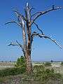
Gallery
-

Over looking Chaires Creek
-

-

-

-

-

-
References
External links
- Bald Point State Park at Florida State Parks
- Bald Point State Park at Visit Florida
- Bald Point State Park at gorp.com