Baldwin Park, Missouri
| Baldwin Park, Missouri | |
|---|---|
| Park | |
 Location of Baldwin Park, Missouri | |
| Coordinates: 38°47′43″N 94°14′44″W / 38.79528°N 94.24556°WCoordinates: 38°47′43″N 94°14′44″W / 38.79528°N 94.24556°W | |
| Country | United States |
| State | Missouri |
| County | Cass |
| Area[1] | |
| • Total | 0.12 sq mi (0.31 km2) |
| • Land | 0.08 sq mi (0.21 km2) |
| • Water | 0.04 sq mi (0.10 km2) |
| Elevation | 889 ft (271 m) |
| Population (2010)[2] | |
| • Total | 92 |
| • Estimate (2012[3]) | 92 |
| • Density | 1,150.0/sq mi (444.0/km2) |
| Time zone | Central (CST) (UTC-6) |
| • Summer (DST) | CDT (UTC-5) |
| FIPS code | 29-03124[4] |
| GNIS feature ID | 1669589[5] |
Baldwin Park is a park in Cass County, Missouri, United States. The population was 92 at the 2010 census.
Geography
Baldwin Park is located at 38°47′43″N 94°14′44″W / 38.79528°N 94.24556°W (38.795321, -94.245640),[6] in Missouri. It is actually a village. It surrounds Baldwin Lake, not a part of the nearest town, Pleasant Hill, Missouri. The Village pays its taxes to Cass County and gets its funding from County, State and Federal taxes. As of the 2010 Census, the Population of Baldwin Park was 92. The village has its own Mayor and Board of Trustees, consisting of four members. As of October 2012, the estimated 2.5 miles of roads were redone.
According to the United States Census Bureau, the village has a total area of 0.12 square miles (0.31 km2), of which, 0.08 square miles (0.21 km2) of it is land and 0.04 square miles (0.10 km2) is water.[1]
Demographics
| Historical population | |||
|---|---|---|---|
| Census | Pop. | %± | |
| 1980 | 126 | — | |
| 1990 | 85 | −32.5% | |
| 2000 | 115 | 35.3% | |
| 2010 | 92 | −20.0% | |
| Est. 2015 | 92 | [7] | 0.0% |
2010 census
As of the census[2] of 2010, there were 92 people, 38 households, and 23 families residing in the village. The population density was 1,150.0 inhabitants per square mile (444.0/km2). There were 40 housing units at an average density of 500.0 per square mile (193.1/km2). The racial makeup of the village was 96.7% White, 1.1% Native American, 1.1% Asian, and 1.1% from two or more races.
There were 38 households of which 34.2% had children under the age of 18 living with them, 36.8% were married couples living together, 7.9% had a female householder with no husband present, 15.8% had a male householder with no wife present, and 39.5% were non-families. 34.2% of all households were made up of individuals and 15.8% had someone living alone who was 65 years of age or older. The average household size was 2.42 and the average family size was 3.00.
The median age in the village was 38 years. 25% of residents were under the age of 18; 6.5% were between the ages of 18 and 24; 28.3% were from 25 to 44; 32.6% were from 45 to 64; and 7.6% were 65 years of age or older. The gender makeup of the village was 47.8% male and 52.2% female.
2000 census
As of the census[4] of 2000, there were 115 people, 41 households, and 27 families residing in the village. The population density was 1,639.7 people per square mile (634.3/km²). There were 44 housing units at an average density of 627.4 per square mile (242.7/km²). The racial makeup of the village was 99.13% White and 0.87% Native American. Hispanic or Latino of any race were 0.87% of the population.
There were 41 households out of which 39.0% had children under the age of 18 living with them, 43.9% were married couples living together, 19.5% had a female householder with no husband present, and 34.1% were non-families. 19.5% of all households were made up of individuals and 9.8% had someone living alone who was 65 years of age or older. The average household size was 2.80 and the average family size was 3.26.
In the village the population was spread out with 36.5% under the age of 18, 2.6% from 18 to 24, 36.5% from 25 to 44, 18.3% from 45 to 64, and 6.1% who were 65 years of age or older. The median age was 34 years. For every 100 females there were 94.9 males. For every 100 females age 18 and over, there were 73.8 males.
The median income for a household in the village was $40,208, and the median income for a family was $38,125. Males had a median income of $35,000 versus $17,292 for females. The per capita income for the village was $22,489. There were no families and 8.8% of the population living below the poverty line, including no under-eighteens and none of those over 64.
References
- 1 2 "US Gazetteer files 2010". United States Census Bureau. Archived from the original on 2012-01-24. Retrieved 2012-07-08.
- 1 2 "American FactFinder". United States Census Bureau. Retrieved 2012-07-08.
- ↑ "Population Estimates". United States Census Bureau. Archived from the original on 2013-06-17. Retrieved 2013-05-30.
- 1 2 "American FactFinder". United States Census Bureau. Archived from the original on 2013-09-11. Retrieved 2008-01-31.
- ↑ "US Board on Geographic Names". United States Geological Survey. 2007-10-25. Retrieved 2008-01-31.
- ↑ "US Gazetteer files: 2010, 2000, and 1990". United States Census Bureau. 2011-02-12. Retrieved 2011-04-23.
- ↑ "Annual Estimates of the Resident Population for Incorporated Places: April 1, 2010 to July 1, 2015". Retrieved July 2, 2016.
- ↑ "Census of Population and Housing". Census.gov. Archived from the original on May 11, 2015. Retrieved June 4, 2015.
Municipalities and communities of Cass County, Missouri, United States | ||
|---|---|---|
| Cities | 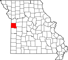 | |
| Villages | ||
| Townships | ||
| Unincorporated communities | ||
| Ghost towns | ||
| Footnotes | ‡This populated place also has portions in an adjacent county or counties | |