Drexel, Missouri
| Drexel, Missouri | |
|---|---|
| City | |
 Location of Drexel, Missouri | |
| Coordinates: 38°28′50″N 94°36′28″W / 38.48056°N 94.60778°WCoordinates: 38°28′50″N 94°36′28″W / 38.48056°N 94.60778°W | |
| Country | United States |
| State | Missouri |
| Counties | Cass, Bates |
| Area[1] | |
| • Total | 2.77 sq mi (7.17 km2) |
| • Land | 2.73 sq mi (7.07 km2) |
| • Water | 0.04 sq mi (0.10 km2) |
| Elevation | 1,001 ft (305 m) |
| Population (2010)[2] | |
| • Total | 965 |
| • Estimate (2012[3]) | 962 |
| • Density | 353.5/sq mi (136.5/km2) |
| Time zone | Central (CST) (UTC-6) |
| • Summer (DST) | CDT (UTC-5) |
| ZIP code | 64742 |
| Area code(s) | 816 |
| FIPS code | 29-20134[4] |
| GNIS feature ID | 0729875[5] |
Drexel is a city in Bates and Cass Counties in the U.S. state of Missouri. The population was 965 at the 2010 census.
History
Drexel was originally called Stuart City, and under the latter name was platted in 1890.[6] The present name of Drexel was the name of a local store owner.[7] A post office called Drexel has been in operation since 1891.[8]
Geography
Drexel is located at 38°28′50″N 94°36′28″W / 38.48056°N 94.60778°W (38.480611, -94.607725).[9]
According to the United States Census Bureau, the city has a total area of 2.77 square miles (7.17 km2), of which, 2.73 square miles (7.07 km2) is land and 0.04 square miles (0.10 km2) is water.[1]
Demographics
| Historical population | |||
|---|---|---|---|
| Census | Pop. | %± | |
| 1900 | 453 | — | |
| 1910 | 512 | 13.0% | |
| 1920 | 543 | 6.1% | |
| 1930 | 553 | 1.8% | |
| 1940 | 450 | −18.6% | |
| 1950 | 456 | 1.3% | |
| 1960 | 651 | 42.8% | |
| 1970 | 723 | 11.1% | |
| 1980 | 908 | 25.6% | |
| 1990 | 936 | 3.1% | |
| 2000 | 1,090 | 16.5% | |
| 2010 | 965 | −11.5% | |
| Est. 2015 | 956 | [10] | −0.9% |
2010 census
As of the census[2] of 2010, there were 965 people, 404 households, and 264 families residing in the city. The population density was 353.5 inhabitants per square mile (136.5/km2). There were 450 housing units at an average density of 164.8 per square mile (63.6/km2). The racial makeup of the city was 97.3% White, 0.9% African American, 0.3% Native American, 0.1% Asian, and 1.3% from two or more races. Hispanic or Latino of any race were 0.7% of the population.
There were 404 households of which 32.4% had children under the age of 18 living with them, 52.2% were married couples living together, 6.9% had a female householder with no husband present, 6.2% had a male householder with no wife present, and 34.7% were non-families. 31.9% of all households were made up of individuals and 15.1% had someone living alone who was 65 years of age or older. The average household size was 2.39 and the average family size was 3.00.
The median age in the city was 39.4 years. 26.2% of residents were under the age of 18; 9.2% were between the ages of 18 and 24; 20.5% were from 25 to 44; 25.9% were from 45 to 64; and 18.2% were 65 years of age or older. The gender makeup of the city was 49.6% male and 50.4% female.
2000 census
As of the census[4] of 2000, there were 1,090 people, 439 households, and 303 families residing in the city. The population density was 1,454.6 people per square mile (561.1/km²). There were 458 housing units at an average density of 611.2 per square mile (235.8/km²). The racial makeup of the city was 98.44% White, 0.46% African American, 0.46% Native American, 0.18% Asian, 0.09% from other races, and 0.37% from two or more races. Hispanic or Latino of any race were 0.64% of the population.
There were 439 households out of which 36.4% had children under the age of 18 living with them, 58.5% were married couples living together, 7.7% had a female householder with no husband present, and 30.8% were non-families. 28.7% of all households were made up of individuals and 14.1% had someone living alone who was 65 years of age or older. The average household size was 2.48 and the average family size was 3.07.
In the city the population was spread out with 29.1% under the age of 18, 7.0% from 18 to 24, 28.5% from 25 to 44, 22.0% from 45 to 64, and 13.4% who were 65 years of age or older. The median age was 36 years. For every 100 females there were 97.1 males. For every 100 females age 18 and over, there were 91.8 males.
The median income for a household in the city was $39,219, and the median income for a family was $44,659. Males had a median income of $37,404 versus $22,404 for females. The per capita income for the city was $17,207. About 4.9% of families and 7.1% of the population were below the poverty line, including 7.5% of those under age 18 and 10.1% of those age 65 or over.
Drexel public water supply
In June 2010, the Missouri Department of Natural Resources warned of a spike of 31.2 parts herbicide atrazine per billion in Drexel's public water supply. The maximum contaminant level set by the U.S. Environmental Protection Agency for long term exposure is 3 parts per billion. The Missouri Department of Health and Senior Services recommended "neither using the water for drinking nor using it to cook, wash dishes or to make ice."[12]
References
- 1 2 "US Gazetteer files 2010". United States Census Bureau. Retrieved 2012-07-08.
- 1 2 "American FactFinder". United States Census Bureau. Retrieved 2012-07-08.
- ↑ "Population Estimates". United States Census Bureau. Retrieved 2013-05-30.
- 1 2 "American FactFinder". United States Census Bureau. Retrieved 2008-01-31.
- ↑ "US Board on Geographic Names". United States Geological Survey. 2007-10-25. Retrieved 2008-01-31.
- ↑ "Cass County Place Names, 1928–1945 (archived)". The State Historical Society of Missouri. Retrieved 17 September 2016.
- ↑ Eaton, David Wolfe (1916). How Missouri Counties, Towns and Streams Were Named. The State Historical Society of Missouri. p. 272.
- ↑ "Post Offices". Jim Forte Postal History. Retrieved 16 September 2016.
- ↑ "US Gazetteer files: 2010, 2000, and 1990". United States Census Bureau. 2011-02-12. Retrieved 2011-04-23.
- ↑ "Annual Estimates of the Resident Population for Incorporated Places: April 1, 2010 to July 1, 2015". Retrieved July 2, 2016.
- ↑ "Census of Population and Housing". Census.gov. Retrieved June 4, 2015.
- ↑ "High Levels of Atrazine Detected in Drexel Drinking Water", States News Service via HighBeam, Jefferson City, Missouri, 23 June 2010 External link in
|work=(help);
Municipalities and communities of Bates County, Missouri, United States | ||
|---|---|---|
| Cities | 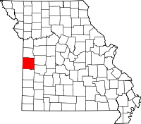 | |
| Villages | ||
| Townships | ||
| Unincorporated communities | ||
| Ghost towns | ||
| Footnotes | ‡This populated place also has portions in an adjacent county or counties | |
Municipalities and communities of Cass County, Missouri, United States | ||
|---|---|---|
| Cities | 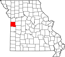 | |
| Villages | ||
| Townships | ||
| Unincorporated communities | ||
| Ghost towns | ||
| Footnotes | ‡This populated place also has portions in an adjacent county or counties | |