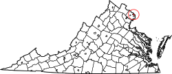
Ballston, Arlington, Virginia
| Ballston, Arlington, Virginia | |
|---|---|
| Neighborhood | |
|
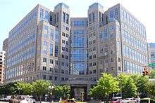
Western edge of Ballston | |
 Ballston, Arlington, Virginia Location of Ballston | |
| Coordinates: 38°52′55″N 77°06′41″W / 38.881831°N 77.111292°WCoordinates: 38°52′55″N 77°06′41″W / 38.881831°N 77.111292°W | |
| Country |
|
| State |
|
| County |
|
| Time zone | EST (UTC-5) |
| • Summer (DST) | EDT (UTC-4) |
| ZIP Codes | 22203 |
| Area code(s) | 703 |
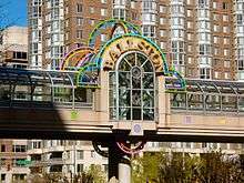
Ballston is a neighborhood in Arlington County, Virginia and is home to the Ballston-MU station on the Orange Line and the Silver Line of the metro system.
History
Ballston is named after the Ball family, one of whose family cemeteries lies in the neighborhood at N. Stafford Street and Fairfax Drive (Virginia State Route 237).[1][2] Ballston began as Birch's Crossroads[3] and later became Ball's Crossroads at what is now the intersection of N. Glebe Road (Virginia State Route 120) and Wilson Boulevard.[4]
A historical marker that stands near the southeastern corner of the intersection reads:
This intersection has been a focal point since about 1740, when two roads were developed, one from the future site of Alexandria to the mouth of Pimmit Run, the other from Awbury’s Ferry (at the site of Rosslyn) to The Falls Church. The first came to be known as the Glebe Road because it passed the glebe of Fairfax Parish and in order to distinguish it from other roads to the Falls. The second was eventually named Wilson Boulevard in honor of President Wilson. The intersection became known as Ball’s Crossroads when Ball’s Tavern was established here in the early 1800s.[4]
In 1896, an interurban electric trolley line, the Fairfax line of the Washington, Arlington & Falls Church Railway (WA&FC), began operating north of the crossroads along the present route of Fairfax Drive, whose name derives from that of the trolleys' final destination, Fairfax City. Construction of the trolley line, which branched at Clarendon to serve both Rosslyn and downtown Washington, D.C., temporarily shifted much of the area's development away from the crossroads.[5] A historical marker that stands near the northwestern corner of Fairfax Drive and N. Stafford Street, one block east of the Ballston Metrorail station (which is at the former site of the Ballston trolley station) states:

By 1900 a well-defined village called Central Ballston had developed in the area bounded by the present-day Wilson Boulevard, Taylor Street, Washington Boulevard, and Pollard Street. More diffuse settlement extended westward to Lubber Run and southward along Glebe Road to Henderson Road.
The track of the Washington, Arlington, and Falls Church Electric Railroad ran along what is now Fairfax Drive; the Ballston Station was at Ballston Avenue, now North Stuart Street. Here Clements Avenue, now Stafford Street, divided to pass on either side of an old Ball family graveyard.[1]
The Ball family burial ground on Washington Boulevard has an historical marker as well, stating
Old Ball Family Burial Ground. This is one of Arlington's oldest family burial grounds. Ensign John Ball (1748–1814), a veteran of the American Revolution (Sixth Virginia Infantry) is buried here. John Ball was the son of Moses Ball, who was one of the pioneer settlers in the Glencarlyn area of Arlington. Also buried here in the cemetery are many of John Ball's direct and collateral descendants including John Wesley Boldin, a Civil War soldier (Company D, Third Pennsylvania Cavalry) and member of the Marcey, Stricker, Donaldson, and Croson families.
In 1912, a competing interurban electric trolley line, the Washington and Old Dominion Railway constructed a branch that crossed the WA&FC near the west end of Ballston (then called Lacey), near a WA&FC car barn and railyard. Interstate 66 and the Bluemont Junction Trail now follow the route of this railroad branch between Rosslyn and the Washington and Old Dominion Railroad Trail in Bluemont Park. A historical marker entitled "Lacey Car Barn" located near the northwest corner of N. Glebe Road and Faifax Drive states:
In 1896, the Washington, Arlington & Falls Church Railway began running electric trolleys from Rosslyn to Falls Church on the present routes of Fairfax Drive and I-66. By 1907, the Fairfax trolley linked Fairfax, Vienna, and Ballston with downtown Washington. In 1910, at this location, the railway built a car barn, railyard, workshops, electrical substation, and general office. In 1912, the rival Washington & Old Dominion Railway began crossing the tracks on a bridge 200 yards west of here, following the present route of I-66 from Rosslyn. The Fairfax trolley closed in 1939, but Metrorail’s Orange Line follows its route through Arlington.[6]
In 1951, the Parkington Shopping Center opened at the intersection formerly known as Balls Crossroads, on the site of the present Ballston Common Mall. Parkington was anchored by the headquarters location of the Hecht Company and was reputed to have the largest parking garage in the U.S. when it opened.[5]
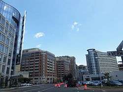
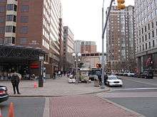
Ballston began to redevelop rapidly after the Washington Metropolitan Area Transit Authority opened the Orange Line's Ballston Metrorail station on December 1, 1979 and when an entrance to Interstate 66 (I-66) opened on December 22, 1982.[5][7] Now highly urbanized, Ballston contains highrise apartment, condominium and commercial buildings and a number of bars and restaurants.
Shopping and recreation

Ballston Common Mall, formerly located at the corner of N. Glebe Road and Wilson Boulevard, is no longer operational. In its place, Ballston Quarter, a shopping and residential complex, is scheduled for completion in 2018.
The Kettler Capitals Iceplex, constructed on top of the Ballston Common Mall's parking garage, houses a Washington Capitals National Hockey League (NHL) office and training facility. In addition to the ice hockey team's 20,000 square feet (1,900 m2) training center, the Iceplex features two indoor NHL-sized ice rinks, office space, locker rooms, a full-service pro-shop, a Capitals team store, a snack bar, and space for special events. The facility provides public skating, figure skating and hockey programs for youth and adults.[8]
Ballston hosts the annual Taste of Arlington food festival,[9] a street fair which has been produced each spring since 1987. The 2009 Taste of Arlington event featured over forty area restaurants offering portions of their cuisine to ticket-holders, and drew approximately 15,000 people.[10] The regional business development organization, the Ballston Business Improvement District (Ballston BID), (formerly the Ballston-Virginia Square Partnership),[11] other area community development organizations and the National Science Foundation organize the festival.[10] Ticket sales at the event raise funds for area charities.[12]
Economy
Ballston is home to several United States government agencies and organizations including:
- The United States Coast Guard
- The National Science Foundation
- The U.S. Fish and Wildlife Service
- The Defense Advanced Research Projects Agency (DARPA)
- The Office of Naval Research
A number of non-profit groups, including The Nature Conservancy[13] and the National Rural Electric Cooperative Association (NRECA),[14] are located in Ballston, as are several government contractors and high tech companies, including CACI, SAIC and the headquarters of ESI International. In 2011, Accenture agreed to move its offices from Reston, Virginia, to a new 360,000 square feet (33,000 m2) facility on the corner of Wilson Boulevard and North Glebe Road in Ballston.[15]
Education
The neighborhood is home to Washington-Lee High School. Ballston is also home to several university facilities, including:
- A Marymount University (MU) satellite campus.[16]
- In January 2014, the Arlington County Board approved MU's site plan application to redevelop the campus with two new buildings, a nine-story office and educational building for Marymount University and a 15-story multifamily building with 272 residential units, by Arlington developer, The Shooshan Company.[17]
- A Virginia Tech research center.[18]
- A George Washington University graduate education center.[19]
Notes
- 1 2 ""Ballston" marker". HMdb.org: The Historical Marker Database. Archived from the original on 2014-03-01. Retrieved 2014-02-28.
- ↑ ""The Ball-Carlin Cemetery" marker". HMdb.org: The Historical Marker Database. Archived from the original on 2014-03-03. Retrieved 2014-03-03.
- ↑ "Early Settlement". Arlington, Virginia: Arlington Historical Society. Archived from the original on 2013-10-30. Retrieved 2013-10-30.
- 1 2 ""Ball's Crossroads" marker". HMdb.org: The Historical Marker Database. Archived from the original on 2014-03-03. Retrieved 2014-03-03.
- 1 2 3 "Buckingam Community Civic Association Neighborhood Conservation Plan" (pdf). Arlington County Department of Community Planning, Housing and Development. October 2006. p. 28. Archived (PDF) from the original on 2013-02-25. Retrieved 2013-02-25.
- ↑ ""Lacey Car Barn" marker". HMdb.org: The Historical Marker Database. Archived from the original on March 1, 2014. Retrieved February 28, 2014.
- ↑ (1)"Background: I-66 History". Idea-66. Virginia Department of Transportation. Archived from the original on 2012-01-23. Retrieved 2013-02-25.
(2) Kozel, Scott M. (2007-04-26). "Interstate 66 and Metrorail Vienna Route". Roads to the Future. Archived from the original on 2013-02-25. Retrieved 2013-02-25. - ↑ "Welcome to Kettler Capitals Iceplex". Kettler Capitals Iceplex. Arlington, Virginia. November 24, 2015. Retrieved 2016-09-03.
- ↑ Taste of Arlington. Retrieved 2009-05-29.
- 1 2 Potts, Maurisa. "15,000 Foodies Come Out for Taste of Arlington". Local Kick. Retrieved 2016-09-05.
- ↑ (1) "About Ballston". Arlington, Virginia: Ballston BID. 2013. Archived from the original on 2013-10-31. Retrieved 2013-10-31.
(2) "Ballston-Virginia Square Partnership". 2007. Archived from the original on 2013-10-31. Retrieved 2013-10-31. - ↑ Lavanya Ramanathan, "Fun You Can Sink Your Teeth Into" The Washington Post (2009-05-15).
- ↑ "Contact Us". The Nature Conservancy. Arlington, Virginia. Retrieved 2013-10-31.
- ↑ "What We Do". NRECA. Arlington, Virginia: NRECA. 2013. Retrieved 2013-10-31.
- ↑ "Accenture signs Ballston lease with JBG" The Washington Business Journal (September 13, 2011).
- ↑ "Ballston Center". Arlington, Virginia: Marymount University. Archived from the original on 2013-10-30. Retrieved 2013-10-30.
- ↑ (1) "Site Plan Projects – 1000 N. Glebe Road (Marymount University at Ballston Center)". Arlington County, Virginia: Arlington County Department of Community Planning, Housing and Development. 2014-02-28. Archived from the original on 2014-03-02. Retrieved 2014-03-02.
(2) "Arlington County Board Approves Plan to Redevelop Marymount University's "Blue Goose" Site". News Release. Arlington County Government Newsroom. 2014-01-25. Archived from the original on 2014-03-02. Retrieved 2014-03-02. - ↑ "Virginia Tech Research Center – Arlington". Virginia Tech in the National Capital Region. Virginia Tech. 2013. Archived from the original on 2013-10-30. Retrieved 2013-10-30.
- ↑ "Graduate Education Center, Arlington". College of Professional Studies. The George Washington University. Archived from the original on 2013-10-30. Retrieved 2013-10-30.
External links
| Wikimedia Commons has media related to Ballston. |
- Why Is It Named Ballston?
- Ballston Metro Station Area Data, Statistics and Development
- Washington Post article about Ballston from February 18th, 2007
- Arlington's Urban Villages – Ballston
- Kettler Capitals Iceplex
- Taste of Arlington