Cherrydale Historic District
|
Cherrydale Historic District | |
|
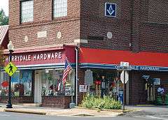
Commercial building in the Cherrydale Historic District, September 2012 | |
   | |
| Location | Roughly bounded by Lorcom Ln., N. Utah and N. Taylor Sts., and I-66, Arlington, Virginia |
|---|---|
| Coordinates | 38°53′41″N 77°6′32″W / 38.89472°N 77.10889°WCoordinates: 38°53′41″N 77°6′32″W / 38.89472°N 77.10889°W |
| Area | 286.3 acres (115.9 ha) |
| Built | 1898 |
| Architect | Conner, J. Arthur; et al. |
| Architectural style | Late Victorian, Late 19th And 20th Century Revivals |
| NRHP Reference # | 03000461[1] |
| VLR # | 000-7821 |
| Significant dates | |
| Added to NRHP | May 22, 2003 |
| Designated VLR | March 19, 2003[2] |
The Cherrydale Historic District is a national historic district located in the Cherrydale neighborhood of Arlington County, Virginia. It contains 948 contributing buildings, 1 contributing site, 2 contributing structures, and 1 contributing object in a residential neighborhood in northern Arlington. The area was platted in 1898, with the majority of dwellings constructed in the second quarter of the 20th century. The dwelling styles include a variety of architectural styles, including a number of Colonial Revival and Queen Anne style dwellings. Also located in the district is the separately listed Cherrydale Volunteer Fire House.[3]
It was listed on the National Register of Historic Places in 2003.[1]
References
- 1 2 National Park Service (2010-07-09). "National Register Information System". National Register of Historic Places. National Park Service.
- ↑ "Virginia Landmarks Register". Virginia Department of Historic Resources. Retrieved 2013-05-12.
- ↑ Carrie E. Albee and Laura V. Trieschmann (November 2002). "National Register of Historic Places Inventory/Nomination: Cherrydale Historic District" (PDF). and Accompanying four photos and Accompanying map


This article is issued from Wikipedia - version of the 11/30/2016. The text is available under the Creative Commons Attribution/Share Alike but additional terms may apply for the media files.