Barnum, Minnesota
| Barnum, Minnesota | |
|---|---|
| City | |
 Location of the city of Barnum within Carlton County, Minnesota | |
| Coordinates: 46°30′15″N 92°41′26″W / 46.50417°N 92.69056°W | |
| Country | United States |
| State | Minnesota |
| County | Carlton |
| Area[1] | |
| • Total | 1.00 sq mi (2.59 km2) |
| • Land | 1.00 sq mi (2.59 km2) |
| • Water | 0 sq mi (0 km2) |
| Elevation | 1,106 ft (337 m) |
| Population (2010)[2] | |
| • Total | 613 |
| • Estimate (2012[3]) | 605 |
| • Density | 613.0/sq mi (236.7/km2) |
| Time zone | Central (CST) (UTC-6) |
| • Summer (DST) | CDT (UTC-5) |
| ZIP code | 55707 |
| Area code(s) | 218 |
| FIPS code | 27-03628[4] |
| GNIS feature ID | 0639642[5] |
| Website | barnummn.us |
Barnum is a city in Carlton County, Minnesota, United States. The population was 613 at the 2010 census.[6]
Interstate Highway 35, Carlton County Road 6 (Main Street), and Carlton County Road 61 (Front Street) are three of the main routes in Barnum.
Geography
According to the United States Census Bureau, the city has a total area of 1.00 square mile (2.59 km2), all of it land.[1] It is located five miles northeast of Moose Lake and 33 miles southwest of the city of Duluth.
Community
Barnum is the home of the Carlton County Fair. The Fair takes place annually in August. Barnum is also home to the Barnum elementary and Barnum high school.
Demographics
| Historical population | |||
|---|---|---|---|
| Census | Pop. | %± | |
| 1880 | 49 | — | |
| 1890 | 417 | 751.0% | |
| 1900 | 391 | −6.2% | |
| 1910 | 262 | −33.0% | |
| 1920 | 242 | −7.6% | |
| 1930 | 271 | 12.0% | |
| 1940 | 327 | 20.7% | |
| 1950 | 344 | 5.2% | |
| 1960 | 417 | 21.2% | |
| 1970 | 382 | −8.4% | |
| 1980 | 464 | 21.5% | |
| 1990 | 482 | 3.9% | |
| 2000 | 525 | 8.9% | |
| 2010 | 613 | 16.8% | |
| Est. 2015 | 598 | [7] | −2.4% |
2010 census
As of the census[2] of 2010, there were 613 people, 236 households, and 152 families residing in the city. The population density was 613.0 inhabitants per square mile (236.7/km2). There were 264 housing units at an average density of 264.0 per square mile (101.9/km2). The racial makeup of the city was 92.0% White, 0.3% African American, 2.4% Native American, 0.2% Asian, and 5.1% from two or more races. Hispanic or Latino of any race were 0.8% of the population.
There were 236 households of which 38.6% had children under the age of 18 living with them, 46.2% were married couples living together, 12.7% had a female householder with no husband present, 5.5% had a male householder with no wife present, and 35.6% were non-families. 30.9% of all households were made up of individuals and 14.9% had someone living alone who was 65 years of age or older. The average household size was 2.57 and the average family size was 3.24.
The median age in the city was 35.2 years. 32.5% of residents were under the age of 18; 5.6% were between the ages of 18 and 24; 27.6% were from 25 to 44; 21.4% were from 45 to 64; and 13.1% were 65 years of age or older. The gender makeup of the city was 46.7% male and 53.3% female.
2000 census
As of the census[4] of 2000, there were 525 people, 226 households, and 138 families residing in the city. The population density was 519.7 people per square mile (200.7/km²). There were 249 housing units at an average density of 246.5 per square mile (95.2/km²). The racial makeup of the city was 97.33% White, 1.52% Native American, and 1.14% from two or more races. Hispanic or Latino of any race were 0.19% of the population. 20.0% were of Norwegian, 17.2% German, 13.0% American, 11.7% Swedish and 6.7% Finnish ancestry according to Census 2000.
There were 226 households out of which 34.5% had children under the age of 18 living with them, 43.4% were married couples living together, 14.2% had a female householder with no husband present, and 38.9% were non-families. 31.0% of all households were made up of individuals and 16.4% had someone living alone who was 65 years of age or older. The average household size was 2.32 and the average family size was 2.96.
In the city the population was spread out with 29.1% under the age of 18, 8.8% from 18 to 24, 30.1% from 25 to 44, 16.8% from 45 to 64, and 15.2% who were 65 years of age or older. The median age was 33 years. For every 100 females there were 94.4 males. For every 100 females age 18 and over, there were 84.2 males.
The median income for a household in the city was $31,518, and the median income for a family was $40,625. Males had a median income of $34,375 versus $21,250 for females. The per capita income for the city was $14,621. About 7.4% of families and 9.4% of the population were below the poverty line, including 10.8% of those under age 18 and 8.0% of those age 65 or over.
References
- 1 2 "US Gazetteer files 2010". United States Census Bureau. Archived from the original on 2012-01-24. Retrieved 2012-11-13.
- 1 2 "American FactFinder". United States Census Bureau. Retrieved 2012-11-13.
- ↑ "Population Estimates". United States Census Bureau. Archived from the original on 2013-06-17. Retrieved 2013-05-28.
- 1 2 "American FactFinder". United States Census Bureau. Archived from the original on 2013-09-11. Retrieved 2008-01-31.
- ↑ "US Board on Geographic Names". United States Geological Survey. 2007-10-25. Retrieved 2008-01-31.
- ↑ "2010 Census Redistricting Data (Public Law 94-171) Summary File". American FactFinder. U.S. Census Bureau, 2010 Census. Archived from the original on 21 July 2011. Retrieved 23 April 2011.
- ↑ "Annual Estimates of the Resident Population for Incorporated Places: April 1, 2010 to July 1, 2015". Retrieved July 2, 2016.
- ↑ "Census of Population and Housing". Census.gov. Archived from the original on May 11, 2015. Retrieved June 4, 2015.
External links
Municipalities and communities of Carlton County, Minnesota, United States | ||
|---|---|---|
| Cities | 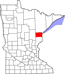 | |
| Townships | ||
| CDPs | ||
| Unorganized territories | ||
| Unincorporated communities | ||
| Indian reservations | ||
| Footnotes | ‡This populated place also has portions in an adjacent county or counties | |
Coordinates: 46°30′11″N 92°41′19″W / 46.50306°N 92.68861°W