Kettle River, Minnesota
| Kettle River, Minnesota | |
|---|---|
| City | |
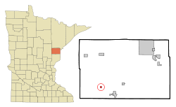 Location of the city of Kettle River within Carlton County, Minnesota | |
| Coordinates: 46°29′14″N 92°52′38″W / 46.48722°N 92.87722°W | |
| Country | United States |
| State | Minnesota |
| County | Carlton |
| Area[1] | |
| • Total | 0.38 sq mi (0.98 km2) |
| • Land | 0.38 sq mi (0.98 km2) |
| • Water | 0 sq mi (0 km2) |
| Elevation | 1,181 ft (360 m) |
| Population (2010)[2] | |
| • Total | 180 |
| • Estimate (2012[3]) | 179 |
| • Density | 473.7/sq mi (182.9/km2) |
| Time zone | Central (CST) (UTC-6) |
| • Summer (DST) | CDT (UTC-5) |
| ZIP code | 55757 |
| Area code(s) | 218 |
| FIPS code | 27-32966[4] |
| GNIS feature ID | 0646127[5] |
Kettle River is a city in Carlton County, Minnesota, United States, along the Kettle River, for which it was named.[6] The population was 180 at the 2010 census.[7] It was incorporated in 1921.
Minnesota State Highway 73 serves as a main route in Kettle River.
Geography
According to the United States Census Bureau, the city has a total area of 0.38 square miles (0.98 km2), all of it land.[1]
Kettle River is located 7 miles west–northwest of Moose Lake. Kettle River is located 30 miles southwest of Cloquet.
Demographics
| Historical population | |||
|---|---|---|---|
| Census | Pop. | %± | |
| 1930 | 169 | — | |
| 1940 | 221 | 30.8% | |
| 1950 | 223 | 0.9% | |
| 1960 | 234 | 4.9% | |
| 1970 | 173 | −26.1% | |
| 1980 | 174 | 0.6% | |
| 1990 | 190 | 9.2% | |
| 2000 | 168 | −11.6% | |
| 2010 | 180 | 7.1% | |
| Est. 2015 | 179 | [8] | −0.6% |
2010 census
As of the census[2] of 2010, there were 180 people, 79 households, and 52 families residing in the city. The population density was 473.7 inhabitants per square mile (182.9/km2). There were 96 housing units at an average density of 252.6 per square mile (97.5/km2). The racial makeup of the city was 92.2% White, 1.7% Native American, and 6.1% from two or more races. Hispanic or Latino of any race were 0.6% of the population.
There were 79 households of which 34.2% had children under the age of 18 living with them, 41.8% were married couples living together, 16.5% had a female householder with no husband present, 7.6% had a male householder with no wife present, and 34.2% were non-families. 29.1% of all households were made up of individuals and 8.8% had someone living alone who was 65 years of age or older. The average household size was 2.28 and the average family size was 2.81.
The median age in the city was 41 years. 24.4% of residents were under the age of 18; 2.9% were between the ages of 18 and 24; 29.4% were from 25 to 44; 25% were from 45 to 64; and 18.3% were 65 years of age or older. The gender makeup of the city was 48.9% male and 51.1% female.
2000 census
As of the census[4] of 2000, there were 168 people, 75 households, and 44 families residing in the city. The population density was 436.4 people per square mile (170.7/km²). There were 88 housing units at an average density of 228.6 per square mile (89.4/km²). The racial makeup of the city was 97.02% White, 0.60% Native American, and 2.38% from two or more races. 36.8% were of Finnish, 25.2% German, 9.7% Norwegian and 6.5% Swedish ancestry according to Census 2000.
There were 75 households out of which 32.0% had children under the age of 18 living with them, 42.7% were married couples living together, 9.3% had a female householder with no husband present, and 41.3% were non-families. 34.7% of all households were made up of individuals and 22.7% had someone living alone who was 65 years of age or older. The average household size was 2.24 and the average family size was 2.82.
In the city the population was spread out with 26.2% under the age of 18, 5.4% from 18 to 24, 28.0% from 25 to 44, 20.2% from 45 to 64, and 20.2% who were 65 years of age or older. The median age was 41 years. For every 100 females there were 102.4 males. For every 100 females age 18 and over, there were 100.0 males.
The median income for a household in the city was $24,750, and the median income for a family was $31,250. Males had a median income of $32,188 versus $18,542 for females. The per capita income for the city was $15,620. None of the families and 7.9% of the population were living below the poverty line, including no under eighteens and 21.4% of those over 64.
Festival
Every August, the town hosts Ma and Pa Kettle Days, an annual festival; that includes a pancake breakfast, parade, a Miss Kettle River pageant, a mud bog on Saturday afternoon, and street dances on Friday and Saturday night. During the parade children bring bags to collect candy thrown from the floats as they pass by.
History
The Kettle River area of Carlton County, Minnesota, was settled by a large concentration of Finnish Immigrants in the years leading up to the First World War and the influence of those immigrants is still noticeable even today.
On October 12, 1918, the 1918 Cloquet Fire caused by sparks on the local railroads left much of western Carlton County area devastated. Several hundred persons were killed by the fire and thousands more left homeless. The only building left standing in Kettle River following the fire was the bank that was made of brick. This building still stands in Kettle River, near the center of the town on the west side of State Highway 73.
Following the fire, with most people homeless and destitute, the Spanish Influenza outbreak of 1918 wreaked even more havoc on the local peoples, taking more lives.
References
- 1 2 "US Gazetteer files 2010". United States Census Bureau. Retrieved 2012-11-13.
- 1 2 "American FactFinder". United States Census Bureau. Retrieved 2012-11-13.
- ↑ "Population Estimates". United States Census Bureau. Retrieved 2013-05-28.
- 1 2 "American FactFinder". United States Census Bureau. Retrieved 2008-01-31.
- ↑ "US Board on Geographic Names". United States Geological Survey. 2007-10-25. Retrieved 2008-01-31.
- ↑ Upham, Warren (1920). Minnesota Geographic Names: Their Origin and Historic Significance. Minnesota Historical Society. p. 75.
- ↑ "2010 Census Redistricting Data (Public Law 94-171) Summary File". American FactFinder. U.S. Census Bureau, 2010 Census. Retrieved 23 April 2011.
- ↑ "Annual Estimates of the Resident Population for Incorporated Places: April 1, 2010 to July 1, 2015". Retrieved July 2, 2016.
- ↑ "Census of Population and Housing". Census.gov. Retrieved June 4, 2015.
External links
- City of Kettle River, MN – official website
- Moose Lake Area Historical Society website
- Moose Lake Depot and Fire Museum website
- Documentary on the 1918 Cloquet Fire
Municipalities and communities of Carlton County, Minnesota, United States | ||
|---|---|---|
| Cities | 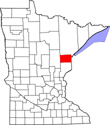 | |
| Townships | ||
| CDPs | ||
| Unorganized territories | ||
| Unincorporated communities | ||
| Indian reservations | ||
| Footnotes | ‡This populated place also has portions in an adjacent county or counties | |
Coordinates: 46°29′30″N 92°52′41″W / 46.49167°N 92.87806°W