Beasley, Texas
| Beasley, Texas | |
|---|---|
| City | |
|
| |
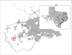 Location of Beasley, Texas | |
| Coordinates: 29°29′47″N 95°55′2″W / 29.49639°N 95.91722°WCoordinates: 29°29′47″N 95°55′2″W / 29.49639°N 95.91722°W | |
| Country | United States |
| State | Texas |
| County | Fort Bend |
| Area | |
| • Total | 1.07 sq mi (2.77 km2) |
| • Land | 1.07 sq mi (2.76 km2) |
| • Water | 0.004 sq mi (0.01 km2) |
| Elevation | 108 ft (33 m) |
| Population (2010) | |
| • Total | 641 |
| • Density | 601/sq mi (232.1/km2) |
| Time zone | Central (CST) (UTC-6) |
| • Summer (DST) | CDT (UTC-5) |
| ZIP code | 77417 |
| Area code(s) | 979 |
| FIPS code | 48-06272[1] |
| GNIS feature ID | 1330260[2] |
Beasley is a city in Fort Bend County, Texas, United States, within the Houston–Sugar Land–Baytown metropolitan area. The city's population was 641 at the 2010 census,[3] up from 590 at the 2000 census. State Highway Loop 540 goes straight through the city from the northeast to the southwest while U.S. Route 59, the Southwest Freeway, passes to the south of Beasley. The Union Pacific Railroad tracks run parallel with Loop 540.
Geography

Beasley is located in west-central Fort Bend County at 29°29′47″N 95°55′2″W / 29.49639°N 95.91722°W (29.496435, -95.917297).[4] US 59 leads northeast 20 miles (32 km) to Sugar Land and 40 miles (64 km) to the center of Houston, while in the other direction leading 85 miles (137 km) southwest to Victoria. Rosenberg is 8 miles (13 km) to the northeast via US 59 and Texas State Highway Spur 529.
According to the United States Census Bureau, Beasley has a total area of 1.1 square miles (2.8 km2), of which 0.004 square miles (0.01 km2), or 0.25%, is water.[3]
Demographics
| Historical population | |||
|---|---|---|---|
| Census | Pop. | %± | |
| 1980 | 410 | — | |
| 1990 | 485 | 18.3% | |
| 2000 | 590 | 21.6% | |
| 2010 | 641 | 8.6% | |
| Est. 2015 | 665 | [5] | 3.7% |
As of the census[1] of 2000, there were 590 people, 216 households, and 155 families residing in the city. The population density was 587.9 people per square mile (227.8/km²). There were 232 housing units at an average density of 231.2 per square mile (89.6/km²). The racial makeup of the city was 77.97% White, 6.61% African American, 12.71% from other races, and 2.71% from two or more races. Hispanic or Latino of any race were 30.68% of the population.
There were 216 households out of which 35.6% had children under the age of 18 living with them, 56.9% were married couples living together, 10.6% had a female householder with no husband present, and 28.2% were non-families. 24.1% of all households were made up of individuals and 7.9% had someone living alone who was 65 years of age or older. The average household size was 2.73 and the average family size was 3.28.
In the city the population was spread out with 28.3% under the age of 18, 8.6% from 18 to 24, 28.3% from 25 to 44, 23.4% from 45 to 64, and 11.4% who were 65 years of age or older. The median age was 36 years. For every 100 females there were 98.0 males. For every 100 females age 18 and over, there were 91.4 males.
The median income for a household in the city was $35,000, and the median income for a family was $47,625. Males had a median income of $30,139 versus $29,107 for females. The per capita income for the city was $14,984. About 5.7% of families and 16.2% of the population were below the poverty line, including 18.9% of those under age 18 and 24.1% of those age 65 or over.
Government and infrastructure
The United States Postal Service Beasley Post Office is located at 7031 Loop 540.[7] Kansas City Southern and CenterPoint Properties jointly own the 689-acre CenterPoint Intermodal Center-Houston Metro (CIC-HM), which opened in 2009.[8] The largest employer in the Beasley area is Hudson Products Corporation, which established manufacturing operations in 1973 on approximately 260 acres located 2 miles west of Beasley. [9]
Education
Residents are zoned to Lamar Consolidated Independent School District.[10]
Residents are zoned to:
- Beasley Elementary School
- Beasley Elementary opened in 1902, with eight students. The parent teacher organization opened in 1918. The school became a part of LCISD in 1947. Its current building opened in 1985.[11]
- Navarro Middle School
- George Junior High School
- B. F. Terry High School
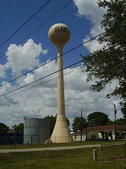
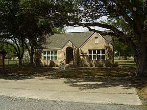
Gallery
-
Beasley City Hall
-
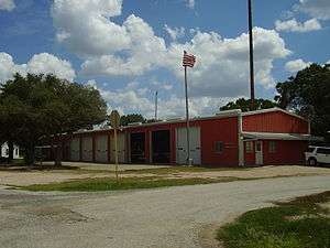
Beasley Fire Station
-
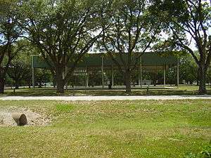
George Pavilion
-

Beasley Elementary School
-
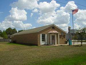
Beasley Post Office
-
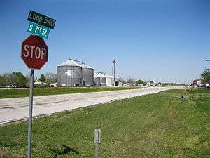
Grain storage buildings on Loop 540
-
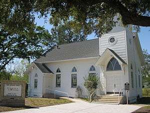
Hope Lutheran Church at 3rd St and Avenue C
-

State Historical Marker at Hope Lutheran
-
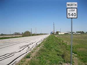
View northeast toward town on Loop 540 near US 59
References
| Wikimedia Commons has media related to Beasley, Texas. |
- 1 2 "American FactFinder". United States Census Bureau. Archived from the original on 2013-09-11. Retrieved 2008-01-31.
- ↑ "US Board on Geographic Names". United States Geological Survey. 2007-10-25. Retrieved 2008-01-31.
- 1 2 "Geographic Identifiers: 2010 Demographic Profile Data (G001): Beasley city, Texas". U.S. Census Bureau, American Factfinder. Retrieved August 26, 2016.
- ↑ "US Gazetteer files: 2010, 2000, and 1990". United States Census Bureau. 2011-02-12. Retrieved 2011-04-23.
- ↑ "Annual Estimates of the Resident Population for Incorporated Places: April 1, 2010 to July 1, 2015". Retrieved July 2, 2016.
- ↑ "Census of Population and Housing". Census.gov. Archived from the original on May 11, 2015. Retrieved June 4, 2015.
- ↑ "Post Office Location - BEASLEY." United States Postal Service. Retrieved on December 6, 2008.
- ↑ KCS Celebrates the Opening of Texas Rail Line and Centerpoint Intermodal Center-Houston Metro Archived February 2, 2014, at the Wayback Machine.
- ↑
- ↑ "LCISD District Map." Lamar Consolidated Independent School District. Retrieved on July 23, 2011.
- ↑ "About Archived April 23, 2012, at the Wayback Machine.." Beasley Elementary School. Retrieved on October 24, 2011.
| Counties | 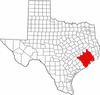 | |
|---|---|---|
| "Principal" cities | ||
| Other cities |
For a complete listing, see list of cities and towns in Houston–The Woodlands–Sugar Land MSA | |
| Unincorporated areas | ||
| Bodies of water | ||
Municipalities and communities of Fort Bend County, Texas, United States | ||
|---|---|---|
| Cities | 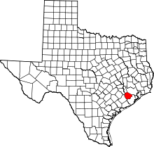 | |
| Town | ||
| Villages | ||
| CDPs | ||
| Unincorporated communities | ||
| Ghost towns | ||
| Footnotes | ‡This populated place also has portions in an adjacent county or counties;
±Former community annexed by Missouri City | |