South Houston, Texas
| City of South Houston | |
|---|---|
| City | |
|
Marker for the city of South Houston | |
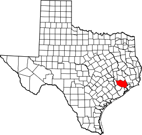
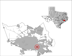 Location of South Houston, Texas | |
| Coordinates: 29°39′40″N 95°13′47″W / 29.66111°N 95.22972°WCoordinates: 29°39′40″N 95°13′47″W / 29.66111°N 95.22972°W | |
| Country |
|
| State |
|
| County | Harris |
| Government | |
| • Type | Council-Manager |
| • City Council |
Mayor Joe Soto Claudia V. Melendez Eddie Torres Willie Rios Robert Garcia Amy Leal |
| Area | |
| • Total | 3.0 sq mi (7.8 km2) |
| • Land | 3.0 sq mi (7.8 km2) |
| • Water | 0.0 sq mi (0.0 km2) |
| Elevation | 30 ft (9 m) |
| Population (2010) | |
| • Total | 16,983 |
| • Density | 5,700/sq mi (2,200/km2) |
| Time zone | Central (CST) (UTC-6) |
| • Summer (DST) | CDT (UTC-5) |
| ZIP code | 77587 |
| Area code(s) | 713 |
| FIPS code | 48-69020[1] |
| GNIS feature ID | 1347476[2] |
| Website |
www |
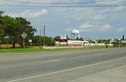
South Houston is a city in the U.S. state of Texas, within Houston–The Woodlands–Sugar Land metropolitan area and Harris County. The population was 16,983 at the 2010 census.[3] It is bordered by the cities of Houston and Pasadena.
History
C.S. Woods of the Western Land Company founded the settlement of Dumont in 1907. A post office appeared in 1910. In 1913 Dumont was incorporated as the city of South Houston.[4] Because of the 1913 incorporation, Houston did not incorporate South Houston's territory into its city limits, while Houston annexed surrounding areas that were unincorporated.[5] South Houston's initial industrial activity consisted of shipping produce along the Galveston, Houston and Henderson Railroad. The hurricane of 1915 destroyed many of the local industries. The establishment of the Houston Ship Channel resulted in the establishment of manufacturing industries inland, including in South Houston. Between the 1940s and the early 1960s South Houston found rapid population growth. The city had 7,523 inhabitants in 1960. In 1980 South Houston had 11,782 inhabitants and 303 businesses. In 1990 14,207 inhabitants lived in South Houston.[4]
Elephants belonging to former South Houston mayor George Christy, a circus owner, assisted the construction of the Spencer Highway.[5]
From the 1980 census to the 1990 census, Hispanics began to move into South Houston by an amount between 1,000 and 3,500 per square mile. Most Hispanics in South Houston were of Mexican descent.[6]
Geography

South Houston is located at 29°39′40″N 95°13′47″W / 29.66111°N 95.22972°W (29.660980, -95.229787).[7]
According to the United States Census Bureau, the city has a total area of 7.8 km², none of which is covered with water.
Demographics
| Historical population | |||
|---|---|---|---|
| Census | Pop. | %± | |
| 1930 | 612 | — | |
| 1940 | 982 | 60.5% | |
| 1950 | 4,126 | 320.2% | |
| 1960 | 7,532 | 82.5% | |
| 1970 | 11,527 | 53.0% | |
| 1980 | 13,293 | 15.3% | |
| 1990 | 14,207 | 6.9% | |
| 2000 | 15,833 | 11.4% | |
| 2010 | 16,983 | 7.3% | |
| Est. 2015 | 17,544 | [8] | 3.3% |

As of the census[1] of 2000, there were 15,833 people, 4,593 households, and 3,697 families residing in the city. The racial makeup of the city was 33% White, 1.04% African American, 0.60% Native American, 0.70% Asian, 0.05% Pacific Islander, 27.74% from other races, and 4.53% from two or more races. Hispanic or Latino of any race were 77.93% of the population.
There were 4,593 households out of which 47.7% had children under the age of 18 living with them, 60.1% were married couples living together, 13.9% had a female householder with no husband present, and 19.5% were non-families. 15.4% of all households were made up of individuals and 5.4% had someone living alone who was 65 years of age or older. The average household size was 3.45 and the average family size was 3.86.
In the city the population was spread out with 34.1% under the age of 18, 11.7% from 18 to 24, 30.8% from 25 to 44, 16.5% from 45 to 64, and 6.8% who were 65 years of age or older. The median age was 28 years. For every 100 females there were 104.1 males. For every 100 females age 18 and over, there were 103.6 males.
The median income for a household in the city was $31,924, and the median income for a family was $34,903. Males had a median income of $27,360 versus $19,870 for females. The per capita income for the city was $12,308. About 17.3% of families and 20.9% of the population were below the poverty line, including 25.8% of those under age 18 and 10.5% of those age 65 or over.
Government and infrastructure
Local government

The South Houston City Council establishes city policies, considering resolutions and ordinances, appointing South Houston residents to positions on municipal committees and boards, and establishing the annual budgets. City council meets during the first and third Tuesdays of each month in the South Houston Municipal Court; meetings begin at 7:30 PM; it is open to members of the public. As of 2008 the mayor is Joe Soto. The council members are Irene Tamayo, Bill Kelly, Albert Hernandez, Robert Garcia, and Amy Burnett.[10]
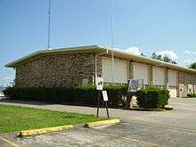
The South Houston Fire Department serves the city. The South Houston Police Department is headquartered at 1023 West Dallas Street. As of 2008 Herbert Gilbert is the chief of police.[11]
County, state, and federal representation
South Houston is located within Harris County Precinct 2; as of 2008 Sylvia Garcia heads Precinct 2.[12]
South Houston is located in District 145 of the Texas House of Representatives. As of 2008 Rick Noriega represents the district.[13] South Houston is within District 6 of the Texas Senate; as of 2008 Mario Gallegos is the representative.[14]
South Houston is within Texas's 29th congressional district; as of 2008 Gene Green is the representative.[15] The United States Postal Service operates the South Houston Post Office at 315 North Allen Genoa Road.[16]
Transportation
Harris County Transit operates public transportation.[17]
Economy
The Lewis Food Town grocery store chain is based in South Houston.[18]
Education
Primary and secondary schools
Public schools
South Houston is served by the Pasadena Independent School District.
The following elementary schools serve sections of South Houston:[19]
- Pearl Hall Elementary School (South Houston)
- Walter Matthys Elementary School (South Houston)
- L.F. Smith Elementary School (South Houston)
- South Houston Elementary School (South Houston)
Sections of South Houston west of Old Galveston Road are served by Rick Schneider Middle School (Houston, Grades 5-6). Parts of South Houston are zoned to Carter Lomax Middle School (Pasadena, Grades 5-6). Parts of South Houston are not served by any "middle school" and instead are served by elementary schools, intermediate schools, and high schools.[20]
Sections of South Houston west of Old Galveston Road are served by South Houston Intermediate School (South Houston, Grades 7-8). Parts east of Old Galveston Road are served by Queens Intermediate School (Pasadena, Grades 6-8).[21]
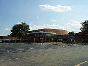
All of South Houston is served by South Houston High School.[22]
Public libraries
South Houston is served by the South Houston Branch of Harris County Public Library at 607 Avenue A. The first South Houston library opened in 1927. In 1937 money was raised to build a structure to house the library; this structure stands in a park next to the current library. In the 1950s the library moved into a building with a welfare office and a clinic. In 1967 the city purchased land and a barracks building from Ellington Field; the city then moved the library there, where it remained until 1991. The current 5,800 square feet (540 m2) branch opened in May 1991.[23]
Gallery of schools
 South Houston Elementary School
 Walter Matthys Elementary School
 L. F. Smith Elementary School
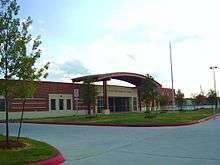 Pearl Hall Elementary School
 South Houston Intermediate School
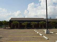
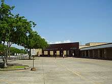
Gallery
 South Houston Police Department front entrance
 South Houston Municipal Court
References
- 1 2 "American FactFinder". United States Census Bureau. Retrieved 2008-01-31.
- ↑ "US Board on Geographic Names". United States Geological Survey. 2007-10-25. Retrieved 2008-01-31.
- ↑ "Profile of General Population and Housing Characteristics: 2010 Demographic Profile Data (DP-1): South Houston city, Texas". U.S. Census Bureau, American Factfinder. Retrieved June 26, 2012.
- 1 2 South Houston, Texas from the Handbook of Texas Online
- 1 2 Lee, Renée C. "Annexed Kingwood split on effects." Houston Chronicle. Sunday October 8, 2006. A21. Retrieved on July 6, 2011. "Some of the area communities that incorporated as cities and escaped annexation by Houston:" Print version exclusively has the information cited; the information is not included in the online edition.
- ↑ Rodriguez, Lori. "Census tracks rapid growth of suburbia." Houston Chronicle. Sunday March 10, 1991. Section A, Page 1.
- ↑ "US Gazetteer files: 2010, 2000, and 1990". United States Census Bureau. 2011-02-12. Retrieved 2011-04-23.
- ↑ "Annual Estimates of the Resident Population for Incorporated Places: April 1, 2010 to July 1, 2015". Retrieved July 2, 2016.
- ↑ "Census of Population and Housing". Census.gov. Retrieved June 4, 2015.
- ↑ "Mayor and City Council." City of South Houston. Accessed June 17, 2008.
- ↑ "Foreword by Chief of Police - Herbert Gilbert." South Houston Police Department. Retrieved on November 29, 2008.
- ↑ Precinct 2 Map." Harris County. Accessed October 13, 2008.
- ↑ "House District 145." Texas House of Representatives. Accessed October 11, 2008.
- ↑ "Senate District 6" Map. Senate of Texas. Accessed September 28, 2008.
- ↑ "Congressional District 29." National Atlas of the United States. Retrieved June 17, 2008.
- ↑ "Post Office Location - SOUTH HOUSTON." United States Postal Service. Retrieved on November 29, 2008.
- ↑ "Routes / Maps." Harris County Transit. Retrieved on January 15, 2010.
- ↑ "Lewis Food Town, Inc." Bloomberg BusinessWeek. Retrieved on January 13, 2011. "CORPORATE HEADQUARTERS 3316 South Shaver Street South Houston, Texas 77587"
- ↑ "Elementary Schools." Pasadena Independent School District.
- ↑ "5th Grade Centers & Middle Schools." Pasadena Independent School District.
- ↑ "Intermediate Schools." Pasadena Independent School District.
- ↑ "High Schools." Pasadena Independent School District.
- ↑ "South Houston Branch Library." Harris County Public Library. Retrieved on November 29, 2008.
Further reading
- A Short History of South Houston (South Houston Chamber of Commerce, 1982).
- News Citizen (Pasadena, Texas), April 9, 1970.
External links
| Wikimedia Commons has media related to South Houston, Texas. |
- City of South Houston official website
- South Houston Chamber of Congress
- South Houston Police Department (Archive)
- South Houston High School
- South Houston, Texas from the Handbook of Texas Online
| Counties | 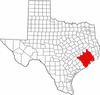 | |
|---|---|---|
| "Principal" cities | ||
| Other cities |
For a complete listing, see list of cities and towns in Houston–The Woodlands–Sugar Land MSA | |
| Unincorporated areas | ||
| Bodies of water | ||
