Belknap Springs, Oregon
| Belknap Springs | |
|---|---|
| Unincorporated community | |
|
Hot Springs sign | |
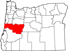
 Belknap Springs  Belknap Springs Location within the state of Oregon | |
| Coordinates: 44°11′26″N 122°2′53″W / 44.19056°N 122.04806°WCoordinates: 44°11′26″N 122°2′53″W / 44.19056°N 122.04806°W | |
| Country | United States |
| State | Oregon |
| County | Lane |
| Established | 1875 |
| Founded by | Rollin Simeon Belknap |
| Time zone | Pacific (PST) (UTC-8) |
| • Summer (DST) | PDT (UTC-7) |
| ZIP code | 97413 |
| Area code(s) | 458 and 541 |
| GNIS feature ID | 1136054 |

Belknap Springs is an unincorporated community and private hot springs resort in Lane County, Oregon, United States, near the McKenzie River. The springs were located and initially developed by R. S. Belknap in 1869. A post office named "Salt Springs" was established in the location in 1874, and the name changed to "Belknap Springs" in 1875.[1] The post office closed in 1877 and reopened in 1891, operating intermittently until 1953.[1] Today the location uses a McKenzie Bridge mailing address.
Belknap Hot Spring
Belknap Hot Spring itself is located across the McKenzie River from the resort at 44°11′39″N 122°3′4″W / 44.19417°N 122.05111°W. The water is piped to the resort.
Touted as a mineral spa in the late 19th century, since then the resort site has gone through several changes of ownership and had various improvements made to it, including the addition of a hotel (currently a lodge) and cabins, forming a summer resort community. The resort has been almost continuously open to the public since the 1870s, except for a period of closure from 1968-1978.
Climate
This region experiences warm (but not hot) and dry summers, with no average monthly temperatures above 71.6 °F (22.0 °C). According to the Köppen Climate Classification system, Belknap Springs has a warm-summer Mediterranean climate, abbreviated "Csb" on climate maps.[2]
| Climate data for Belknap Springs | |||||||||||||
|---|---|---|---|---|---|---|---|---|---|---|---|---|---|
| Month | Jan | Feb | Mar | Apr | May | Jun | Jul | Aug | Sep | Oct | Nov | Dec | Year |
| Record high °F (°C) | 69 (21) |
72 (22) |
78 (26) |
93 (34) |
100 (38) |
104 (40) |
106 (41) |
106 (41) |
105 (41) |
92 (33) |
70 (21) |
58 (14) |
106 (41) |
| Average high °F (°C) | 39 (4) |
44.3 (6.8) |
49.8 (9.9) |
56.4 (13.6) |
64.8 (18.2) |
72.4 (22.4) |
81.5 (27.5) |
81.6 (27.6) |
75.3 (24.1) |
62 (17) |
46.7 (8.2) |
38.3 (3.5) |
59.3 (15.2) |
| Average low °F (°C) | 27.5 (−2.5) |
29 (−2) |
30.5 (−0.8) |
33.8 (1) |
39.1 (3.9) |
44.8 (7.1) |
48.9 (9.4) |
48.5 (9.2) |
43.9 (6.6) |
37.8 (3.2) |
32.8 (0.4) |
28.3 (−2.1) |
37.1 (2.8) |
| Record low °F (°C) | 2 (−17) |
−2 (−19) |
6 (−14) |
18 (−8) |
26 (−3) |
31 (−1) |
34 (1) |
35 (2) |
28 (−2) |
19 (−7) |
8 (−13) |
−4 (−20) |
−4 (−20) |
| Average precipitation inches (mm) | 11.56 (293.6) |
8.64 (219.5) |
7.95 (201.9) |
5.49 (139.4) |
4.11 (104.4) |
2.51 (63.8) |
0.82 (20.8) |
1.12 (28.4) |
2.21 (56.1) |
5.68 (144.3) |
11.74 (298.2) |
13.22 (335.8) |
75.04 (1,906) |
| Average snowfall inches (cm) | 21.2 (53.8) |
13.1 (33.3) |
10.9 (27.7) |
2.1 (5.3) |
0.1 (0.3) |
0 (0) |
0 (0) |
0 (0) |
0 (0) |
0.2 (0.5) |
6.1 (15.5) |
20.8 (52.8) |
74.5 (189.2) |
| Average precipitation days | 18 | 16 | 18 | 17 | 14 | 9 | 4 | 4 | 7 | 12 | 19 | 19 | 157 |
| Source: [3] | |||||||||||||
See also
References
- 1 2 McArthur, Lewis A.; Lewis L. McArthur (2003) [1928]. Oregon Geographic Names (Seventh ed.). Portland, Oregon: Oregon Historical Society Press. ISBN 0-87595-277-1.
- ↑ Climate Summary for Belknap Springs, Oregon
- ↑ "BELKNAP SPRINGS 8 N, OR (350652)". Western Regional Climate Center. Retrieved November 22, 2015.
External links
- "Belknap Springs". Geographic Names Information System. United States Geological Survey.
- "Belknap Hot Spring". Geographic Names Information System. United States Geological Survey.
- "An Historical Guide to Belknap Hot Springs". from Belknap Hot Springs, Spa and Gardens, current owners of the hot springs resort
- "Belknap history". from McKenzie Hot Springs Cottage (owned by descendants of original Belknap Springs owners)