Creswell, Oregon
| Creswell, Oregon | |
|---|---|
| City | |
|
Creswell City Hall | |
| Nickname(s): The Friendly City | |
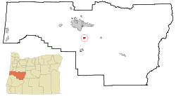 Location in Oregon | |
| Coordinates: 43°55′5″N 123°1′17″W / 43.91806°N 123.02139°WCoordinates: 43°55′5″N 123°1′17″W / 43.91806°N 123.02139°W | |
| Country | United States |
| State | Oregon |
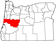
| County | Lane |
| Incorporated | 1909 |
| Government | |
| • Mayor | Dave Stram |
| Area[1] | |
| • Total | 1.72 sq mi (4.45 km2) |
| • Land | 1.70 sq mi (4.40 km2) |
| • Water | 0.02 sq mi (0.05 km2) |
| Elevation | 542 ft (165.2 m) |
| Population (2010)[2] | |
| • Total | 5,031 |
| • Estimate (2012[3]) | 5,068 |
| • Density | 2,959.4/sq mi (1,142.6/km2) |
| Time zone | Pacific (UTC-8) |
| • Summer (DST) | Pacific (UTC-7) |
| ZIP code | 97426 |
| Area code(s) | 541 |
| FIPS code | 41-16950[4] |
| GNIS feature ID | 1119540[5] |
| Website | www.ci.creswell.or.us |
.jpg)
Creswell is a city in the Willamette Valley of Lane County, Oregon, United States. The population at the 2010 census was 5,031.[6]
History
The first store opened at Creswell in 1872, and a town sprang up around it.[7] The city was named for John Creswell, 23rd United States Postmaster General.[7] A post office has been in operation in Creswell since 1872.[8]
Geography
According to the United States Census Bureau, the city has a total area of 1.72 square miles (4.45 km2), of which, 1.70 square miles (4.40 km2) is land and 0.02 square miles (0.05 km2) is water.[1]
Demographics
| Historical population | |||
|---|---|---|---|
| Census | Pop. | %± | |
| 1910 | 367 | — | |
| 1920 | 273 | −25.6% | |
| 1930 | 345 | 26.4% | |
| 1940 | 497 | 44.1% | |
| 1950 | 662 | 33.2% | |
| 1960 | 760 | 14.8% | |
| 1970 | 1,199 | 57.8% | |
| 1980 | 1,770 | 47.6% | |
| 1990 | 2,431 | 37.3% | |
| 2000 | 3,579 | 47.2% | |
| 2010 | 5,031 | 40.6% | |
| Est. 2015 | 5,199 | [9] | 3.3% |
2010 census
As of the census[2] of 2010, there were 5,031 people, 1,906 households, and 1,366 families residing in the city. The population density was 2,959.4 inhabitants per square mile (1,142.6/km2). There were 2,023 housing units at an average density of 1,190.0 per square mile (459.5/km2). The racial makeup of the city was 89.6% White, 0.4% African American, 1.0% Native American, 1.0% Asian, 0.1% Pacific Islander, 4.1% from other races, and 3.7% from two or more races. Hispanic or Latino of any race were 8.6% of the population.
There were 1,906 households of which 37.3% had children under the age of 18 living with them, 54.2% were married couples living together, 12.6% had a female householder with no husband present, 4.8% had a male householder with no wife present, and 28.3% were non-families. 21.7% of all households were made up of individuals and 7.1% had someone living alone who was 65 years of age or older. The average household size was 2.61 and the average family size was 3.01.
The median age in the city was 35.7 years. 26.8% of residents were under the age of 18; 6.9% were between the ages of 18 and 24; 28.9% were from 25 to 44; 25.7% were from 45 to 64; and 11.8% were 65 years of age or older. The gender makeup of the city was 48.7% male and 51.3% female.
2000 census
As of the census[4] of 2000, there were 3,579 people, 1,271 households, and 911 families residing in the city. The population density was 2,957.0 people per square mile (1,142.0/km²). There were 1,343 housing units at an average density of 1,109.6 per square mile (428.5/km²). The racial makeup of the city was 89.02% White, 0.31% African American, 1.82% Native American, 0.53% Asian, 0.17% Pacific Islander, 4.08% from other races, and 4.08% from two or more races. Hispanic or Latino of any race were 7.01% of the population. There were 1,271 households out of which 41.4% had children under the age of 18 living with them, 53.1% were married couples living together, 13.5% had a female householder with no husband present, and 28.3% were non-families. 21.6% of all households were made up of individuals and 8.7% had someone living alone who was 65 years of age or older. The average household size was 2.77 and the average family size was 3.21.
In the city the population 31.3% under the age of 18, 8.5% from 18 to 24, 30.8% from 25 to 44, 18.4% from 45 to 64, and 11.0% who were 65 years of age or older. The median age was 32 years. For every 100 females there were 90.5 males. For every 100 females age 18 and over, there were 89.7 males.
The median income for a household in the city was $34,053, and the median income for a family was $40,709. Males had a median income of $28,583 versus $22,917 for females. The per capita income for the city was $13,736. About 15.3% of families and 19.0% of the population were below the poverty line, including 24.1% of those under age 18 and 5.3% of those age 65 or over.
Parks and recreation
Creswell is the home of the Emerald Valley Golf Club. The course is located on 170 acres (0.69 km2) along the west bank of the Willamette River's Coast Fork. It was built in 1966 by James and Eugene Russell. After a series of owners, businessman Jim Pliska bought the golf course in 2002. Today, Emerald Valley Golf Club is the home of the University of Oregon golf team.[11][12]
Education
The Creswell School District has three schools: Creslane Elementary School, Creswell Middle School, and Creswell High School.
Media
The Creswell Chronicle is the city's weekly newspaper.
Transportation
The city has a general aviation airport, Hobby Field, (IATA airport code:77S, ICAO airport code: 77S), and is located on Interstate 5 and Oregon Route 99. Lane County Transit (LTD) has limited bus service to Creswell.
Notable people
- Mark Few, head coach for the Gonzaga Bulldogs men's basketball team
- Luke Jackson, basketball player
References
- 1 2 "US Gazetteer files 2010". United States Census Bureau. Archived from the original on 2012-01-24. Retrieved 2012-12-21.
- 1 2 "American FactFinder". United States Census Bureau. Retrieved 2012-12-21.
- ↑ "Population Estimates". United States Census Bureau. Archived from the original on 2013-06-17. Retrieved 2013-06-02.
- 1 2 "American FactFinder". United States Census Bureau. Archived from the original on 2013-09-11. Retrieved 2008-01-31.
- ↑ "US Board on Geographic Names". United States Geological Survey. 2007-10-25. Retrieved 2008-01-31.
- ↑ "Race, Hispanic or Latino, Age, and Housing Occupancy: 2010 Census Redistricting Data (Public Law 94-171) Summary File (QT-PL), Creswell city, Oregon". U.S. Census Bureau, American FactFinder 2. Archived from the original on September 11, 2013. Retrieved October 31, 2011.
- 1 2 "Names of Lane County Communities Reveal Interesting Histories, Anecdotes". Eugene Register-Guard. 4 January 1942. p. 4. Retrieved 23 April 2015.
- ↑ "Lane County". Jim Forte Postal History. Retrieved 23 April 2015.
- ↑ "Annual Estimates of the Resident Population for Incorporated Places: April 1, 2010 to July 1, 2015". Retrieved July 2, 2016.
- ↑ "Census of Population and Housing". Census.gov. Archived from the original on May 11, 2015. Retrieved June 4, 2015.
- ↑ "Emerald Valley changes owners", Eugene Register-Guard, Eugene, Oregon, 25 April 1974, p. 3C.
- ↑ "Emerald Valley Golf Club", on-line Course Finder, Oregon Golf Association, Woodburn, Oregon, 24 April 2010.