Bentley, Kansas
| Bentley, Kansas | |
|---|---|
| City | |
 Location within Sedgwick County and Kansas | |
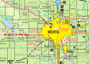 KDOT map of Sedgwick County (legend) | |
| Coordinates: 37°53′11″N 97°31′2″W / 37.88639°N 97.51722°WCoordinates: 37°53′11″N 97°31′2″W / 37.88639°N 97.51722°W | |
| Country | United States |
| State | Kansas |
| County | Sedgwick |
| Established | 1888 [1] |
| Incorporated | 1959 [1] |
| Government | |
| • Mayor | Rex Satterthwaite |
| • City Clerk | Lisa Wright |
| Area[2] | |
| • Total | 0.30 sq mi (0.78 km2) |
| • Land | 0.30 sq mi (0.78 km2) |
| • Water | 0 sq mi (0 km2) |
| Elevation | 1,388 ft (423 m) |
| Population (2010)[3] | |
| • Total | 530 |
| • Estimate (2015)[4] | 523 |
| • Density | 1,800/sq mi (680/km2) |
| Time zone | Central (CST) (UTC-6) |
| • Summer (DST) | CDT (UTC-5) |
| ZIP code | 67016 |
| Area code(s) | 316 |
| FIPS code | 20-06125[5] |
| GNIS feature ID | 0473672[6] |
| Website | bentleyks.webs.com |
Bentley is a city in Sedgwick County, Kansas, United States. It is named in honor of the city's founder Orsemus Hills Bentley.[1] As of the 2010 census, the city population was 530.[7]
History
Bentley was laid out in 1888 when the Kansas Midland Railway was extended to that point. It was named for Orsemus Hills Bentley, a railroad official.[1][8]
The first post office in Bentley was established in March 1888.[9]
Geography
Bentley is located at 37°53′11″N 97°31′2″W / 37.88639°N 97.51722°W (37.886437, -97.517133).[10] According to the United States Census Bureau, the city has a total area of 0.30 square miles (0.78 km2), all of it land.[2]
Demographics
| Historical population | |||
|---|---|---|---|
| Census | Pop. | %± | |
| 1960 | 204 | — | |
| 1970 | 260 | 27.5% | |
| 1980 | 311 | 19.6% | |
| 1990 | 360 | 15.8% | |
| 2000 | 368 | 2.2% | |
| 2010 | 530 | 44.0% | |
| Est. 2015 | 523 | [4] | −1.3% |
| U.S. Decennial Census | |||
2010 census
As of the census[3] of 2010, there were 530 people, 199 households, and 142 families residing in the city. The population density was 1,766.7 inhabitants per square mile (682.1/km2). There were 221 housing units at an average density of 736.7 per square mile (284.4/km2). The racial makeup of the city was 92.1% White, 0.9% African American, 3.0% Native American, 0.8% Asian, 2.1% from other races, and 1.1% from two or more races. Hispanic or Latino of any race were 7.2% of the population.
There were 199 households of which 38.2% had children under the age of 18 living with them, 59.3% were married couples living together, 8.5% had a female householder with no husband present, 3.5% had a male householder with no wife present, and 28.6% were non-families. 24.1% of all households were made up of individuals and 6% had someone living alone who was 65 years of age or older. The average household size was 2.66 and the average family size was 3.16.
The median age in the city was 35.2 years. 27.7% of residents were under the age of 18; 7.2% were between the ages of 18 and 24; 28.1% were from 25 to 44; 27.6% were from 45 to 64; and 9.4% were 65 years of age or older. The gender makeup of the city was 53.2% male and 46.8% female.
2000 census
As of the census[5] of 2000, there were 368 people, 139 households, and 107 families residing in the city. The population density was 1,705.5 people per square mile (645.8/km²). There were 150 housing units at an average density of 695.2 per square mile (263.3/km²). The racial makeup of the city was 95.92% White, 0.54% Native American, 0.27% Asian, 1.36% from other races, and 1.90% from two or more races. Hispanic or Latino of any race were 3.26% of the population.
There were 139 households out of which 41.7% had children under the age of 18 living with them, 63.3% were married couples living together, 7.2% had a female householder with no husband present, and 23.0% were non-families. 22.3% of all households were made up of individuals and 9.4% had someone living alone who was 65 years of age or older. The average household size was 2.65 and the average family size was 3.05.
In the city the population was spread out with 30.7% under the age of 18, 7.3% from 18 to 24, 29.3% from 25 to 44, 21.7% from 45 to 64, and 10.9% who were 65 years of age or older. The median age was 35 years. For every 100 females there were 104.4 males. For every 100 females age 18 and over, there were 102.4 males.
As of 2000 the median income for a household in the city was $39,375, and the median income for a family was $46,250. Males had a median income of $32,083 versus $25,694 for females. The per capita income for the city was $16,111. About 8.2% of families and 9.0% of the population were below the poverty line, including 15.4% of those under age 18 and 5.9% of those age 65 or over.
Government
The Bentley government consists of a mayor and five council members. The council meets the 2nd and 4th Thursday of each month at 7PM.[11]
Infrastructure
Transportation
The Kansas Midland Railway previously went though the city.[1]
References
- 1 2 3 4 5 Bentley - Website
- 1 2 "US Gazetteer files 2010". United States Census Bureau. Archived from the original on 2012-07-14. Retrieved 2012-07-06.
- 1 2 "American FactFinder". United States Census Bureau. Retrieved 2012-07-06.
- 1 2 "Annual Estimates of the Resident Population for Incorporated Places: April 1, 2010 to July 1, 2015". Retrieved July 2, 2016.
- 1 2 "American FactFinder". United States Census Bureau. Archived from the original on 2013-09-11. Retrieved 2008-01-31.
- ↑ "US Board on Geographic Names". United States Geological Survey. 2007-10-25. Retrieved 2008-01-31.
- ↑ "2010 City Population and Housing Occupancy Status". U.S. Census Bureau. Archived from the original on July 21, 2011. Retrieved March 6, 2011.
- ↑ Bentley, Orsemus Hills (1910). History of Wichita and Sedgwick County, Kansas: Past and Present. Windmill Publications. p. 619.
- ↑ "Kansas Post Offices, 1828-1961". Kansas Historical Society. Archived from the original on October 9, 2013. Retrieved 10 June 2014.
- ↑ "US Gazetteer files: 2010, 2000, and 1990". United States Census Bureau. 2011-02-12. Retrieved 2011-04-23.
- ↑ Bentley - Government Archived August 12, 2011, at the Wayback Machine.
External links
| Wikimedia Commons has media related to Bentley, Kansas. |
- City
- Schools
- USD 440, local school district
- USD 440 School District Boundary Map, KDOT
- Maps
- Bentley City Map, KDOT
Municipalities and communities of Sedgwick County, Kansas, United States | ||
|---|---|---|
| Cities |  | |
| CDPs | ||
| Unincorporated communities | ||
| Townships | ||
| Footnotes | ‡This populated place also has portions in an adjacent county or counties | |