Benton City, Missouri
| Benton City, Missouri | |
|---|---|
| Village | |
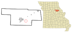 Location of Benton City, Missouri | |
| Coordinates: 39°8′5″N 91°45′52″W / 39.13472°N 91.76444°WCoordinates: 39°8′5″N 91°45′52″W / 39.13472°N 91.76444°W | |
| Country | United States |
| State | Missouri |
| County | Audrain |
| Area[1] | |
| • Total | 0.10 sq mi (0.26 km2) |
| • Land | 0.10 sq mi (0.26 km2) |
| • Water | 0 sq mi (0 km2) |
| Elevation | 823 ft (251 m) |
| Population (2010)[2] | |
| • Total | 104 |
| • Estimate (2012[3]) | 104 |
| • Density | 1,040.0/sq mi (401.5/km2) |
| Time zone | Central (CST) (UTC-6) |
| • Summer (DST) | CDT (UTC-5) |
| ZIP code | 65232 |
| Area code(s) | 573 |
| FIPS code | 29-04834[4] |
| GNIS feature ID | 0729432[5] |
Benton City is a village in Audrain County, Missouri, United States. The population was 104 at the 2010 census.
History
Benton City was platted in 1881.[6] The village is named for Thomas Hart Benton.[7]
Geography
Benton City is located at 39°8′5″N 91°45′52″W / 39.13472°N 91.76444°W (39.134798, -91.764443).[8]
According to the United States Census Bureau, the village has a total area of 0.10 square miles (0.26 km2), all of it land.[1]
Demographics
| Historical population | |||
|---|---|---|---|
| Census | Pop. | %± | |
| 1880 | 64 | — | |
| 1890 | 109 | 70.3% | |
| 1900 | 116 | 6.4% | |
| 1910 | 233 | 100.9% | |
| 1920 | 130 | −44.2% | |
| 1930 | 120 | −7.7% | |
| 1940 | 136 | 13.3% | |
| 1950 | 141 | 3.7% | |
| 1960 | 155 | 9.9% | |
| 1970 | 121 | −21.9% | |
| 1980 | 155 | 28.1% | |
| 1990 | 139 | −10.3% | |
| 2000 | 122 | −12.2% | |
| 2010 | 104 | −14.8% | |
| Est. 2015 | 105 | [9] | 1.0% |
2010 census
As of the census[2] of 2010, there were 104 people, 49 households, and 37 families residing in the village. The population density was 1,040.0 inhabitants per square mile (401.5/km2). There were 59 housing units at an average density of 590.0 per square mile (227.8/km2). The racial makeup of the village was 99.0% White and 1.0% from other races. Hispanic or Latino of any race were 1.0% of the population.
There were 49 households of which 16.3% had children under the age of 18 living with them, 63.3% were married couples living together, 10.2% had a female householder with no husband present, 2.0% had a male householder with no wife present, and 24.5% were non-families. 22.4% of all households were made up of individuals and 12.2% had someone living alone who was 65 years of age or older. The average household size was 2.12 and the average family size was 2.43.
The median age in the village was 49 years. 9.6% of residents were under the age of 18; 7.6% were between the ages of 18 and 24; 25% were from 25 to 44; 32.8% were from 45 to 64; and 25% were 65 years of age or older. The gender makeup of the village was 51.0% male and 49.0% female.
2000 census
As of the census[4] of 2000, there were 122 people, 53 households, and 38 families residing in the village. The population density was 1,177.0 people per square mile (471.0/km²). There were 60 housing units at an average density of 578.9 per square mile (231.7/km²). The racial makeup of the village was 97.54% White and 2.46% Native American. Hispanic or Latino of any race were 0.82% of the population.
There were 53 households out of which 24.5% had children under the age of 18 living with them, 62.3% were married couples living together, 3.8% had a female householder with no husband present, and 28.3% were non-families. 22.6% of all households were made up of individuals and 5.7% had someone living alone who was 65 years of age or older. The average household size was 2.30 and the average family size was 2.66.
In the vill the population was spread out with 20.5% under the age of 18, 13.1% from 18 to 24, 27.0% from 25 to 44, 25.4% from 45 to 64, and 13.9% who were 65 years of age or older. The median age was 38 years. For every 100 females there were 106.8 males. For every 100 females age 18 and over, there were 125.6 males.
The median income for a household in the village was $2, and the median income for a family was $1,000. Males had a median income of $24,861 versus $18,750 for females. The per capita income for the village was $16,112. None of the population and all of the families were below the poverty line.
Notable native
- Anna J. Harrison - First woman president of the American Chemical Society.
- Conrad Strackbein - Executive board of trustees Motts
References
- 1 2 "US Gazetteer files 2010". United States Census Bureau. Archived from the original on 2012-07-14. Retrieved 2012-07-08.
- 1 2 "American FactFinder". United States Census Bureau. Retrieved 2012-07-08.
- ↑ "Population Estimates". United States Census Bureau. Archived from the original on 2013-06-17. Retrieved 2013-05-30.
- 1 2 "American FactFinder". United States Census Bureau. Archived from the original on 2013-09-11. Retrieved 2008-01-31.
- ↑ "US Board on Geographic Names". United States Geological Survey. 2007-10-25. Retrieved 2008-01-31.
- ↑ Eaton, David Wolfe (1916). How Missouri Counties, Towns and Streams Were Named. The State Historical Society of Missouri. p. 204.
- ↑ "Audrain County Place Names, 1928-1945 (archived)". The State Historical Society of Missouri. Archived from the original on 24 June 2016. Retrieved 30 August 2016.
- ↑ "US Gazetteer files: 2010, 2000, and 1990". United States Census Bureau. 2011-02-12. Retrieved 2011-04-23.
- ↑ "Annual Estimates of the Resident Population for Incorporated Places: April 1, 2010 to July 1, 2015". Retrieved July 2, 2016.
- ↑ "Census of Population and Housing". Census.gov. Archived from the original on May 11, 2015. Retrieved June 4, 2015.
Municipalities and communities of Audrain County, Missouri, United States | ||
|---|---|---|
| Cities |  | |
| Villages | ||
| Townships | ||
| Unincorporated communities | ||
| Ghost town | ||
| Footnotes | ‡This populated place also has portions in an adjacent county or counties | |