Berri Barmera Council
| Berri Barmera Council South Australia | |||||||||||||
|---|---|---|---|---|---|---|---|---|---|---|---|---|---|
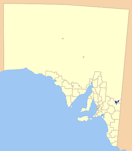 Location of the Berri Barmera Council in SA | |||||||||||||
| Population | 10,419 (2015 est)[1] | ||||||||||||
| • Density | 20.510/km2 (53.12/sq mi) | ||||||||||||
| Established | 1996 | ||||||||||||
| Area | 508 km2 (196.1 sq mi) | ||||||||||||
| Mayor | Peter Hunt [2] | ||||||||||||
| Region | Murray and Mallee [3] | ||||||||||||
| State electorate(s) | Chaffey | ||||||||||||
| Federal Division(s) | Barker | ||||||||||||
|
| |||||||||||||
| Website | Berri Barmera Council | ||||||||||||
| |||||||||||||
Berri Barmera Council is a local government area in the Riverland region of South Australia.
It includes the towns of Barmera, Berri, Cobdogla, Glossop, Katarapko, Loveday and Winkie, and parts of Monash and Overland Corner.[4]
History
The Berri Barmera Council was created on 1 October 1996 with the amalgamation of the District Council of Barmera and the District Council of Berri.[5]
The District Council of Berri had been created in 1922, 11 years after the town was proclaimed. Its first major project was to provide reliable electricity to the entire area. It bought the Berri Electric Supply Company in 1936 to facilitate this, and later sold it to the Electricity Trust of South Australia, a state government agency.
The District Council of Barmera had been created as the "District Council of Cobdogla" on 17 June 1925 and been renamed Barmera in 1937. Barmera had been a soldier settlement community after World War I.
Councillors
| Ward | Councillor | Notes | |
|---|---|---|---|
| Mayor [2] | Peter Hunt | ||
| Unsubdivided [2] | Rhonda Centofanti | ||
| Margaret Evans | |||
| Mike Fuller | |||
| Linc Gore | |||
| Andrew Kassebaum | |||
| Stephen Lynch | |||
| Trevor Scott | |||
| David Waterman | |||
The Berri Barmera Council has a directly-elected mayor.[6]
References
- ↑ "3218.0 – Regional Population Growth, Australia, 2014–15". Australian Bureau of Statistics. Retrieved 29 September 2016.
- 1 2 3 "Elected Member Details". Berri Barmera Council. Retrieved 1 April 2016.
- ↑ "Murray and Mallee SA Government region" (PDF). The Government of South Australia. Retrieved 10 October 2014.
- ↑ "Location SA Map Viewer". Government of South Australia. Retrieved 1 April 2016.
- ↑ "Past Elected Members". Berri Barmera Council. Retrieved 31 March 2016.
- ↑ "Election Results 2014" (PDF). Local Government Association of South Australia. Retrieved 15 February 2016.
External links
Coordinates: 34°17′00″S 140°36′00″E / 34.2833333333°S 140.6°E