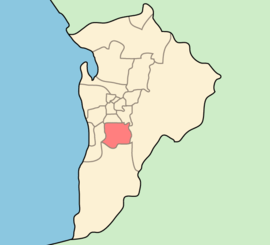
City of Mitcham
| City of Mitcham South Australia | |||||||||||||
|---|---|---|---|---|---|---|---|---|---|---|---|---|---|
 | |||||||||||||
| Population | 66,347 (2015 est)[1] | ||||||||||||
| • Density | 878/km2 (2,270/sq mi) | ||||||||||||
| Established | 1853 | ||||||||||||
| Area | 75.55 km2 (29.2 sq mi) | ||||||||||||
| Mayor | Glenn Spear | ||||||||||||
| Council seat | Torrens Park | ||||||||||||
| Region | Metropolitan Adelaide | ||||||||||||
| State electorate(s) | Davenport, Elder, Heysen, Waite | ||||||||||||
| Federal Division(s) | Boothby | ||||||||||||
|
| |||||||||||||
| Website | City of Mitcham | ||||||||||||
| |||||||||||||
The City of Mitcham is a local government area in the foothills of eastern Adelaide, South Australia. Within its bounds is Flinders University, South Australia's third largest and the notable, affluent suburb of Springfield which contains some of the city's most expensive properties.
History
The City of Mitcham was founded in 1853 as the District Council of Mitcham and was the first local government area formally founded in South Australia after the City of Adelaide.[2][3]
The part of Mitcham district council west of Goodwood Road was removed and added to the District Council of Brighton (later the City of Marion) on 19 December 1854.[3] Then on 25 October 1883 portions of the Mitcham and Echunga district councils around Stirling were detached to form the new District Council of Stirling.[3]
The Corporate Town of Unley was created in 1871, when Unley and surrounding areas were severed from the Mitcham council to create a separate municipality.[4]
Suburbs
- Bedford Park - 5042
- Belair - 5052
- Bellevue Heights - 5050
- Blackwood – 5051
- Brown Hill Creek – 5062
- Clapham - 5062
- Clarence Gardens - 5039
- Colonel Light Gardens - 5041
- Coromandel Valley - 5051
- Craigburn Farm - 5051
- Cumberland Park - 5041
- Daw Park - 5041
- Eden Hills - 5050
- Glenalta - 5052
- Hawthorn - 5062
- Hawthorndene - 5051
- Kingswood - 5062
- Leawood Gardens - 5150
- Lower Mitcham - 5062
- Lynton - 5062
- Melrose Park - 5039
- Mitcham - 5062
- Netherby - 5062
- Panorama - 5041
- Pasadena - 5042
- Springfield - 5062
- St. Marys - 5042
- Torrens Park - 5062
- Upper Sturt - 5156
- Urrbrae - 5064
- Westbourne Park - 5041
Wards
The City of Mitcham is divided into 6 wards, each of which elect 2 or 3 representatives to the Council.[5] They cover suburbs roughly as follows.[6]
| Ward | Suburbs |
|---|---|
| Overton | Clarence Gardens, Cumberland Park, Melrose Park, Daw Park, (part of) Colonel Light Gardens |
| Gault | Westbourne Park, Hawthorn, (most of) Colonel Light Gardens, Lower Mitcham, (part of) Clapham |
| Boorman | Kingswood, Netherby, Urrbrae, Torrens Park, Mitcham, Springfield, Brownhill Creek, Leawood Gardens, Lynton |
| Babbage | St Marys, Pasadena, Panorama, (part of) Clapham, Bedford Park |
| The Park | (most of) Belair, Glenalta, (part of) Crafers West, (part of) Blackwood, Hawthorndene, (part of) Upper Sturt |
| Craigburn | Eden Hills, (part of) Belair, (most of) Blackwood, Bellevue Heights, Craigburn Farm, (part of) Coromandel Valley |
See also
- Local Government Areas of South Australia
- List of Adelaide suburbs
- List of Adelaide parks and gardens
References
- ↑ "3218.0 – Regional Population Growth, Australia, 2014–15". Australian Bureau of Statistics. Retrieved 29 September 2016.
- ↑ "About Council". City of Mitcham. Retrieved 2008-11-11.
- 1 2 3 Marsden, Susan (2012). "LOCAL GOVERNMENT ASSOCIATION OF SOUTH AUSTRALIA: A HISTORY OF SOUTH AUSTRALIAN COUNCILS to 1936" (PDF). Retrieved 23 February 2016.
- ↑ "Overview History of the Unley District" (PDF). City of Unley. Retrieved 15 February 2016.
- ↑ "Elected Members". City of Mitcham. Retrieved 2011-05-28.
- ↑ "Ward Map". City of Mitcham. Retrieved 2011-05-28.
External links
Coordinates: 35°1′S 138°38′E / 35.017°S 138.633°E