Outback Communities Authority
| Outback Communities Authority South Australia | |||||||||||||
|---|---|---|---|---|---|---|---|---|---|---|---|---|---|
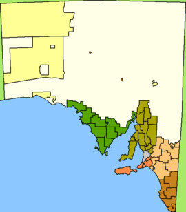 The extent of the unincorporated area in South Australia (shown in white) | |||||||||||||
| Population | 4,350 (2015 est)[1] | ||||||||||||
| • Density | 0.006967/km2 (0.018045/sq mi) | ||||||||||||
| Established | 2009 | ||||||||||||
| Area | 624,339.0 km2 (241,058.6 sq mi) | ||||||||||||
| Mayor | Cecilia Woolford[2] | ||||||||||||
| Council seat |
Port Augusta Andamooka | ||||||||||||
| Region |
Far North[3] Eyre and Western[4] | ||||||||||||
| State electorate(s) | Giles, Stuart, Flinders[5][6][7] | ||||||||||||
| Federal Division(s) | Grey[8] | ||||||||||||
|
| |||||||||||||
| |||||||||||||
The Outback Communities Authority (OCA) is a statutory authority in South Australia (SA) created under the Outback Communities (Administration and Management) Act 2009.[9] It has been established to "manage the provision of public services and facilities to outback communities" which are widely dispersed across the unincorporated area which covers almost 60% of South Australia's land area.[10] The authority has its seat at both Port Augusta which is located outside the unincorporated area and at Andamooka. The authority serves an area of 624,339 square kilometres (241,059 sq mi)[11] which has a population of 3,750 of whom 639 are Indigenous Australians and includes several large pastoral leases and mining operations.[12]
The authority's area of responsibility does not include Aboriginal reserves, the largest of which are Anangu Pitjantjatjara Yankunytjatjara in the northwest of SA and Maralinga Tjarutja in the west of SA.
Outback Areas Community Development Trust
The Outback Communities (Administration and Management) Act 2009 established the Outback Communities Authority as the legal successor to the Outback Areas Community Development Trust[9] which had previously been established in 1978 under the Outback Areas Community Development Trust Act 1978.[13]
Organisational structure
The authority consists of a board of seven members of which four must be residents of client communities. The board oversees a small team of support staff led by a general manager. As of 2012, support staff consisted of six persons employed full-time with one additional person employed part-time.[14]
Client communities
As of 2014, the authority provided services to the following communities: Andamooka, Beltana, Blinman, Border Village, Cockburn, Coorabie, Copley, Fowlers Bay, Glendambo, Innamincka, Iron Knob, Kingoonya, Leigh Creek, Lyndhurst, Marla, Mannahill, Marree, Oodnadatta, Parachilna, Penong, Pimba, William Creek, Woomera and Yunta. [15]
Surrounding LGAs
Because of the size of the unincorporated area in South Australia, the authority provides services in an area bounded by a large number of local government areas (LGAs), 29 in total, both in South Australia and in the adjoining jurisdictions of New South Wales, the Northern Territory, Queensland and Western Australia. Its service area also completely surrounds the Municipal Council of Roxby Downs and the District Council of Coober Pedy. The following LGAs, which border the unincorporated area, total 27 with 17 being in South Australia:
 |
South Australia (from north to south) Anangu Pitjantjatjara Yankunytjatjara Maralinga Tjarutja |
Northern Territory (from west to east) MacDonnell Region ( Iyarrka Ward & Rodinga Ward) |
Queensland from west to east Diamantina, Barcoo, Bulloo |
|
| Western Australia (from north to south) Laverton Menzies Kalgoorlie-Boulder Dundas |
|
New South Wales (from north to south) Unincorporated Far West Wentworth Shire | ||
| ||||
| | ||||
| South Australia (from west to east) Ceduna, Streaky Bay, Wudinna, Kimba, Franklin Harbour, Whyalla, Port Augusta, Flinders Ranges, Orroroo Carrieton, Peterborough, Goyder, Mid Murray, Loxton Waikerie, Berri and Barmera & Renmark Paringa |
Citations and references
Citations
- ↑ "3218.0 – Regional Population Growth, Australia, 2014–15". Australian Bureau of Statistics. Retrieved 29 September 2016.
- ↑ "OCA members". Government of South Australia. Retrieved 12 October 2014.
- ↑ "Far North SA Government Region" (PDF). Department of Planning, Transport and Infrastructure. Retrieved 10 October 2014.
- ↑ "Eyre Western SA Government region" (PDF). The Government of South Australia. Retrieved 10 October 2014.
- ↑ "Giles, 2014 State election boundaries". ELECTORAL COMMISSION SA. Retrieved 17 October 2014.
- ↑ "Flinders, 2014 State election boundaries". ELECTORAL COMMISSION SA. Retrieved 17 October 2014.
- ↑ "Stuart, 2014 State election boundaries". ELECTORAL COMMISSION SA. Retrieved 17 October 2014.
- ↑ "Federal electoral division of Grey, boundary gazetted 16 December 2011" (PDF). Australian Electoral Commission. Retrieved 20 August 2015.
- 1 2 "Outback Communities (Administration and Management) Act 2009". Attorney-General's Department, Government of South Australia. Retrieved 10 October 2014.
- ↑ OCA, 2013, page 3
- ↑ http://www.abs.gov.au/AUSSTATS/[email protected]/Latestproducts/LGA19399Environment/Energy12002-2006?opendocument&tabname=Summary&prodno=LGA19399&issue=2002-2006
- ↑ http://www.censusdata.abs.gov.au/ABSNavigation/prenav/ProductSelect?newproducttype=QuickStats&btnSelectProduct=View+QuickStats+%3E&collection=Census&period=2006&areacode=LGA49399&geography=&method=&productlabel=&producttype=&topic=&navmapdisplayed=true&javascript=true&breadcrumb=LP&topholder=0&leftholder=0¤taction=201&action=401&textversion=false
- ↑ "Outback Areas Community Development Trust Act 1978" (PDF). Attorney-General's Department, Government of South Australia. Retrieved 28 February 2016.
- ↑ OCA, 2013, pages 5-7
- ↑ "Communities". OUtback Communities Authority. Retrieved 19 May 2016.
References
- Outback Communities Authority (OCA) Annual Report 2011 - 12 (PDF). Government of South Australia. 2013. Retrieved 11 October 2014.
External links
32°29′25″S 137°45′46″E / 32.490245°S 137.762817°ECoordinates: 32°29′25″S 137°45′46″E / 32.490245°S 137.762817°E